Trstenik, Šentrupert
Trstenik (pronounced [təɾstɛˈniːk]) is a settlement in the Municipality of Šentrupert in southeastern Slovenia. It lies just northeast of Mirna in the historical region of Lower Carniola. The municipality is now included in the Southeast Slovenia Statistical Region.[2] It includes the hamlets of Butara, Gorenji Konec (Slovene: Gorenji konec), Veliki Konec (Veliki konec), Kurja Dolina (Kurja dolina), Dolenji Konec (Doleji konec), Kot (German: Winkel[3]), and Sotlo.[4]
Trstenik | |
|---|---|
.jpg.webp) | |
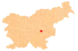
 Trstenik Location in Slovenia | |
| Coordinates: 45°57′40.3″N 15°4′9.86″E | |
| Country | |
| Traditional region | Lower Carniola |
| Statistical region | Southeast Slovenia |
| Municipality | Šentrupert |
| Area | |
| • Total | 1.41 km2 (0.54 sq mi) |
| Elevation | 275.9 m (905.2 ft) |
| Population (2002) | |
| • Total | 104 |
| [1] | |
References
- Statistical Office of the Republic of Slovenia
- Šentrupert municipal site
- Leksikon občin kraljestev in dežel zastopanih v državnem zboru, vol. 6: Kranjsko. 1906. Vienna: C. Kr. Dvorna in Državna Tiskarna, p. 85.
- Savnik, Roman, ed. 1971. Krajevni leksikon Slovenije, vol. 2. Ljubljana: Državna založba Slovenije, pp. 627–628.
External links
| Settlements | Administrative centre: Šentrupert
|  |
|---|---|---|
| Landmarks |
| |
| Notable people |
| |
This article is issued from Wikipedia. The text is licensed under Creative Commons - Attribution - Sharealike. Additional terms may apply for the media files.