Turški Vrh
Turški Vrh (pronounced [ˈtuːɾʃki ˈʋəɾx], German: Türkenberg[2]) is a settlement in the Municipality of Zavrč in the Haloze area of eastern Slovenia. The area traditionally belonged to the Styria region. It is now included in the Drava Statistical Region.[3]
Turški Vrh | |
|---|---|
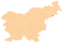
 Turški Vrh Location in Slovenia | |
| Coordinates: 46°21′44.68″N 16°3′8.69″E | |
| Country | |
| Traditional region | Styria |
| Statistical region | Drava |
| Municipality | Zavrč |
| Area | |
| • Total | 4.21 km2 (1.63 sq mi) |
| Elevation | 287.4 m (942.9 ft) |
| Population (2002) | |
| • Total | 280 |
| [1] | |
Name
The name Turški Vrh literally means 'Turk Peak'; the name is explained as either being connected with Ottoman raids that occurred in the area[4] or with a folk tradition that a Turkish midwife is buried behind a shrine at house number 20 in the village.[5] Locally the village is known as Turski Vrh.[5]
Church
The local church on a hill in the south of the settlement, right on the border with Croatia, is dedicated to Saints Hermagoras and Fortunatus and belongs to the Parish of Zavrč. It dates to the second half of the 17th century.[6]
References
- Statistical Office of the Republic of Slovenia
- Leksikon občin kraljestev in dežel zastopanih v državnem zboru, vol. 4: Štajersko. Vienna: C. Kr. Dvorna in Državna Tiskarna. 1904. p. 244.
- Zavrč municipal site
- Bračič, Vladimir (1967). Vinorodne Haloze: Socialno-geografski problemi s posebnim ozirom na viničarstvo. Maribor: Obzorja. p. 65.
- Savnik, Roman (1980). Krajevni leksikon Slovenije, vol. 4. Ljubljana: Državna založba Slovenije. pp. 426–427.
- Slovenian Ministry of Culture register of national heritage reference number 3526
External links
| Settlements | Administrative centre: Zavrč
|  |
|---|---|---|
| Landmarks |
| |
