U2 (Nuremberg U-Bahn)
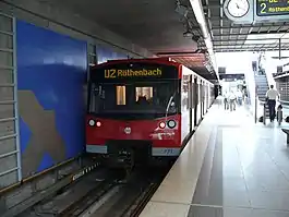
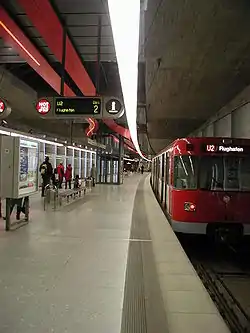
The U2 is an underground line in Nuremberg, opened on 28 January 1984. The line is about 13.1 km long and has 16 stations; the termini are Röthenbach and Flughafen. Since 2010 all trains in regular operations are run driverless.
| U2 | ||||||||||||||||||||||||||||||||||||||||||||||||||||||||||||||||||||||||||||||||||||||||||||||||||||||||||||||||||||||||||||||||||||||||||||||||||||||||||||||||||||||||||||||||||||||||||||||||||||||||||||||||||||||||||||||||||||||||||||||||||||||||||||||||||||||||||||||||||||||||||||||
|---|---|---|---|---|---|---|---|---|---|---|---|---|---|---|---|---|---|---|---|---|---|---|---|---|---|---|---|---|---|---|---|---|---|---|---|---|---|---|---|---|---|---|---|---|---|---|---|---|---|---|---|---|---|---|---|---|---|---|---|---|---|---|---|---|---|---|---|---|---|---|---|---|---|---|---|---|---|---|---|---|---|---|---|---|---|---|---|---|---|---|---|---|---|---|---|---|---|---|---|---|---|---|---|---|---|---|---|---|---|---|---|---|---|---|---|---|---|---|---|---|---|---|---|---|---|---|---|---|---|---|---|---|---|---|---|---|---|---|---|---|---|---|---|---|---|---|---|---|---|---|---|---|---|---|---|---|---|---|---|---|---|---|---|---|---|---|---|---|---|---|---|---|---|---|---|---|---|---|---|---|---|---|---|---|---|---|---|---|---|---|---|---|---|---|---|---|---|---|---|---|---|---|---|---|---|---|---|---|---|---|---|---|---|---|---|---|---|---|---|---|---|---|---|---|---|---|---|---|---|---|---|---|---|---|---|---|---|---|---|---|---|---|---|---|---|---|---|---|---|---|---|---|---|---|---|---|---|---|---|---|---|---|---|---|---|---|---|---|---|---|---|---|---|---|---|---|---|---|---|---|---|---|---|---|---|---|
 | ||||||||||||||||||||||||||||||||||||||||||||||||||||||||||||||||||||||||||||||||||||||||||||||||||||||||||||||||||||||||||||||||||||||||||||||||||||||||||||||||||||||||||||||||||||||||||||||||||||||||||||||||||||||||||||||||||||||||||||||||||||||||||||||||||||||||||||||||||||||||||||||
 | ||||||||||||||||||||||||||||||||||||||||||||||||||||||||||||||||||||||||||||||||||||||||||||||||||||||||||||||||||||||||||||||||||||||||||||||||||||||||||||||||||||||||||||||||||||||||||||||||||||||||||||||||||||||||||||||||||||||||||||||||||||||||||||||||||||||||||||||||||||||||||||||
| Overview | ||||||||||||||||||||||||||||||||||||||||||||||||||||||||||||||||||||||||||||||||||||||||||||||||||||||||||||||||||||||||||||||||||||||||||||||||||||||||||||||||||||||||||||||||||||||||||||||||||||||||||||||||||||||||||||||||||||||||||||||||||||||||||||||||||||||||||||||||||||||||||||||
| Stations | 16 | |||||||||||||||||||||||||||||||||||||||||||||||||||||||||||||||||||||||||||||||||||||||||||||||||||||||||||||||||||||||||||||||||||||||||||||||||||||||||||||||||||||||||||||||||||||||||||||||||||||||||||||||||||||||||||||||||||||||||||||||||||||||||||||||||||||||||||||||||||||||||||||
| Service | ||||||||||||||||||||||||||||||||||||||||||||||||||||||||||||||||||||||||||||||||||||||||||||||||||||||||||||||||||||||||||||||||||||||||||||||||||||||||||||||||||||||||||||||||||||||||||||||||||||||||||||||||||||||||||||||||||||||||||||||||||||||||||||||||||||||||||||||||||||||||||||||
| Type | Rapid transit | |||||||||||||||||||||||||||||||||||||||||||||||||||||||||||||||||||||||||||||||||||||||||||||||||||||||||||||||||||||||||||||||||||||||||||||||||||||||||||||||||||||||||||||||||||||||||||||||||||||||||||||||||||||||||||||||||||||||||||||||||||||||||||||||||||||||||||||||||||||||||||||
| System | Nuremberg U-Bahn | |||||||||||||||||||||||||||||||||||||||||||||||||||||||||||||||||||||||||||||||||||||||||||||||||||||||||||||||||||||||||||||||||||||||||||||||||||||||||||||||||||||||||||||||||||||||||||||||||||||||||||||||||||||||||||||||||||||||||||||||||||||||||||||||||||||||||||||||||||||||||||||
| Operator(s) | Verkehrs-Aktiengesellschaft Nürnberg | |||||||||||||||||||||||||||||||||||||||||||||||||||||||||||||||||||||||||||||||||||||||||||||||||||||||||||||||||||||||||||||||||||||||||||||||||||||||||||||||||||||||||||||||||||||||||||||||||||||||||||||||||||||||||||||||||||||||||||||||||||||||||||||||||||||||||||||||||||||||||||||
| History | ||||||||||||||||||||||||||||||||||||||||||||||||||||||||||||||||||||||||||||||||||||||||||||||||||||||||||||||||||||||||||||||||||||||||||||||||||||||||||||||||||||||||||||||||||||||||||||||||||||||||||||||||||||||||||||||||||||||||||||||||||||||||||||||||||||||||||||||||||||||||||||||
| Opened | 28 January 1984 | |||||||||||||||||||||||||||||||||||||||||||||||||||||||||||||||||||||||||||||||||||||||||||||||||||||||||||||||||||||||||||||||||||||||||||||||||||||||||||||||||||||||||||||||||||||||||||||||||||||||||||||||||||||||||||||||||||||||||||||||||||||||||||||||||||||||||||||||||||||||||||||
| Completed | 27 November 1999 | |||||||||||||||||||||||||||||||||||||||||||||||||||||||||||||||||||||||||||||||||||||||||||||||||||||||||||||||||||||||||||||||||||||||||||||||||||||||||||||||||||||||||||||||||||||||||||||||||||||||||||||||||||||||||||||||||||||||||||||||||||||||||||||||||||||||||||||||||||||||||||||
| Technical | ||||||||||||||||||||||||||||||||||||||||||||||||||||||||||||||||||||||||||||||||||||||||||||||||||||||||||||||||||||||||||||||||||||||||||||||||||||||||||||||||||||||||||||||||||||||||||||||||||||||||||||||||||||||||||||||||||||||||||||||||||||||||||||||||||||||||||||||||||||||||||||||
| Line length | 13.2 km (8.2 mi) | |||||||||||||||||||||||||||||||||||||||||||||||||||||||||||||||||||||||||||||||||||||||||||||||||||||||||||||||||||||||||||||||||||||||||||||||||||||||||||||||||||||||||||||||||||||||||||||||||||||||||||||||||||||||||||||||||||||||||||||||||||||||||||||||||||||||||||||||||||||||||||||
| Track gauge | 1,435 mm (4 ft 8 1⁄2 in) standard gauge | |||||||||||||||||||||||||||||||||||||||||||||||||||||||||||||||||||||||||||||||||||||||||||||||||||||||||||||||||||||||||||||||||||||||||||||||||||||||||||||||||||||||||||||||||||||||||||||||||||||||||||||||||||||||||||||||||||||||||||||||||||||||||||||||||||||||||||||||||||||||||||||
| Electrification | 750 V DC third rail | |||||||||||||||||||||||||||||||||||||||||||||||||||||||||||||||||||||||||||||||||||||||||||||||||||||||||||||||||||||||||||||||||||||||||||||||||||||||||||||||||||||||||||||||||||||||||||||||||||||||||||||||||||||||||||||||||||||||||||||||||||||||||||||||||||||||||||||||||||||||||||||
| ||||||||||||||||||||||||||||||||||||||||||||||||||||||||||||||||||||||||||||||||||||||||||||||||||||||||||||||||||||||||||||||||||||||||||||||||||||||||||||||||||||||||||||||||||||||||||||||||||||||||||||||||||||||||||||||||||||||||||||||||||||||||||||||||||||||||||||||||||||||||||||||
Overview
The route begins in the southwest of Nuremberg at Röthenbach station, at the western end of a three-track parking and turning system, and continues east along the Schweinauer main street under the Main-Danube Canal and the Südwesttangente highway (southwest tangent) to the station Hohe Marter. This station is the longest in the Nuremberg subway network with 268 m and replaces the two abandoned tram stops Friesenstraße and Schweinau, which were formerly located at the two present-day subway exits.
The route continues under Schweinauer Hauptstraße to Schweinau train station and St. Leonhard train station, which, due to its location in the middle of Schweinauer Straße, is completely elastic so as not to give off the vibrations caused by driving to the surrounding houses. Next is the Rothenburger Straße station under the Frankenschnellweg (A73). The last part of the route runs in a curve under the Obere Kanalstraße and then leads in a right arc to the station Plärrer, where the U2 meets the U1.
After the station Plärrer the route runs under the Frauentorgraben to the station Opernhaus. This is open to the moat, which was uncovered in the course of subway construction and designed as a pedestrian area. The route continues to the main train station, where the U2 meets the U1 for the second time, and then heads north to the Wöhrder Wiese station. Due to its location in the Pegnitzgrund, the station had to be lowered and the northern Pegnitzarm had to be incorporated into the station building, which can be seen in the lower ceiling, which extends across the entire station. The following route runs under the Laufertorgraben and steeply climbs towards the station Rathenauplatz, which can be observed in the station itself, as the ceiling from the southern to the northern platform has a significant difference in height.
After the Rathenauplatz station, the route initially runs under the Bayreuther Straße, turns right to the Rennweg station under the same-named street and continues under Schoppershofstraße to the Schoppershof train station. Between this and the following station Nordostbahnhof under the Leipziger Platz is located next to a track change one of the few sections of the U2, in which the two track rails together in a tunnel.
In the further course under the Bessemerstraße is located in a tube together with the city-side track a parking and turning system and at the junction with the Äußere Bayreuther Straße the station Herrnhütte. Then the route leads in a narrow counter arc under housing development to the station brick under the Fritz Munkert Platz, at whose northern end is another parking and turning system. The two railway tracks are then merged and run as a single-track tunnel in a westerly direction to the terminus airport.
Stations
| Stations | Transfers |
|---|---|
| U2 | |
| Röthenbach | |
| Hohe Marter | |
| Schweinau | |
| Sankt Leonhard | |
| Rothenburger Straße | |
| Plärrer | |
| Opernhaus | |
| Hauptbahnhof | |
| Wöhrder Wiese | |
| Rathenauplatz | |
| Rennweg | |
| Schoppershof | |
| Nordostbahnhof | |
| Herrnhütte | |
| Ziegelstein | |
| Marienberg | planned |
| Flughafen | |
Opening dates
- 28 January 1984: Plärrer ↔ Schweinau
- 27 September 1986: Schweinau ↔ Röthenbach
- 23 September 1988: Plärrer ↔ Hauptbahnhof
- 24 September 1990: Hauptbahnhof ↔ Rathenauplatz
- 29 September 1993: Rathenauplatz ↔ Schoppershof
- 27 January 1996: Schoppershof ↔ Herrnhütte
- 27 November 1999: Herrnhütte ↔ Flughafen
Operations
During the rush hour peak trains leave every 3 1/3 minutes (200 seconds) overlapping with U3 to a 100 second headway between Rothenburger Straße and Rathenauplatz. As the section of track between Airport and Ziegelstein is single track, only one train every ten minutes serves the airport with most other trains terminating early at Ziegelstein.
Planned extensions
As early as the first U-Bahn plans which formed the basis for the decision to build an U-Bahn, an extension towards Stein was proposed. However, the problem with such an extension is the municipal border involved and local politicians in Stein have been reluctant to assume the financial burden of construction and especially the long term burden of maintenance and operation. Another problem is the de:Gemeindeverkehrsfinanzierungsgesetz (municipal traffic financing law or GVFG) which regulates which construction projects get federal and state funding and mandates a so-called "Benefit-Cost Quotient" above 1.0 (i.e. "benefits" exceeding "costs") and an extension to Stein is unlikely to meet that as only the newly built stretch would be taken under consideration.[1] There are also various plans for branches and an additional station on the last stretch towards the airport.
See also
| Wikimedia Commons has media related to U2 (Nürnberg). |
References

Public Transport in Nuremberg | |
|---|---|
| Nuremberg U-Bahn |
|
| Nuremberg S-Bahn | |
| Nuremberg Tramway | |