Umm Al Maa
Umm Al Maa (Arabic: ام الماء, romanized: ‘Umm al-Mā’) is an archaeological site in northwest Qatar located in the municipality of Al Khor, near the border with Al Shamal.[1] It is most notable for its ancient cemetery, which is thought to date to the Bronze Age.
ام الماء | |
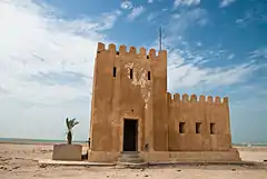
 Qala'at (Fort) Umm Al Maa | |
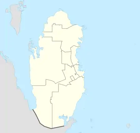
 Approximate location of Umm Al Maa archaeological site | |
| Location | Northwest Qatar |
|---|---|
| Coordinates | 25.817443°N 50.990465°E |
| Type | Settlement |
| Area | At least 600 km² |
| History | |
| Periods | Bronze Age (c. 3,000 BC) |
| Cultures | Unknown, possibly Dilmun |
| Site notes | |
| Excavation dates | 1957 1970s 1988–1991 |
| Archaeologists | Geoffrey Bibby & Peter Glob Beatrice de Cardi Masatoshi A Konishi, Takeshi Gotoh & Yoshihiko Akashi |
Etymology
The word "umm" is Arabic for "mother", and is a commonly used prefix used to signify geographic features. "Maa", the second constituent, is the Arabic word "water"; it was given this name in reference to multiple freshwater wells found in the area.[1]
Area description
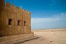
The immense region of Umm Al Maa is situated on the west coast of Qatar, around 80 km northwest of Doha and 55 km southwest of Madinat ash Shamal. For the most part, the area consists of level rocky plains and is accentuated with occasional low hillocks, depressions (rawdas) and furrows. Elevations of between 10 and 20 meters can be observed on its hillocks, which mainly comprise limestone but which are also composed of sedimentary depositions and sand. Rawdas of the area show great variations in size and length, with some only measuring a few meters in diameter and the largest depression, named Mleiha, having a length of several hundred meters.[2]
The area was long recognized for its abundance of potable water, as signified by its name. During rainy season, its multiple depressions would accommodate vast reservoirs of rainwater, which would supplement already-existing wells in the area, one of which is presently being used for a date palm plantation. Sabkhas (salt-flats) prevail on its coastline. Not much vegetation is to be found, with the exception of desert shrubs, prickly bushes, and on rare occasions, an Acacia tree.[2]

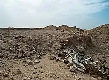
Most of the human activity seems to have been concentrated in the central Mleiha depression, which has an area of approximately 25 km². However, the burial ground's boundaries are known to extend much further; at least from the coastline in the west to the highway between Al Jemailiya and Al Ghuwariyah in the east, and from as far north as the highway linking Zubarah and Al Ghuwariyah to the Dukhan Highway in the south. These boundaries would give it a minimum size of roughly 600 km². Many of the burial mounds are grouped around low hillocks or in the rawdas. The better portion of these burial sites are in abhorrent conditions as a result of grave robbers, chemical and wind weathering, human traffic and recreational off-roading. These mounds are overlain mainly with limestone and on average have diameters of between 3 and 6 meters and stand from 10 cm to 1 meter tall. Similar ancient cemeteries have been observed at Ar Rakiyat to the north and at a smaller scale near the city of Al Khor on the eastern coast. Although the first official estimate of tombs was put at roughly 50 by the Danes in late 1950s, a German archaeological team that conducted a preliminary survey of the site in 2008 claimed there were at least a few hundred, if not thousands of mounds.[3]
Settlement
British archaeologist Beatrice de Cardi and her team were the first to study the settlement at Umm Al Maa in any great detail. Most remarkable among their discoveries were Indian Red Polished Ware and glazed earthenware, which they dated to the Sasanian period (c. third century AD to seventh century AD).[4]
The German archaeological team which carried out a preliminary survey of the area in 2008 noted that it had not found conclusive evidence of a settlement. Remnants of various stone structures were observed, but the majority were associated fire pits, prayer areas, barns and tent corrals, all of which would point towards more recent origins. The most convincing evidence of prior settlement was uncovered in the Mleiha depression near the only water well still in use, where outcroppings of old structures can be spotted. However, an earthenware fragment found by the team near the well was said not to be older than 200 to 300 years, thus this area may also be associated with more recent habitation. The team theorized that the ancient cairns were likely constructed by nomads rather than settled peoples, as the climate and geography of the area discouraged a sedentary lifestyle.[5]
Graveyard
Discovery

In 1957, an ancient graveyard containing 50 cairns was found here by a Danish archaeological duo consisting of Geoffrey Bibby and Peter Glob. The average cairn had a 10-meter diameter and stood around 1 meter tall. One of the cairns uncovered by the Danes in 1957, which had a diameter of 6 meters, a height of 0.6 meters and a length of 1.9 meters, was of particular interest. Further investigation uncovered that it had a stone cist with three roof slabs (flat rocks used to cover a grave) encompassed by smaller rocks. The cist was facing north-to-south and was fitted into the bedrock. Within the cist lied a skeleton facing towards the north. As no grave products were found alongside the skeleton, the Danes were unable to date it. However, they were able to date pit fired earthenware and sherds of an alabaster bowl found in the cairns. They postulated that the cairns and pottery most likely dated to the Bronze Age (c. 3,000 BC), which they concluded by comparison of similar Bronze Aged cairns found in Bahrain.[6]
First season
Picking up where the Danes left off was a Japanese archaeological mission which comprised Masatoshi A Konishi, Takeshi Gotoh and Yoshihiko Akashi. They surveyed Qatar from 1988 to 1991.[6] The Japanese team released their first report on the cairns in 1989. In their second report, they referred to these sites as 'burial mounds' rather than cairns. A burial mound dubbed J-2 by the Japanese team was found in an oval arrangement measuring 3.4 meters by 2.5 meters. Upon removing the roof slabs, a cist was uncovered. It was roughly 1.7 meters long and 0.3 meters wide. It comprised five or six substantial stone sections placed around the walls of a rectangular pit excavated into the bedrock. Inside the cist, a skeleton was found whose heading was roughly NWN-SES. As the skeleton was delicate, fallen slabs had fractured its head into several pieces. The skeleton belonged to a woman who was likely in late adulthood. No grave artifacts were found alongside the skeleton.[7]
Second season
Amid the second season, 1990–91, the Japanese group unearthed two burial complexes labelled J-3 and J-4, which featured a series of oval burial mounds measuring between 4 and 8 meters in diameter. The mounds were heaped on a thin, level layer of dark-colored sand with a depth of 4 to 8 centimeters. The mounds themselves were made mainly of light-colored sand and were slightly slanted.[7] After the mounds were dug up, oval arrangements of intently piled stones with recessed centers were uncovered. Disturbance of some of the mounds by grave robbers was readily apparent. Both complexes contained burial chambers covered by roof slabs and heaps of pebbles. Within one of the chambers, a skeleton was discovered, but it had decayed beyond the point of recognition, and no further information could be discerned. Artifacts recovered from the chamber include a little circular bead made of dark transparent flint glass and fragments of a bronze or copper bowl.[8]
More artifacts were discovered in the other chamber, including a cylindrical-shaped agate bead, two circular flint glass beads, pieces of bronze and copper rings, and an intact bronze and copper ring. Further items were found beneath the mound, including a stone mortar and fragments of pottery.[8]
There was little consistency in the planning of these burial chambers and the accommodations for their inhabitants. For instance, some were built to accommodate bodies in a contracted position, while others seemed to have been built to house more than one corpse.[9]
The Japanese team noted the similarity of the pottery and other finds to those of a Seleucid site on Failaka Island and posited a date of sometime between the first century BC and the first century AD.[10] Archaeologist Muhammad Abdul Nayeem has stated that these burials were reminiscent of graves purportedly built by nomads in Dhahran, Saudi Arabia around the third millennium BC.[9]
References
- "Geportal". The Centre for Geographic Information Systems of Qatar. Retrieved 24 February 2019.
- Juergen Schreiber, Tibor-Tamás Daroczi, Barbara Muhle & Joerg Ewersen (2009). "Excavations at the burial ground of Umm al-Ma', Qatar. Preliminary Report on the first season". p. 5. Retrieved 25 February 2019.CS1 maint: uses authors parameter (link)
- Juergen Schreiber, Tibor-Tamás Daroczi, Barbara Muhle & Joerg Ewersen (2009). "Excavations at the burial ground of Umm al-Ma', Qatar. Preliminary Report on the first season". p. 7. Retrieved 25 February 2019.CS1 maint: uses authors parameter (link)
- Juergen Schreiber, Tibor-Tamás Daroczi, Barbara Muhle & Joerg Ewersen (2008). "Excavations at the burial ground of Umm al-Ma', Qatar. Preliminary Report on the first season". p. 6. Retrieved 25 February 2019.CS1 maint: uses authors parameter (link)
- Juergen Schreiber, Tibor-Tamás Daroczi, Barbara Muhle & Joerg Ewersen (2008). "Excavations at the burial ground of Umm al-Ma', Qatar. Preliminary Report on the first season". p. 8. Retrieved 25 February 2019.CS1 maint: uses authors parameter (link)
- Abdul Nayeem, Muhammad (1998). Qatar Prehistory and Protohistory from the Most Ancient Times (Ca. 1,000,000 to End of B.C. Era). Hyderabad Publishers. p. 155. ISBN 9788185492049.
- Abdul Nayeem, Muhammad (1998). Qatar Prehistory and Protohistory from the Most Ancient Times (Ca. 1,000,000 to End of B.C. Era). Hyderabad Publishers. p. 158. ISBN 9788185492049.
- Abdul Nayeem, Muhammad (1998). Qatar Prehistory and Protohistory from the Most Ancient Times (Ca. 1,000,000 to End of B.C. Era). Hyderabad Publishers. p. 161. ISBN 9788185492049.
- Abdul Nayeem, Muhammad (1998). Qatar Prehistory and Protohistory from the Most Ancient Times (Ca. 1,000,000 to End of B.C. Era). Hyderabad Publishers. p. 164. ISBN 9788185492049.
- Juergen Schreiber, Tibor-Tamás Daroczi, Barbara Muhle & Joerg Ewersen (2008). "Excavations at the burial ground of Umm al-Ma', Qatar. Preliminary Report on the first season". p. 7. Retrieved 25 February 2019.CS1 maint: uses authors parameter (link)