Upper Bighouse
Upper Bighouse is a remote linear crofting township, which lies on the west bank of the Halladale River in the former county of Sutherland. It is now in the Highland council area.[1][2]
| Upper Bighouse | |
|---|---|
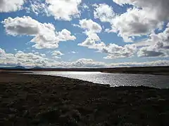 Loch nan Gall Looking roughly south along the loch, Ben Griam Beg and Ben Griam Mor on the horizon. | |
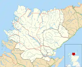 Upper Bighouse Location within the Sutherland area | |
| OS grid reference | NC888635 |
| Council area | |
| Country | Scotland |
| Sovereign state | United Kingdom |
| Post town | Thurso |
| Postcode district | KW13 6 |
| Police | Scotland |
| Fire | Scottish |
| Ambulance | Scottish |
Upper Bighouse is located 4 miles south of Melvich.
References
- "Upper Bighouse". The Gazetteer for Scotland. School of GeoSciences, University of Edinburgh and The Royal Scottish Geographical Society. Retrieved 4 January 2018.
- Microsoft; Nokia (7 March 2017). "Upper Bighouse" (Map). Bing Maps. Microsoft. Retrieved 7 March 2017.
This article is issued from Wikipedia. The text is licensed under Creative Commons - Attribution - Sharealike. Additional terms may apply for the media files.