Urbandale, Ottawa
Urbandale[1] (also known as Canterbury)[2] is a neighbourhood in Alta Vista Ward in Ottawa, Ontario, Canada. The neighbourhood is roughly located south of Pleasant Park Road, west of St. Laurent Boulevard, north of Walkley Road and east of the Kilborn Allotment Garden.[3] The total population for this area was 4,622 according to the Canada 2016 Census.[4]
Urbandale | |
|---|---|
Neighbourhood | |
 Sainte-Geneviève Parish | |
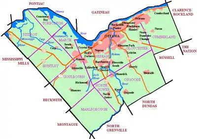 Urbandale Location within Ottawa | |
| Coordinates: 45°23′20″N 75°37′03″W | |
| Country | Canada |
| Province | Ontario |
| City | Ottawa |
| Government | |
| • MPs | David McGuinty |
| • MPPs | John Fraser |
| • Councillors | Jean Cloutier |
| • Governing body | Canterbury Community Association |
| Area | |
| • Land | 1.554 km2 (0.600 sq mi) |
| Elevation | 80 m (260 ft) |
| Population (2016) | |
| • Total | 4,622 |
| Canada 2016 Census | |
| Time zone | UTC-5 (Eastern (EST)) |
| Forward sortation area | K1G |
| Website | Canterbury Community Association |
The neighbourhood was built in the late 1950s and early 1960s,[5][6] and was first named Urbandale Acres and was built by Economy Home Builders Ltd.[7] Today, the name "Urbandale Acres" usually refers to an adjacent subdivision.[8] The Canterbury Square apartment complex would begin being built in 1964,[9] while the Lord Halifax Place apartments would be built by the end of the decade.
The neighbourhood was part of the Elmvale-Urbandale-Sharel Community Association, which changed its name to the Canterbury Community Association in 1968.[10]
Amenities
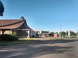
In the middle of the neighbourhood is Canterbury Park, which is hope to the Canterbury Community Centre, Brian Kilrea Arena, the Canterbury Pool and the Jim Tubman Chevrolet Sens Rink. The neighbourhood is also home to Canterbury High School, Sainte-Geneviève Catholic Elementary School, Arch Street Public School and Hawthorne Public School.
References
- "Urbandale". Geographical Names Data Base. Natural Resources Canada.
- "New ward name had Canterbury feeling left out". Ottawa Citizen. May 16, 1997. Retrieved July 8, 2020.
- https://www.google.com/maps/place/Urbandale,+Ottawa,+ON
- https://www12.statcan.gc.ca/census-recensement/2016/dp-pd/prof/details/page.cfm?Lang=E&Geo1=CT&Code1=5050008.00&Geo2=PR&Code2=01&Data=Count&SearchText=5050008.00&SearchType=Begins&SearchPR=01&B1=All&Custom=&TABID=3
- Producer: Surveys and Mapping Branch, Department of Energy, Mines and Resources Date published: 1963-01-01 (publication), 2016-01-01 (publication)
- GeoOttawa 1965 Aerial Map
- "NEW Pacesetting Model Homes by Economy Home Builders Ltd". Ottawa Citizen. November 8, 1958. Retrieved July 8, 2020.
- https://ottawadwellings.com/urbandale-acres/
- "Apartment Complex Underway". Ottawa Journal. July 11, 1964. Retrieved July 8, 2020.
- "Community Ass'n Shortens Name". Ottawa Journal. June 20, 1968. Retrieved July 8, 2020.
Places adjacent to Urbandale, Ottawa | |
|---|---|