Uriarra, New South Wales
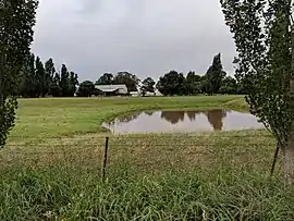
Uriarra is a locality in the Southern Tablelands of New South Wales, Australia in the Yass Valley Shire. It is north of the locality of Uriarra in the Australian Capital Territory and north-west of Canberra.[2][3] At the 2016 census, it had a population of 30.[1] The locality is mostly located in the Urayarra parish of Cowley County, although part of it in Pabral parish, which lies further west.[2]
| Uriarra New South Wales | |||||||||||||||
|---|---|---|---|---|---|---|---|---|---|---|---|---|---|---|---|
 | |||||||||||||||
Uriarra Location in New South Wales | |||||||||||||||
| Coordinates | 35°14′36″S 148°49′04″E | ||||||||||||||
| Population | 30 (2016 census)[1] | ||||||||||||||
| Postcode(s) | 2611 | ||||||||||||||
| LGA(s) | Yass Valley Council | ||||||||||||||
| County | Cowley | ||||||||||||||
| Parish |
| ||||||||||||||
| State electorate(s) | Goulburn | ||||||||||||||
| Federal Division(s) | Eden-Monaro | ||||||||||||||
| |||||||||||||||
References
- Australian Bureau of Statistics (27 June 2017). "Uriarra". 2016 Census QuickStats. Retrieved 24 July 2017.

- "Uriarra". Geographical Names Register (GNR) of NSW. Geographical Names Board of New South Wales. Retrieved 24 December 2020.
- "Uriarra". OpenStreetMap. Retrieved 25 December 2017.
| Towns and residential areas | |
|---|---|
| Localities |
|
Main Article: Local government areas of New South Wales | |
This article is issued from Wikipedia. The text is licensed under Creative Commons - Attribution - Sharealike. Additional terms may apply for the media files.