Valdese, North Carolina
Valdese is a town in Burke County, North Carolina, United States. The population was 4,490 at the 2010 census.[5] It is part of the Hickory-Lenoir-Morganton Metropolitan Statistical Area. One of the largest Waldensian congregations in the United States was founded in the town in the late nineteenth century, now known as the Waldensian Presbyterian Church. The town was settled by immigrants from the Cottian Alps in the Piedmont region of Italy.
Valdese, North Carolina | |
|---|---|
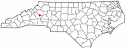 Location of Valdese, North Carolina | |
| Coordinates: 35°44′36″N 81°33′31″W | |
| Country | United States |
| State | North Carolina |
| County | Burke |
| Incorporated | 1920 |
| Area | |
| • Total | 7.87 sq mi (20.39 km2) |
| • Land | 7.86 sq mi (20.36 km2) |
| • Water | 0.01 sq mi (0.03 km2) |
| Elevation | 1,217 ft (371 m) |
| Population (2010) | |
| • Total | 4,490 |
| • Estimate (2019)[2] | 4,420 |
| • Density | 562.34/sq mi (217.13/km2) |
| Time zone | UTC-5 (Eastern (EST)) |
| • Summer (DST) | UTC-4 (EDT) |
| ZIP code | 28690 |
| Area code(s) | 828 |
| FIPS code | 37-69520[3] |
| GNIS feature ID | 0996570[4] |
| Website | townofvaldese |
History
Settled in 1893 by a group of Waldensians from Northern Italy; Valdese is Italian for "Valley of our Lord." the town was incorporated in 1920.[6]
In addition to Waldensian Presbyterian Church, the Jean-Pierre Auguste Dalmas House and Valdese Elementary School are listed on the National Register of Historic Places.[7]
The Valdese News, a newspaper serving Burke County, was published there from 1938 through 1950.
Geography
Valdese is located in eastern Burke County at 35°44′36″N 81°33′31″W (35.743270, -81.558662).[8] It is bordered to the east by the town of Rutherford College. The Valdese town limits extend north to Rhodhiss Lake on the Catawba River, then follow the land along the southern side of the lake for 4 miles (6 km) to the west.
U.S. Route 70 passes through the town as Main Street, leading west 7 miles (11 km) to the center of Morganton, the county seat, and east 14 miles (23 km) to Hickory. Interstate 40 runs along the southern border of the town, providing access from exits 111 and 112.
According to the United States Census Bureau, the town has a total area of 7.7 square miles (20.0 km2), of which 0.012 square miles (0.03 km2), or 0.17%, is water.[5]
Demographics
| Historical population | |||
|---|---|---|---|
| Census | Pop. | %± | |
| 1930 | 1,816 | — | |
| 1940 | 2,615 | 44.0% | |
| 1950 | 2,730 | 4.4% | |
| 1960 | 2,941 | 7.7% | |
| 1970 | 3,182 | 8.2% | |
| 1980 | 3,364 | 5.7% | |
| 1990 | 3,914 | 16.3% | |
| 2000 | 4,485 | 14.6% | |
| 2010 | 4,490 | 0.1% | |
| 2019 (est.) | 4,420 | [2] | −1.6% |
| U.S. Decennial Census[9] | |||
As of the census[3] of 2000, there were 4,485 people, 1,886 households, and 1,180 families residing in the town. The population density was 823.8 people per square mile (318.3/km2). There were 1,992 housing units at an average density of 365.9 per square mile (141.4/km2). The racial makeup of the town was 91.53% White, 1.05% African American, 0.22% Native American, 3.99% Asian, 0.07% Pacific Islander, 2.25% from other races, and 0.89% from two or more races. Hispanic or Latino of any race were 4.91% of the population.
There were 1,886 households, out of which 28.3% had children under the age of 18 living with them, 46.5% were married couples living together, 12.0% had a female householder with no husband present, and 37.4% were non-families. 33.8% of all households were made up of individuals, and 16.5% had someone living alone who was 65 years of age or older. The average household size was 2.29 and the average family size was 2.90.
In the town, the population was spread out, with 23.5% under the age of 18, 7.0% from 18 to 24, 26.8% from 25 to 44, 22.1% from 45 to 64, and 20.6% who were 65 years of age or older. The median age was 40 years. For every 100 females, there were 83.7 males. For every 100 females age 18 and over, there were 78.6 males.
The median income for a household in the town was $30,617, and the median income for a family was $41,411. Males had a median income of $27,482 versus $22,429 for females. The per capita income for the town was $18,965. About 8.3% of families and 11.9% of the population were below the poverty line, including 15.7% of those under age 18 and 11.5% of those age 65 or over.
Notable people
- Hugh Blackwell, member of the North Carolina House of Representatives[11]
- Doug Cline, American Football League (AFL) linebacker for the Houston Oilers and San Diego Chargers
- J. Bazzel Mull, Christian minister and religious broadcaster in East Tennessee[12]
- Stanley Pons, electrochemist
- Tyler Shatley, NFL guard for the Jacksonville Jaguars
- George Shuffler, bluegrass musician
Sister city
Valdese has one sister city, as designated by Sister Cities International:
 Torre Pellice, Italy
References
- "2019 U.S. Gazetteer Files". United States Census Bureau. Retrieved July 27, 2020.
- "Population and Housing Unit Estimates". United States Census Bureau. May 24, 2020. Retrieved May 27, 2020.
- "U.S. Census website". United States Census Bureau. Retrieved 2008-01-31.
- "US Board on Geographic Names". United States Geological Survey. 2007-10-25. Retrieved 2008-01-31.
- "Geographic Identifiers: 2010 Demographic Profile Data (G001): Valdese town, North Carolina". U.S. Census Bureau, American Factfinder. Archived from the original on February 12, 2020. Retrieved February 14, 2014.
- "North Carolina Gazetteer". Retrieved December 23, 2020.
- "National Register Information System". National Register of Historic Places. National Park Service. July 9, 2010.
- "US Gazetteer files: 2010, 2000, and 1990". United States Census Bureau. 2011-02-12. Retrieved 2011-04-23.
- "Census of Population and Housing". Census.gov. Retrieved June 4, 2015.
- GHIGO F. (1980) The Provençal speech of the Waldensian colonists of Valdese, North Carolina, Valdese: Historic Valdese Foundation;
HOLMES U. T. (1934) "Waldensian speech in North Carolina", Zeitschrift für romanische Philologie 54: 500-513 - Rep. Hugh Blackwell | North Carolina. TrackBill. Retrieved Jul 24, 2020.
- Jerry Summers: J. Bazzell Mull And Mrs. Mull. TheChattanoogan.com. Retrieved Jul 24, 2020.
External links
Municipalities and communities of Burke County, North Carolina, United States | ||
|---|---|---|
| Cities | 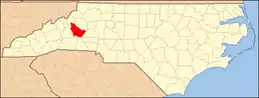 Burke County map | |
| Towns | ||
| CDPs | ||
| Unincorporated communities | ||
| Footnotes | ‡This populated place also has portions in an adjacent county or counties | |
| ||