Van Buren Township, Monroe County, Indiana
Van Buren Township is one of eleven townships in Monroe County, Indiana, United States. As of the 2010 census, its population was 11,981 and it contained 5,347 housing units.[2]
Van Buren Township | |
|---|---|
 Township hall, located in Stanford | |
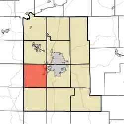 Location in Monroe County | |
| Coordinates: 39°07′23″N 86°37′58″W | |
| Country | |
| State | |
| County | Monroe |
| Government | |
| • Type | Indiana township |
| Area | |
| • Total | 34.85 sq mi (90.3 km2) |
| • Land | 34.85 sq mi (90.3 km2) |
| • Water | 0 sq mi (0 km2) 0% |
| Elevation | 820 ft (250 m) |
| Population (2010) | |
| • Total | 11,981 |
| • Density | 343.8/sq mi (132.7/km2) |
| Time zone | UTC-5 (Eastern (EST)) |
| • Summer (DST) | UTC-4 (EDT) |
| ZIP codes | 47403, 47404 |
| Area code(s) | 812, 930 |
| GNIS feature ID | 453950 |
History
Van Buren Township was established in 1837.[3]
Geography
According to the 2010 census, the township has a total area of 34.85 square miles (90.3 km2), all land.[2]
Cities, towns, villages
- Bloomington (west edge)
Unincorporated towns
- Elwren at 39.108658°N 86.669723°W
- Garden Acres at 39.124492°N 86.578054°W
- Highland Village at 39.160880°N 86.58361°W
- Kirby at 39.136714°N 86.609999°W
- Leonard Springs at 39.140603°N 86.577221°W
- Stanford at 39.089769°N 86.666668°W
- Van Buren Park at 39.135880°N 86.580832°W
(This list is based on USGS data and may include former settlements.)
Cemeteries
The township contains these two cemeteries: Harmony and Keller.
Major highways
Airports and landing strips
School districts
- Monroe County Community School Corporation
Political districts
- Indiana's 4th congressional district
- State House District 60
- State Senate District 40
References
- "Van Buren Township, Monroe County, Indiana". Geographic Names Information System. United States Geological Survey. Retrieved 2009-09-27.
- United States Census Bureau 2008 TIGER/Line Shapefiles
- IndianaMap
- "US Board on Geographic Names". United States Geological Survey. October 25, 2007. Retrieved 2017-05-09.
- "Population, Housing Units, Area, and Density: 2010 - County -- County Subdivision and Place -- 2010 Census Summary File 1". United States Census. Archived from the original on 2020-02-12. Retrieved 2013-05-10.
- Blanchard, Charles (1884). Counties of Morgan, Monroe and Brown, Indiana: Historical and Biographical. F.A. Battey & Company. pp. 381.
External links
Places adjacent to Van Buren Township, Monroe County, Indiana | |
|---|---|
Municipalities and communities of Monroe County, Indiana, United States | ||
|---|---|---|
| City | Map of Indiana highlighting Monroe County | |
| Towns | ||
| Townships | ||
| CDPs | ||
| Other unincorporated communities |
| |
| ||
| Authority control |
|
|---|
This article is issued from Wikipedia. The text is licensed under Creative Commons - Attribution - Sharealike. Additional terms may apply for the media files.
