Van Dyne, Wisconsin
Van Dyne is an unincorporated census-designated place in the town of Friendship, in Fond du Lac County, Wisconsin, United States.[3][4] At the 2010 census, its population is 279.[1] The road traveling north-south through the community was part of the Yellowstone Trail and later Wisconsin Highway 175; it is now a county highway.
Van Dyne, Wisconsin | |
|---|---|
Census-designated place | |
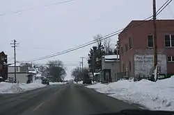 Looking south at downtown Van Dyne | |
 Van Dyne, Wisconsin | |
| Coordinates: 43°53′15″N 88°30′15″W | |
| Country | |
| State | |
| County | Fond du Lac |
| Area | |
| • Total | 2.05 km2 (0.790 sq mi) |
| • Land | 2.04 km2 (0.788 sq mi) |
| • Water | 0.005 km2 (0.002 sq mi) |
| Elevation | 241 m (791 ft) |
| Population | |
| • Total | 279 |
| • Density | 140/km2 (350/sq mi) |
| Time zone | UTC-6 (Central (CST)) |
| • Summer (DST) | UTC-5 (CDT) |
| Zip codes | 54979 |
| Area code(s) | 920 |
| GNIS feature ID | 1584511[2] |
History
The community was first platted by Daniel Van Duyne in 1866, and was a stop for a railroad between Fond du Lac and Oshkosh.[5][6] A post office has been operating in Van Dyne since 1866.[7]
Images
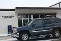 Post office
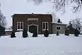 School
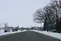 Sign
Sign
References
| Wikimedia Commons has media related to Van Dyne, Wisconsin. |
- "U.S. Census website". U.S. Census Bureau. Retrieved 20 April 2011.
- "US Board on Geographic Names". United States Geological Survey. 2007-10-25. Retrieved 2008-01-31.
- http://wisconsin.hometownlocator.com/wi/fond-du-lac/van-dyne.cfm
- http://www.wisconsinhistory.org/dictionary/index.asp?action=view&term_id=4283
- Ruth Shaw Worthing, The History of Fond du Lac County as Told by Its Place-Names Oshkosh, Wisconsin: Globe Printing, 1975. pg. 104
- Chicago and North Western Railway Company (1908). A History of the Origin of the Place Names Connected with the Chicago & North Western and Chicago, St. Paul, Minneapolis & Omaha Railways. p. 133.
- "Fond du Lac County". Jim Forte Postal History. Retrieved 30 March 2015.
Municipalities and communities of Fond du Lac County, Wisconsin, United States | ||
|---|---|---|
| Cities | 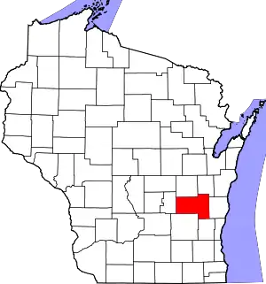 | |
| Villages | ||
| Towns | ||
| CDPs | ||
| Unincorporated communities |
| |
| Ghost towns/neighborhoods | ||
| Footnotes | ‡This populated place also has portions in an adjacent county or counties | |
| ||
This article is issued from Wikipedia. The text is licensed under Creative Commons - Attribution - Sharealike. Additional terms may apply for the media files.