Varnavas
Varnavas (Greek: Βαρνάβας "Barnabas") is a town in East Attica, Greece. Since the 2011 local government reform it is part of the municipality Marathon, of which it is a municipal unit.[2] It is part of Athens metropolitan area.
Varnavas
Βαρνάβας | |
|---|---|
 Varnavas Location within the regional unit 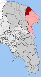 | |
| Coordinates: 38°13′N 23°55′E | |
| Country | Greece |
| Administrative region | Attica |
| Regional unit | East Attica |
| Municipality | Marathon |
| • Municipal unit | 37.349 km2 (14.421 sq mi) |
| Elevation | 453 m (1,486 ft) |
| Population (2011)[1] | |
| • Rural | 1,326 |
| • Municipal unit | 2,081 |
| • Municipal unit density | 56/km2 (140/sq mi) |
| Time zone | UTC+2 (EET) |
| • Summer (DST) | UTC+3 (EEST) |
| Postal code | 190 14 |
| Area code(s) | 22950 |
| Vehicle registration | ZX |
| Website | istomediahost.gr/varnavas |
Geography
Varnavas is situated in the hills of northeastern Attica. The main land use is agriculture. The nearest towns are Kapandriti (4 km west) and Grammatiko (4 km southeast). It is 8 km northwest of Marathon and 32 km northeast of the center of Athens. Landmarks include the Historic People's Museum of Varnavas (Istoriko Laografiko Mouseio Varnava).
The municipal unit has a land area of 37.349 km2 (14 sq mi)[3] and a total population of 2,081 inhabitants (2011).[1] Its other settlements are Agía Paraskeví (pop. 244), Ágioi Dimítrios kai Panteleímon (189), Moní Metamorfóseos Sotíros (136), Ágios Ioánnis (81), Pouríthi (66), Moní Panagías (32), and Limniónas (7).
Historical population
| Year | Village population | Community population |
|---|---|---|
| 1981 | 1,130 | - |
| 1991 | 1,170 | 1,404 |
| 2001 | 1,425 | 1,722 |
| 2011 | 1,326 | 2,081 |
References
- "Απογραφή Πληθυσμού - Κατοικιών 2011. ΜΟΝΙΜΟΣ Πληθυσμός" (in Greek). Hellenic Statistical Authority.
- Kallikratis law Greece Ministry of Interior (in Greek)
- "Population & housing census 2001 (incl. area and average elevation)" (PDF) (in Greek). National Statistical Service of Greece.
External links
- Official website (in English and Greek)
- GTP Travel Pages (Community)