Vina, California
Vina is a census-designated place (CDP) in Tehama County, California.[2] Vina sits at an elevation of 210 feet (64 m).[2] The 2010 United States census reported Vina's population was 237.
Vina | |
|---|---|
 Vina Position in California. | |
| Coordinates: 39°56′01″N 122°03′09″W | |
| Country | |
| State | |
| County | Tehama |
| Area | |
| • Total | 1.352 sq mi (3.501 km2) |
| • Land | 1.352 sq mi (3.501 km2) |
| • Water | 0 sq mi (0 km2) 0% |
| Elevation | 210 ft (60 m) |
| Population (2010) | |
| • Total | 237 |
| • Density | 180/sq mi (68/km2) |
| Time zone | UTC-8 (Pacific (PST)) |
| • Summer (DST) | UTC-7 (PDT) |
| ZIP Code | 96092 |
| Area code(s) | 530 |
| GNIS feature ID | 2628796 |
| U.S. Geological Survey Geographic Names Information System: Vina, California | |
Vina is the location of the Roman Catholic Trappist Abbey of New Clairvaux.[3]
History
Vina had its start in the 1860s as a winery operation, and derives its name from the Spanish-language word meaning "vineyard".[4] A post office has been in operation at Vina since 1871.[5]
Geography
According to the United States Census Bureau, the CDP covers an area of 1.4 square miles (3.5 km2), all of it land.
Demographics
The 2010 United States Census[6] reported that Vina had a population of 237. The population density was 175.3 people per square mile (67.7/km2). The racial makeup of Vina was 195 (82.3%) White, 1 (0.4%) African American, 7 (3.0%) Native American, 2 (0.8%) Asian, 0 (0.0%) Pacific Islander, 20 (8.4%) from other races, and 12 (5.1%) from two or more races. Hispanic or Latino of any race were 42 persons (17.7%).
The Census reported that 203 people (85.7% of the population) lived in households, 34 (14.3%) lived in non-institutionalized group quarters, and 0 (0%) were institutionalized.
There were 70 households, out of which 29 (41.4%) had children under the age of 18 living in them, 39 (55.7%) were opposite-sex married couples living together, 11 (15.7%) had a female householder with no husband present, 5 (7.1%) had a male householder with no wife present. There were 3 (4.3%) unmarried opposite-sex partnerships, and 0 (0%) same-sex married couples or partnerships. 10 households (14.3%) were made up of individuals, and 5 (7.1%) had someone living alone who was 65 years of age or older. The average household size was 2.90. There were 55 families (78.6% of all households); the average family size was 3.20.
The population was spread out, with 49 people (20.7%) under the age of 18, 21 people (8.9%) aged 18 to 24, 61 people (25.7%) aged 25 to 44, 55 people (23.2%) aged 45 to 64, and 51 people (21.5%) who were 65 years of age or older. The median age was 40.9 years. For every 100 females, there were 125.7 males. For every 100 females age 18 and over, there were 129.3 males.
There were 76 housing units at an average density of 56.2 per square mile (21.7/km2), of which 51 (72.9%) were owner-occupied, and 19 (27.1%) were occupied by renters. The homeowner vacancy rate was 3.8%; the rental vacancy rate was 9.5%. 152 people (64.1% of the population) lived in owner-occupied housing units and 51 people (21.5%) lived in rental housing units.
References
- "U.S. Census". Archived from the original on 2011-02-20. Retrieved 2012-12-19.
- U.S. Geological Survey Geographic Names Information System: Vina, California
- Greenberg, Peter (2 October 2007). The Complete Travel Detective Bible: The Consummate Insider Tells You What You Need to Know in an Increasingly Complex World. Rodale. p. 156. ISBN 978-1-59486-708-8.
- "Place Names" (PDF). Tehama County Department of Education. p. 56. Archived from the original (PDF) on 8 May 2017. Retrieved 25 March 2018.
- "Post Offices". Jim Forte Postal History. Retrieved 26 March 2018.
- "2010 Census Interactive Population Search: CA - Vina CDP". U.S. Census Bureau. Archived from the original on July 15, 2014. Retrieved July 12, 2014.
Municipalities and communities of Tehama County, California, United States | ||
|---|---|---|
| Cities | 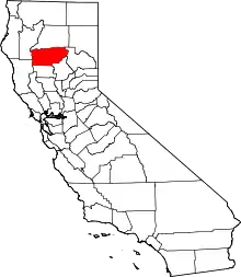 Tehama County map | |
| CDPs | ||
| Unincorporated communities | ||
| Footnotes | ‡This populated place also has portions in an adjacent county or counties | |
| ||
| Authority control |
|---|
