Wacousta, Michigan
Wacousta is an unincorporated community and census-designated place (CDP) in Clinton County in the U.S. state of Michigan. The CDP is located within Watertown Charter Township. As of the 2010 census, it had a population of 1,440.[3]
Wacousta, Michigan | |
|---|---|
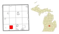 Location within Clinton County | |
 Wacousta Location within the state of Michigan  Wacousta Location within the United States | |
| Coordinates: 42°49′40″N 84°42′02″W | |
| Country | United States |
| State | Michigan |
| County | Clinton |
| Township | Watertown |
| Area | |
| • Total | 8.99 sq mi (23.28 km2) |
| • Land | 8.91 sq mi (23.08 km2) |
| • Water | 0.08 sq mi (0.21 km2) |
| Elevation | 797 ft (243 m) |
| Population (2010) | |
| • Total | 1,440 |
| • Density | 161.6/sq mi (62.4/km2) |
| Time zone | UTC-5 (Eastern (EST)) |
| • Summer (DST) | UTC-4 (EDT) |
| ZIP code | |
| Area code(s) | 517 |
| FIPS code | 26-82680[1] |
| GNIS feature ID | 1615648[2] |
History
The community of Wacousta was listed as a newly-organized census-designated place for the 2010 census, meaning it now has officially defined boundaries and population statistics for the first time.[4]
Geography
The Wacousta CDP has a total area of 8.99 square miles (23.28 km2), of which 8.91 square miles (23.08 km2) is land and 0.08 square miles (0.21 km2) (0.89%) is water.[3]
The Looking Glass River flows from east to west across the CDP.
References
- "Geographic Identifiers: 2010 Demographic Profile Data (G001): Wacousta CDP, Michigan". U.S. Census Bureau, American Factfinder. Archived from the original on February 12, 2020. Retrieved October 1, 2014.
- U.S. Geological Survey Geographic Names Information System: Wacousta, Michigan
- "Michigan: 2010 Population and Housing Unit Counts 2010 Census of Population and Housing" (PDF). 2010 United States Census. United States Census Bureau. September 2012. p. 19 Michigan. Retrieved January 9, 2021.
- "Michigan: 2010 Population and Housing Unit Counts 2010 Census of Population and Housing" (PDF). 2010 United States Census. United States Census Bureau. September 2012. p. III-5. Retrieved January 8, 2021.
Municipalities and communities of Clinton County, Michigan, United States | ||
|---|---|---|
| Cities | 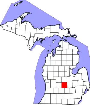 Map of Michigan highlighting Clinton County.svg | |
| Villages | ||
| Charter townships | ||
| Civil townships | ||
| CDPs | ||
| Other unincorporated communities | ||
| Footnotes | ‡This populated place also has portions in an adjacent county or counties | |
| ||
This article is issued from Wikipedia. The text is licensed under Creative Commons - Attribution - Sharealike. Additional terms may apply for the media files.
