Wall Lake, Iowa
Wall Lake is a city in Sac County, Iowa, United States. The population was 819 at the 2010 census.
Wall Lake, Iowa | |
|---|---|
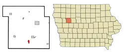 Location of Wall Lake, Iowa | |
| Coordinates: 42°16′16″N 95°5′30″W | |
| Country | |
| State | |
| County | Sac |
| Area | |
| • Total | 1.23 sq mi (3.19 km2) |
| • Land | 1.23 sq mi (3.19 km2) |
| • Water | 0.00 sq mi (0.00 km2) |
| Elevation | 1,257 ft (383 m) |
| Population | |
| • Total | 819 |
| • Estimate (2019)[3] | 769 |
| • Density | 624.19/sq mi (241.05/km2) |
| Time zone | UTC-6 (Central (CST)) |
| • Summer (DST) | UTC-5 (CDT) |
| ZIP code | 51466 |
| Area code(s) | 712 |
| FIPS code | 19-82020 |
| GNIS feature ID | 0462614 |
| Website | http://www.walllake.com |
Geography
Wall Lake is located at 42°16′16″N 95°5′30″W (42.271141, -95.091724).[6]
According to the United States Census Bureau, the city has a total area of 1.23 square miles (3.19 km2), all land.[7]
Demographics
| Year | Pop. | ±% |
|---|---|---|
| 1880 | 208 | — |
| 1890 | 439 | +111.1% |
| 1900 | 659 | +50.1% |
| 1910 | 561 | −14.9% |
| 1920 | 737 | +31.4% |
| 1930 | 749 | +1.6% |
| 1940 | 762 | +1.7% |
| 1950 | 753 | −1.2% |
| 1960 | 812 | +7.8% |
| 1970 | 936 | +15.3% |
| 1980 | 892 | −4.7% |
| 1990 | 875 | −1.9% |
| 2000 | 841 | −3.9% |
| 2010 | 819 | −2.6% |
| 2019 | 769 | −6.1% |
| Source:"U.S. Census website". United States Census Bureau. Retrieved 2020-03-29. and Iowa Data Center Source: | ||
2010 census
As of the census[2] of 2010, there were 819 people, 335 households, and 217 families living in the city. The population density was 665.9 inhabitants per square mile (257.1/km2). There were 366 housing units at an average density of 297.6 per square mile (114.9/km2). The racial makeup of the city was 99.8% White, 0.1% Asian, and 0.1% from two or more races. Hispanic or Latino of any race were 0.1% of the population.
There were 336 households, of which 26.9% had children under the age of 18 living with them, 54.9% were married couples living together, 7.2% had a female householder with no husband present, 2.7% had a male householder with no wife present, and 35.2% were non-families. 32.8% of all households were made up of individuals, and 17.3% had someone living alone who was 65 years of age or older. The average household size was 2.25 and the average family size was 2.84.
The median age in the city was 49.3 years. 22.3% of residents were under the age of 18; 3.9% were between the ages of 18 and 24; 20.1% were from 25 to 44; 25.2% were from 45 to 64; and 28.6% were 65 years of age or older. The gender makeup of the city was 45.9% male and 54.1% female.
2000 census
As of the census[9] of 2000, there were 841 people, 322 households, and 216 families living in the city. The population density was 776.2 people per square mile (300.7/km2). There were 338 housing units at an average density of 311.9 per square mile (120.8/km2). The racial makeup of the city was 98.22% White, 0.12% African American, 0.12% Native American, 0.12% Asian, and 1.43% from two or more races. Hispanic or Latino of any race were 0.12% of the population.
There were 326 households, out of which 30.4% had children under the age of 18 living with them, 57.1% were married couples living together, 6.8% had a female householder with no husband present, and 32.9% were non-families. 30.1% of all households were made up of individuals, and 20.2% had someone living alone who was 65 years of age or older. The average household size was 2.40 and the average family size was 3.00.
Age spread: 23.9% under the age of 18, 8.4% from 18 to 24, 21.6% from 25 to 44, 20.2% from 45 to 64, and 25.8% who were 65 years of age or older. The median age was 42 years. For every 100 females, there were 92.0 males. For every 100 females age 18 and over, there were 82.9 males.
The median income for a household in the city was $33,125, and the median income for a family was $38,750. Males had a median income of $27,386 versus $19,375 for females. The per capita income for the city was $15,390. About 7.2% of families and 11.0% of the population were below the poverty line, including 15.8% of those under age 18 and 8.3% of those age 65 or over.
Education
The city is served by the East Sac County Community School District.[10] It was a part of the Wall Lake Community School District until July 1, 1996, when it merged into the Wall Lake View Auburn School District. That in turn merged into East Sac County on July 1, 2011.[11]
Notable people
- Andy Williams, singer, was born in Wall Lake.
- Adam Williams, actor and Navy Cross recipient in World War II.
See also
References
- "2019 U.S. Gazetteer Files". United States Census Bureau. Retrieved July 17, 2020.
- "U.S. Census website". United States Census Bureau. Retrieved 2012-05-11.
- "Population and Housing Unit Estimates". United States Census Bureau. May 24, 2020. Retrieved May 27, 2020.
- History of Western Iowa, Its Settlement and Growth. Western Publishing Company. 1882. pp. 534.
- Chicago and North Western Railway Company (1908). A History of the Origin of the Place Names Connected with the Chicago & North Western and Chicago, St. Paul, Minneapolis & Omaha Railways. p. 135.
- "US Gazetteer files: 2010, 2000, and 1990". United States Census Bureau. 2011-02-12. Retrieved 2011-04-23.
- "US Gazetteer files 2010". United States Census Bureau. Retrieved 2012-05-11.
- "Census of Population and Housing". Census.gov. Retrieved June 4, 2015.
- "U.S. Census website". United States Census Bureau. Retrieved 2008-01-31.
- "East Sac County." Iowa Department of Education. Retrieved on July 18, 2018.
- "REORGANIZATION & DISSOLUTION ACTIONS SINCE 1965-66." Iowa Department of Education. Retrieved on July 20, 2018.
Municipalities and communities of Sac County, Iowa, United States | ||
|---|---|---|
| Cities | Map of Iowa highlighting Sac County | |
| Townships | ||
| Unincorporated community | ||
| Ghost town | ||
| Footnotes | ‡This populated place also has portions in an adjacent county or counties | |
| ||
| Authority control |
|---|