Wangan, Penghu
Wangan Township[3][4][5][6][7] / Wang-an Township (Chinese: 望安鄉; pinyin: Wàng'ān Xiāng; Pe̍h-ōe-jī: Bāng-oaⁿ-hiong) is a rural township in Penghu County (the Pescadores), Taiwan. It is the second smallest township after Cimei Township in Penghu County. The township is made up of eighteen islands six of which are inhabited.[1]
Wangan
望安 Wang-an, Wang'an, Pa Chao | |
|---|---|
| Wangan Township · 望安鄉 | |
 | |
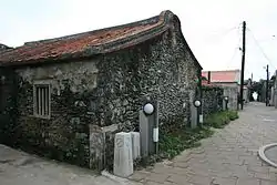
Wangan Township Hall Penghu County | |
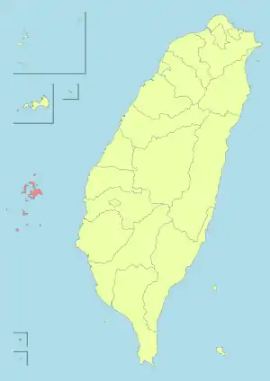
.svg.png.webp) Wangan Township in Penghu County | |
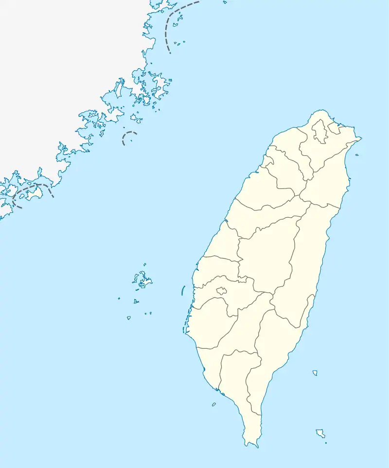
 Wangan Location in the Republic of China (Taiwan) | |
| Coordinates: 23°21′25.4″N 119°30′1.2″E | |
| Country | |
| County | |
| Rural villages (村) | 9 |
| Government | |
| • Chief Executive (鄉長) | Peng Ya-Hu (彭亞湖) |
| Area | |
| • Total | 13.7824 km2 (5.3214 sq mi) |
| Population (November 2017)[2] | |
| • Total | 5,188 |
| • Density | 380/km2 (970/sq mi) |
| Time zone | UTC+8 (National Standard Time) |
| Postal code | 882 |
| Website | www www |
Name
The main island is named Wangan Island.[8] The island was originally known as Bazhao / Pa Chao (八罩).[9]
Geography


It is located at the southern sea of Penghu. There are nineteen islets with nine villages on six of islets. Four village on the main island while others are on their own islet. Islands in the township include:[3][10][11][12]
- Hua Islet (Hua hsü, Hana-shima; 花嶼), Mau Islets (貓嶼), Cau Islet (草嶼), Nan Yun (南塭/南𥔋[13]), Wangan Island (望安島), Maanshan Islet (馬鞍山嶼), Jiangjyunao Islet (Chiang-chün-ao hsü, Shōgunō-sho; 將軍澳嶼), Chuanfanyu Reef (船帆嶼礁), Toujin (頭巾), Tiejhen (鐵砧), West Islet (Hsi-hsü-p'ing, Sei-sūpin; 西嶼平), East Islet (Tung-hsü-p'ing, Tō-sūpin; 東嶼平), Siji Islet (Hsi-chi hsü, Saikichi-sho; 西吉嶼), Chutou Islet (鋤頭嶼), and Dongji Island (Dongji Islet, Tung-chi hsü, Tō-kichi-sho; 東吉嶼).
Geology
The northern side of the island has a higher average elevation than the southern side. It consists of wave-cut platforms along its coastline.
Administrative divisions
Wangan includes nine rural villages:[1][14][15]
- Dongan[4]/Dong-an/Tungan Village (東安村)
- Si-an/Xian Village (西安村)
- Jhongshe[16]/Zhongshe Village (中社村)
- Shuei-an/Shuian Village (水垵村)
- Jiangjyun/Jiangjun Village (將軍村) centered on Jiangjyunao Islet (Chiang-chün-ao hsü, Shōgunō-sho; 將軍澳嶼)
- Dongji/Tungji Village (東吉村) centered on Dongji Island (Dongji Islet, Tung-chi hsü, Tō-kichi-sho; 東吉嶼)
- Dongping/Tungping Village (東坪村) centered on East Islet (Tung-hsü-p'ing, Tō-sūpin; 東嶼平)
- Siping/Xiping Village (西坪村) centered on West Islet (Hsi-hsü-p'ing, Sei-sūpin; 西嶼平)
- Huayu Village (花嶼村) centered on Hua Islet (花嶼)
Tourist attractions
- Budai Port
- Jiangjyun Island
- Jongshe Historic House
- Mao Islet
- Mount Tiantai
- Wangan Green Turtle Tourism and Conservation Center
- Yuanyang Caves
Transportation
Water
The township houses the Tanmen Port.
See also
References
- 望安鄉簡介. 澎湖縣望安鄉公所 Wangan Township Hall, Penghu County (in Chinese). 9 March 2018. Retrieved 31 October 2019.
本鄉位於澎湖群島之南方,由18個島嶼所組成,面積約為13.7824 平方公里,人口約4500人。其中有人居住者僅有望安島(行政區域劃分為東安、西安、中社、水垵四個村)、將軍澳嶼(將軍村)、東吉嶼(東吉村)、東嶼坪(東坪村)、西嶼坪(西坪村)、花嶼(花嶼村)六個島嶼,地勢平坦單調,無高山亦無河川,海岸多彎曲,附近海中多暗礁,潮流險惡,最高海拔為79公尺(大貓嶼)為澎湖縣最高點。
- 最新人口統計. 西嶼鄉戶政事務所 Xiyu Township Household Registration Office, Penghu County (in Chinese). November 2017. Retrieved 2 November 2019.
2017年11月 各里人口數、戶數統計 村里 鄰數 戶數 男 女 人口總數{...}總計 128 2025 2801 2387 5188
- "PENGHU From island to island" (PDF). Penghu County Government. 2010s. p. 2. Retrieved 31 October 2019.
Hua Islet Mau Islet Cau Islet Nan Yun Wangan Township Manashan [sic] Islet Jiangjyunnao [sic] Islet Chunanfanyu [sic] Reef Toujin Tiejhan [sic] West Islet East Islet Siji Islet Chutou Islet
- "Wangan Introduction". Wangan Township Office-Penghu County. Retrieved 31 October 2019.
Makung Airport has flights to Taipei, Taichung, Chiayi, Kaohsiung, and the offshore islands of Wangan and Chimei.{...}Dongan Vil., Wangan Township, Penghu County 882, Taiwan (R.O.C.)
- Kuo Hsing-i and Chi Jo-yao (25 July 2018). "Penghu's 5th desalination plant to operate by the end of the year". Focus Taiwan. Retrieved 31 October 2019.
The other two desalination plants in Penghu are in Wangan Township (望安鄉) and Siyu Township (西嶼鄉).
CS1 maint: uses authors parameter (link) - Chia-Chi Wu and Huei-Min Tsai (April 2016). "Capacity building for tourism development in a nested social–ecological system—A case study of the South Penghu Archipelago Marine National Park, Taiwan". Ocean & Coastal Management. 123: 66–73. doi:10.1016/j.ocecoaman.2016.02.001.
Four main islands—Xiyuping, Dongyuping, Xiji, and Dongji—and many small islets and wave-swept rocks are present in this region, which is part of the Wangan Township of Penghu County
CS1 maint: uses authors parameter (link) - 1.7-鄉鎮市區戶口數 [Population for Township and District]. Ministry of the Interior. August 2020. Retrieved 21 September 2020.
望安鄉 Wangan Township 13.7824 2,076 5,349 2,902 2,447 118.59 2.58 388
- Sarah Clark, ed. (2013). Taiwan. Insight Guides. Apa Publications. p. 235. ISBN 978-178-005-605-0.
Wangan Island (Wangan Dao) is approached by boat. It is famous for its turtles, but it is also a home to some quaint fishing villages, and features an impressive, craggy coastline.
- "Wangan Island". Penghu Tour Web Site. Retrieved 16 April 2018.
- 澎湖縣土地段名代碼表 (in Chinese). Department of Land Administration. 8 August 2000. Retrieved 1 November 2019.
地政事務所名稱(代碼) 澎湖(XA) 鄉鎮市區名稱(代碼) 望安鄉(05) 段 小段 代碼 備註
- 澎湖的島嶼. 澎湖國家風景區管理處 (in Chinese). Retrieved 2 November 2019.
# 行政區域 島嶼名稱 經度 緯度 面積 (平方公里) 有人居住 (*) {...}58 望安鄉 狗沙仔 119° 31' 41.29" 23° 22' 39.29" 0.1112 59 望安鄉 金瓜仔礁 119° 31' 30.58" 23° 22' 26.54" 0.1490 60 望安鄉 將軍澳嶼 119° 31' 51.39" 23° 22' 03.70" 1.5617 * 61 望安鄉 船帆嶼礁 119° 33' 09.78" 23° 21' 53.41" 0.0026 62 望安鄉 後袋仔 119° 32' 12.74" 23° 21' 40.53" 0.0279 63 望安鄉 馬鞍山嶼 119° 30' 49.06" 23° 22' 56.25" 0.0598 64 望安鄉 望安島 119° 30' 02.93" 23° 22' 19.24" 6.7413 * 65 望安鄉 花嶼 119° 19' 20.14" 23° 24' 11.71" 1.2737 * 66 望安鄉 大貓嶼 119° 19' 15.32" 23° 19' 24.57" 0.0903 67 望安鄉 小貓嶼 119° 19' 29.81" 23° 19' 20.12" 0.0117 68 望安鄉 草嶼2 (位於花嶼) 119° 20' 13.89" 23° 19' 06.00" 0.1821 69 望安鄉 頭巾 119° 30' 06.04" 23° 17' 23.25" 0.0074 70 望安鄉 西嶼坪嶼 119° 30' 26.60" 23° 16' 12.14" 0.3477 * 71 望安鄉 二塭 119° 30' 08.84" 23° 15' 28.98" 0.0028 72 望安鄉 東嶼坪嶼 119° 30' 59.41" 23° 15' 36.67" 0.4792 * 73 望安鄉 西吉嶼 119° 36' 56.23" 23° 14' 56.40" 0.8978 74 望安鄉 鋤頭嶼 119° 39' 33.48" 23° 15' 45.12" 0.1471 75 望安鄉 東吉嶼 119° 40' 18.79" 23° 15' 21.09" 1.7712 * 76 望安鄉 鐘仔 119° 31' 12.65" 23° 14' 02.66" 0.0040 77 望安鄉 船後礁 119° 30' 46.34" 23° 23' 45.37" 0.0027 78 望安鄉 天台山塭 119° 29' 16.18" 23° 22' 42.19" 0.0054 79 望安鄉 籠塭 119° 28' 48.56" 23° 21' 26.38" 0.0163 80 望安鄉 凹門礁 119° 31' 03.58" 23° 21' 23.50" 0.0004 81 望安鄉 北塭 119° 27' 43.93" 23° 21' 14.28" 0.0121 82 望安鄉 白沙塭 119° 28' 07.40" 23° 21' 06.48" 0.0063 83 望安鄉 南塭 119° 27' 56.39" 23° 20' 50.14" 0.0099 84 望安鄉 鐵砧 119° 30' 09.01" 23° 16' 34.69" 0.0205 85 望安鄉 香爐 119° 31' 10.02" 23° 15' 12.39" 0.0033 86 望安鄉 柴垵塭 119° 37' 05.97" 23° 15' 18.72" 0.0011 87 望安 豬母礁 119° 32' 49.72" 23° 14' 10.82" 0.0183 88 望安鄉 大塭 119° 32' 21.07" 23° 20' 57.69" 0.0175 89 望安鄉 酒甕礁 119° 31' 10.70" 23° 21' 06.48" 0.0015
- 澎湖縣土地段名代碼表 (in Chinese). Department of Land Administration. 15 January 2008. Retrieved 2 November 2019.
地政事務所名稱(代碼) 澎湖(XA) 鄉鎮市區名稱(代碼) 望安鄉(05) 段 小段 代碼 備註{...}將軍澳 0075 嶼坪 0076 東吉 0077 花嶼 0078 西吉 0079 草嶼 0135 註銷 南塭 0136 註銷 狗沙仔 0201 金瓜仔礁 0202 船帆嶼礁 0203 更正 後袋仔 0204 馬鞍山嶼 0205 大貓嶼 0206 小貓嶼 0207 頭巾 0208 二塭 0209 鋤頭嶼 0210 鐘仔 0211 船後礁 0212 天台山塭 0213 籠塭 0214 凹門礁 0215{...}北塭 0216 白沙塭 0217 鐵砧 0218 香爐 0219 柴垵塭 0220 豬母礁 0221 大塭 0222 酒甕礁 0223 南塭二 0224 草嶼二 0225 南塭一 0226
- 台灣縣市地圖集 (in Chinese). Banqiao District, Taiwan: 金時代文化出版有限公司. November 2010. p. 305. ISBN 978-986-6261-12-1.
南𥔋 北𥔋 籠𥔋 南𥔋 大𥔋 二𥔋
- "Precinct". Penghu County Govermment. Retrieved 31 October 2019.
Penghu county consists of 1 city and 5 townships, which are Magong city, Huxi Township, Baisha Township, Xiyu Township, Wang-an Township and Qimei Township.{...}The names of 9 villages in Wang-an Township Dong-an, Si-an, Jhongshe, Shuei-an, Jiangjyun, Dongping, Siping, Dongji and Huayu.
- "2018 Local Elections". Central Election Commission. Retrieved 31 October 2019.
Tungan Vil. Xian Vil. Zhongshe Vil. Shuian Vil. Jiangjun Vil. Tungping Vil. Xiping Vil. Tungji Vil. Huayu Vil.
- "Jhongshe Historical House". PENGHU NATIONAL SCENIC AREA. 21 December 2017. Retrieved 31 October 2019.
Jhongshe, Wangan Township, Penghu County{...}In 1971, the late president Chiang Ching-kuo visited the flower house, and seeing that it sits in the middle of four other villages in Wang an Township, renamed it “Jhongshe” (the village in the middle).{...}The architecture style of the historical houses in Jhongshe Village is called “one stamp” style sanheyuan.
External links
| Wikimedia Commons has media related to Wangan Township, Penghu County. |
- Wang-an Township Hall
- 【MIT台灣誌 #377】生態之島 望安 ('Made in Taiwan Annals of Taiwan #377: Ecological Island Wangan') (in Chinese)


