Wangjing, Manipur
Wangjing is a town and a municipal council in Thoubal district in the Indian state of Manipur.[1] It is about 6 km from district headquarters and an agricultural town in Thoubal district in the Indian state of Manipur. It is bordered by Heirok village in the east, Tentha village in the south-west, and on the other side by agricultural land. Wangjing River, a rivulet flowing down from the eastern hills, runs through the middle of the town, serving as a natural spring. It is connected to other parts of the state by the Imphal–Moreh national highway. It is the junction between Heirok and Tentha village.
Wangjing | |
|---|---|
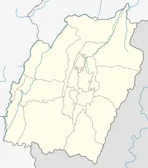
 Wangjing Location in Manipur, India  Wangjing Wangjing (India) | |
| Coordinates: 24.6°N 94.03°E | |
| Country | |
| State | Manipur |
| District | Thoubal |
| Area | |
| • Total | 4 km2 (2 sq mi) |
| Elevation | 766 m (2,513 ft) |
| Population (2011) | |
| • Total | 8,055 |
| • Density | 2,000/km2 (5,200/sq mi) |
| Languages | |
| • Official | Meiteilon (Manipuri) |
| Time zone | UTC+5:30 (IST) |
| Vehicle registration | MN |
| Website | manipur |
Geography
Wangjing is located at 24.6°N 94.03°E.[2] It has an average elevation of 766 metres (2513 feet).
Demographics
As of 2011 India census,[3] Wangjing had a population of 8,055. Males constitute 49% of the population and females 51%. Wangjing has an average literacy rate of 62%, higher than the national average of 59.5%: male literacy is 73%, and female literacy is 52%. In Wangjing, 15% of the population is under 6 years of age.
Economy
The economy of Wangjing depends on agriculture. Rice and cabbage are important products. Business is widely practiced in the bazar (market) area, and it is a secondary source of income generation.
Politics
The town is located in two Assembly constituencies, Wangjing Tentha and part of Khangabok. Wangjing Tentha Assembly constituency is part of Outer Manipur (Lok Sabha constituency).[4]
Sports
Kodompokpi District Sports Complex[5] is the multi-purpose stadium in Wangjing, Thoubal (Manipur). It is used mostly for football and athletics. The stadium holds 5,000 people and opened in 2016. The All India Football Federation allotted AMFA to host the prestigious The Sub-junior Girls’ National Football Championship 2017 from 26 October to 6 November at two venues of the State. which participated by 21 teams from across India including Manipur. The championship held at two venues, Artificial Turf Ground, Khuman Lampak, Imphal and Kodompokpi District Sports Complex, Wanging.
Healthcare
Wangjing Town is facilitated with two private clinic and one government primary healthcare centre which are open 24 hours and provide all required facilities.
- Primary Healthcare Centre, Wangjing-Lamding
- Swiss Clinic, Wangjing Bazar
- P.C.C Wangjing Bazar
- Emagi Eye care, Wangjing Bazar
Road
AH-1 passes through the Wangjing town and connected with Thoubal town and Moreh the border town of Manipur. It also connected with Tentha, Heirok, Salungpham, Wangbal (Uyal), Kairembikhok by inter village road.
Education
- Y.K. College
- Royal Academy Hr secondary Wangjing
- Institute of Rural Education (IRE), Wangjing
- Unique Children's School, Wangjing
- Wangjing High School (formerly Wangjing Secondary School)
- Rural Public School, Wangjing Heitupokpi Leikai
- Wangjing UJB School
- Wangjing Hodamba LP School Wangjing
- Wangjing Awang leikai LP School
- Wangjing Tekcham leikai LP school
References
- "Wangjing (NP)". 2011 Census of India. Government of India. Archived from the original on 15 September 2017. Retrieved 15 September 2017.
- Falling Rain Genomics, Inc - Wangjing
- "Census of India 2011: Data from the 2001 Census, including cities, villages and towns (Provisional)". Census Commission of India. Archived from the original on 16 June 2004. Retrieved 1 November 2008.
- "Assembly Constituencies – Corresponding Districts and Parliamentary Constituencies" (PDF). Manipur. Election Commission of India. Retrieved 7 October 2008.
- "Kodompokpi District Sports Complex". The Sangai Express. Manipur.
