Washington State Route 262
State Route 262 (SR 262) is a state highway in the U.S. state of Washington, serving rural Grant County. The highway travels north from SR 26 between Royal City and Othello through farmland and east through the Columbia National Wildlife Refuge and on top of the O'Sullivan Dam over the Potholes Reservoir before ending at SR 17 northwest of Warden. A roadway to the Potholes Reservoir has appeared on maps since 1922 and a fully paved road on the current route was built by 1981. SR 262 was designated in 1991 primarily to serve Potholes State Park.
| ||||
|---|---|---|---|---|
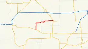 SR 262 is highlighted in red. | ||||
| Route information | ||||
| Auxiliary route of SR 26 | ||||
| Defined by RCW 47.17.481 | ||||
| Maintained by WSDOT | ||||
| Length | 24.22 mi[1] (38.98 km) | |||
| Existed | 1991[2]–present | |||
| Major junctions | ||||
| West end | ||||
| East end | ||||
| Location | ||||
| Counties | Grant | |||
| Highway system | ||||
| ||||

Route description
State Route 262 (SR 262) begins at an intersection with SR 26 between Royal City and Othello, north of the west area of the Columbia National Wildlife Refuge in rural Grant County.[3][4] Passing north through farmland with center pivot irrigation on the Frenchman Hills,[5] the highway turns east into O'Sullivan and passes Potholes State Park.[6] The roadway continues east and forms the boundary of the Potholes Reservoir,[7] the O'Sullivan Dam,[8][9] and the northern boundary of the Columbia National Wildlife Refuge.[10] SR 262 travels east, passing Soda Lake and Warden Lake,[11][12] before travelling through the Lind Coulee and ending at an intersection with SR 17 northwest of Warden.[13][14]
Every year, the Washington State Department of Transportation (WSDOT) conducts a series of surveys on its highways in the state to measure traffic volume. This is expressed in terms of average annual daily traffic (AADT), which is a measure of traffic volume for any average day of the year. In 2011, WSDOT calculated that between 480 and 1,200 vehicles per day used the highway.[15]
History
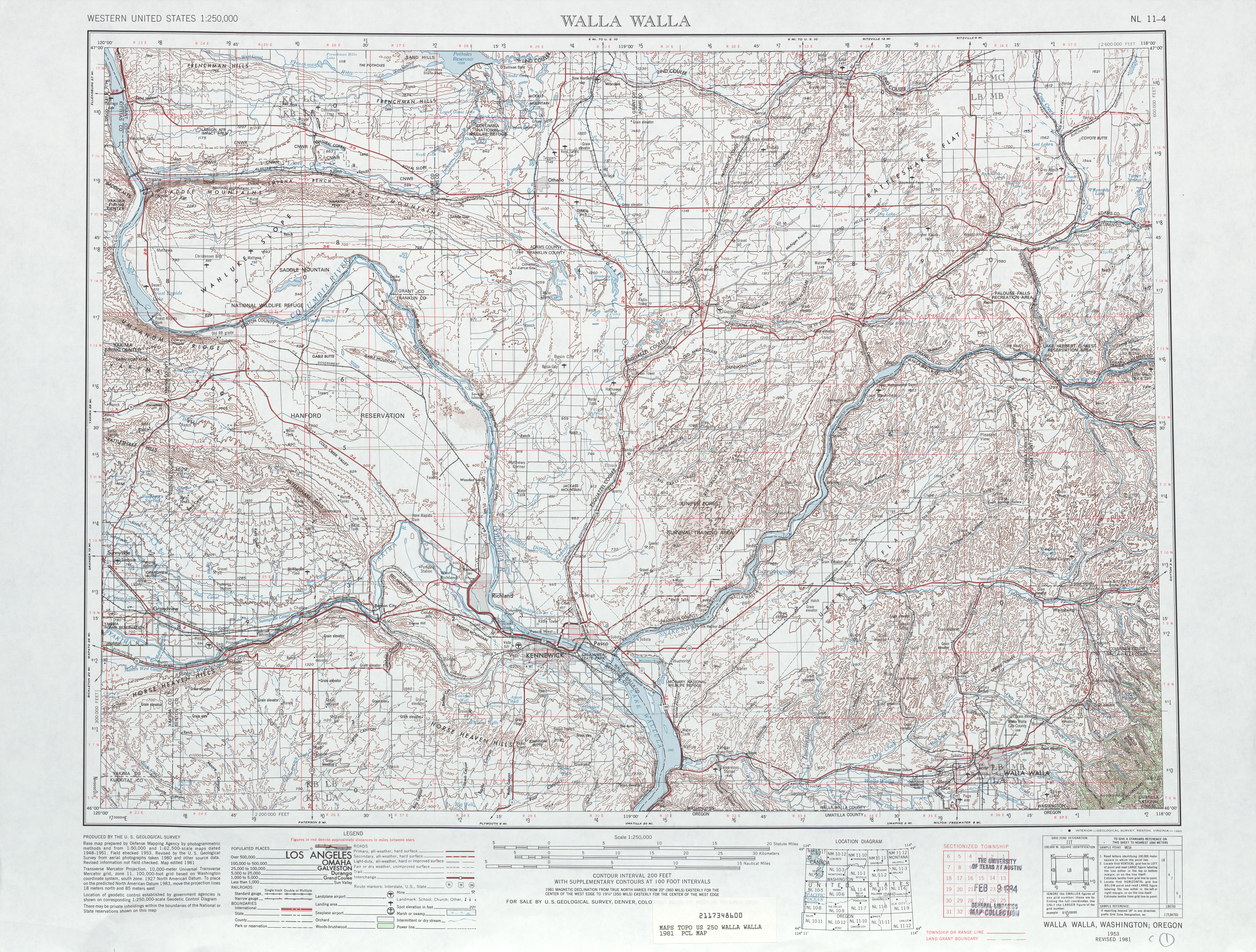
A basic, unpaved road was built during the early 20th century in Lind Coulee on the current route of State Route 262 (SR 262), appearing on a 1922 United States Geological Survey map of the Othello area.[16] After the establishment of the Columbia National Wildlife Refuge in 1944 and the completion of the O'Sullivan Dam and the Potholes Reservoir in 1949,[17][18] the road was paved and connected to SR 17 after the 1964 highway renumbering.[19][20] By the 1980s, a permanent road was built from SR 26 over the Frenchman Hills to the O'Sullivan Dam and onto SR 17.[21] The highway was designated as SR 262 in 1991 and designated into law in April 1992,[2] and has not been heavily revised since 1991.[22]
Major intersections
The entire highway is in Grant County.
| Location | mi[1] | km | Destinations | Notes | |
|---|---|---|---|---|---|
| | 0.00 | 0.00 | Western terminus | ||
| | 24.22 | 38.98 | Eastern terminus | ||
| 1.000 mi = 1.609 km; 1.000 km = 0.621 mi | |||||
References
- Staff (2012), State Highway Log: Planning Report 2011, SR 2 to SR 971 (PDF), Washington State Department of Transportation, pp. 1296–1298, retrieved January 13, 2013
- "47.17.481: State route No. 262", Revised Code of Washington, Washington State Legislature, 1991, retrieved January 13, 2013
- "Feature Detail Report for: Columbia National Wildlife Refuge", Geographic Names Information System, United States Geological Survey, September 10, 1979, retrieved January 13, 2013
- Columbia NWR (PDF) (Map). United States Fish and Wildlife Service. Retrieved January 13, 2013.
- "Feature Detail Report for: Frenchman Hills", Geographic Names Information System, United States Geological Survey, September 10, 1979, retrieved January 13, 2013
- Potholes State Park (PDF) (Map). Washington State Parks. December 16, 2010. Retrieved January 13, 2013.
- "Feature Detail Report for: Potholes Reservoir", Geographic Names Information System, United States Geological Survey, September 10, 1979, retrieved January 13, 2013
- "Feature Detail Report for: O'Sullivan Dam", Geographic Names Information System, United States Geological Survey, September 10, 1979, retrieved January 13, 2013
- Dam details - O'Sullivan Dam, United States Bureau of Reclamation, May 17, 2012, retrieved January 13, 2013
- Columbia National Wildlife Refuge, Scenic Auto Drive (PDF) (Map). United States Fish and Wildlife Service. Retrieved January 13, 2013.
- "Feature Detail Report for: Soda Lake", Geographic Names Information System, United States Geological Survey, September 10, 1979, retrieved January 13, 2013
- Warden Lake (Grant County), Washington Department of Fish and Wildlife, retrieved January 13, 2013
- Google (January 13, 2013). "State Route 262" (Map). Google Maps. Google. Retrieved January 13, 2013.
- "Feature Detail Report for: Lind Coulee", Geographic Names Information System, United States Geological Survey, September 10, 1979, retrieved January 13, 2013
- Staff (2011), 2011 Annual Traffic Report (PDF), Washington State Department of Transportation, pp. 163–164, retrieved January 13, 2013
- Washington: Othello Quadrangle, 1922 (JPG) (Map). 1:250,000. United States Geological Survey. 1922. Retrieved January 13, 2013.
- Tate, Cassandra (August 31, 2005), Columbia National Wildlife Refuge, HistoryLink, retrieved January 13, 2013
- Gibson, Elizabeth (December 3, 2005), First irrigation water reaches Pasco on May 15, 1948, HistoryLink, retrieved January 13, 2013
- Prahl, C. G. (December 1, 1965), Identification of State Highways (PDF), Washington State Highway Commission, Department of Highways, retrieved January 13, 2013
- Walla Walla, 1963 (JPG) (Map). 1:250,000. United States Geological Survey. 1963. Retrieved January 13, 2013.
- Walla Walla, 1981 (JPG) (Map). 1:250,000. United States Geological Survey. 1981. Retrieved January 13, 2013.
- Washington State Highways, 2011–2012 (PDF) (Map). 1:842,000. Washington State Department of Transportation. 2011. Retrieved January 13, 2013.