Waterford Nuclear Generating Station
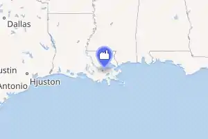
The Waterford Steam Electric Station, Unit 3, also known as Waterford 3, is a nuclear power plant located on a 3,000-acre (1,200 ha) plot in Killona, Louisiana, in St. Charles Parish, about 25 miles (40 km) west of New Orleans.[2]
| Waterford Nuclear Generating Station | |
|---|---|

| |
| Official name | Waterford Steam Electric Station |
| Country | United States |
| Location | Killona, St. Charles Parish, Louisiana |
| Coordinates | 29°59′43″N 90°28′16″W |
| Status | Operational |
| Construction began | November 14, 1974 |
| Commission date | September 24, 1985 |
| Construction cost | $5.476 billion (2007 USD)[1] |
| Owner(s) | Entergy Louisiana |
| Operator(s) | Entergy Nuclear |
| Nuclear power station | |
| Reactor type | PWR |
| Reactor supplier | Combustion Engineering |
| Cooling source | Mississippi River |
| Thermal capacity | 1 × 3716 MWth |
| Power generation | |
| Units operational | 1 × 1240 MW |
| Make and model | CE 2-loop (DRYAMB) |
| Nameplate capacity | 1190 MW |
| Capacity factor | 82.12% (2017) 87.10% (lifetime) |
| Annual net output | 8402 GWh (2017) |
| External links | |
| Website | Waterford 3 |
This plant has one Combustion Engineering two-loop pressurized water reactor. The plant produces 1,240 megawatts of electricity since the site's last refuel in March 2019. It has a dry ambient pressure containment building.
On August 28, 2005, Waterford shut down due to Hurricane Katrina approaching and declared an unusual event (the least-serious of a four-level emergency classification scale).[3] Shortly after Katrina, Waterford restarted and resumed normal operation.
During the 2011 Mississippi River floods, the plant was shut down briefly after a refueling shutdown on April 6,[4] but was restarted on May 12.[5][6]
The plant also shut down on October 17, 2012, for steam-generator replacement. The plant returned to full power in the middle of January 2013.
Surrounding population
The Nuclear Regulatory Commission defines two emergency planning zones around nuclear power plants: a plume exposure pathway zone with a radius of 10 miles (16 km), concerned primarily with exposure to, and inhalation of, airborne radioactive contamination, and an ingestion pathway zone of about 50 miles (80 km), concerned primarily with ingestion of food and liquid contaminated by radioactivity.[7]
The 2010 U.S. population within 10 miles (16 km) of Waterford was 75,538, an increase of 7.4 percent in a decade, according to an analysis of U.S. Census data for msnbc.com. The 2010 U.S. population within 50 miles (80 km) was 1,969,431, a decrease of 0.8 percent since 2000. Cities within 50 miles include New Orleans (33 miles to city center).[8]
Seismic risk
The Nuclear Regulatory Commission's estimate of the risk each year of an earthquake intense enough to cause core damage to the reactor at Waterford was 1 in 50,000, according to an NRC study published in August 2010.[9][10]
Notes
- "EIA - State Nuclear Profiles". www.eia.gov. Retrieved 3 October 2017.
- Waterford on US Nuclear Power Plants List
- NRC Page on Waterford 3 shutdown prior to Hurricane Katrina
- "NRC: Power Reactor Status Report for April 6, 2011". Nuclear Regulatory Commission. Retrieved 2011-05-16.
- "NRC: Power Reactor Status Report for May 11, 2011". Nuclear Regulatory Commission. 2011-05-11. Retrieved 2011-05-16.
- "NRC: Power Reactor Status Report for May 13, 2011". Nuclear Regulatory Commission. 2011-05-13. Retrieved 2011-05-16.
- "NRC: Emergency Planning Zones". United States Nuclear Regulatory Commission. Retrieved 2019-12-22.
- Bill Dedman, Nuclear neighbors: Population rises near US reactors, NBC News, April 14, 2011 http://www.nbcnews.com/id/42555888 Accessed May 1, 2011.
- Bill Dedman, "What are the odds? US nuke plants ranked by quake risk," NBC News, March 17, 2011 http://www.nbcnews.com/id/42103936 Accessed April 19, 2011.
- "Archived copy" (PDF). Archived from the original (PDF) on 2017-05-25. Retrieved 2011-04-19.CS1 maint: archived copy as title (link)