Waterhen River (Saskatchewan)
The Waterhen River is an east-flowing river in northwest Saskatchewan in the basin of the Beaver River (Canada). It is north of and parallel to the east-flowing part of the Beaver River and joins the north-flowing part of that river. It is at the southern edge of the boreal forest belt. The large Primrose Lake discharges south through the Martineau River into Cold Lake on the Alberta-Saskatchewan border. Cold Lake discharges east into the Cold River through Pierce Lake then into Lac des Iles. The Waterhen River begins on the east side of Lac des Iles and flows east to Waterhen Lake. Most of the river from Lac des Iles to Waterhen Lake is in Meadow Lake Provincial Park. East of Waterhen Lake the river leaves the park and flows east and somewhat north into the north-flowing part of the Beaver River.

| Waterhen River | |
|---|---|
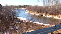 Waterhen River north of Green Lake | |
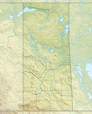 Location of the mouth in Saskatchewan | |
| Location | |
| Country | Canada |
| Province | Saskatchewan |
| Physical characteristics | |
| Source | Lac des Iles |
| • location | east of Cold Lake, Saskatchewan |
| • coordinates | 54°27′12″N 109°16′26″W |
| Mouth | Beaver River |
• location | Division 18, Saskatchewan |
• coordinates | 54°38′19″N 107°46′41″W |
| Basin features | |
| River system | Churchill River drainage basin |
| [1][2] | |
South of the river is Saskatchewan Highway 55, part of the Northern Woods and Water Route. Towns south of the river are Cold Lake, Alberta, Beaver Crossing, Alberta, Pierceland, Saskatchewan, Goodsoil, Saskatchewan and Meadow Lake, Saskatchewan.
Cree began moving into the area in the eighteenth century. There was a canoe route up the Waterhen with a portage to the Beaver River on the south side of Cold Lake. The first trading post in the area was Cold Lake House built by the Montreal traders in 1781 near the present Beaver Crossing, Alberta, south of Cold Lake. Around 1790 the North West Company had a post on Waterhen Lake.[3]
See also
References
- "Natural Resources Canada-Canadian Geographical Names (Waterhen River)". Retrieved 2014-10-11.
- "Atlas of Canada Toporama". Retrieved 2014-10-11.
- Morton,"A History of the Canadian West",page 451