Saskatchewan Highway 55
Highway 55 is a paved, undivided provincial highway in the Canadian province of Saskatchewan.[2] It runs from Alberta Highway 55 the Alberta border, west of Pierceland, to Highway 9, near Mountain Cabin. Highway 55 is 652 km long. It forms part of the interprovincial Northern Woods and Water Route.
| ||||
|---|---|---|---|---|
| Northern Woods and Water Route | ||||
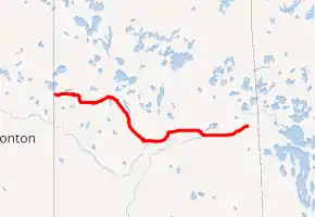
Highway 55 highlighted in red. | ||||
| Route information | ||||
| Maintained by Saskatchewan Ministry of Highways and Infrastructure | ||||
| Length | 650.1 km[1] (404.0 mi) | |||
| Major junctions | ||||
| West end | Alberta border continues as | |||
| ||||
| East end | ||||
| Location | ||||
| Rural municipalities | Beaver River RM, Meadow Lake RM, Northern Administration District, Big River RM, Canwood RM, Shellbrook RM, Buckland RM, Garden River RM, Paddockwood RM, Torch River RM, Nipawin RM, Moose Range RM, Hudson Bay RM | |||
| Major cities | Prince Albert | |||
| Highway system | ||||
Provincial highways in Saskatchewan
| ||||
.svg.png.webp)
Attractions
On the west portion of Highway 55 from the Alberta border, the Village of Pierceland is located at Highway 21. To the North of Pierceland is the Meadow Lake Provincial Park. This top rated Park stretches about 115 kilometres from the Alberta border to just north of the City of Meadow Lake, Saskatchewan.
The regional park of Morin Lake is 15 km south of the highway near Debden, Saskatchewan, and Victoire, Saskatchewan.[3] Nipawin Bridge located on highway 55 is Saskatchewan's longest bridge.[4]
Wildcat Hill Provincial Park is located just south of the eastern end of the highway; however, the park itself is only accessible by ATV or snowmobile.
Major intersections
| Rural municipality | Location | km[1] | mi | Destinations | Notes | |||
|---|---|---|---|---|---|---|---|---|
| Beaver River No. 622 | | 0.0 | 0.0 | Continuation into Alberta | ||||
| Pierceland | 15.6 | 9.7 | ||||||
| Peerless | 51.9 | 32.2 | West end of Hwy 26 concurrency | |||||
| | 53.3 | 33.1 | East end of Hwy 26 concurrency | |||||
| ↑ / ↓ | | 71.2 | 44.2 | Crosses the Beaver River | ||||
| Meadow Lake No. 588 | | 89.0 | 55.3 | |||||
| | 111.0 | 69.0 | West end of Hwy 4 concurrency | |||||
| City of Meadow Lake | 120.9 | 75.1 | East end of Hwy 4 concurrency | |||||
| Meadow Lake No. 588 | | 132.1 | 82.1 | |||||
| | 140.1 | 87.1 | ||||||
| Northern Administration District | Green Lake | 170.3 | 105.8 | Passes through Green Lake | ||||
| | 198.2 | 123.2 | ||||||
| Big River No. 555 | Big River | 246.5 | 153.2 | Passes through Big River | ||||
| | 254.5 | 158.1 | ||||||
| | 255.6 | 158.8 | ||||||
| Canwood No. 494 | Debden | 284.6 | 176.8 | |||||
| | 309.8 | 192.5 | ||||||
| Canwood | 310.3 | 192.8 | ||||||
| Shellbrook No. 493 | | 329.0 | 204.4 | |||||
| Shellbrook | 334.0 | 207.5 | West end of Hwy 3 concurrency | |||||
| Holbein | 346.7 | 215.4 | ||||||
| Buckland No. 491 |
No major junctions | |||||||
| City of Prince Albert | 376.2 | 233.8 | Interchange; east end of Hwy 3 concurrency | |||||
| 377.0 | 234.3 | Riverside Drive | Westbound access to Hwy 2 south / Hwy 3 east | |||||
| Buckland No. 491 | | 393.6 | 244.6 | Pulp Haul Road | ||||
| Garden River No. 490 | | 395.9 | 246.0 | West end of Hwy 780 concurrency | ||||
| | 399.9 | 248.5 | East end of Hwy 780 concurrency | |||||
| Meath Park | 417.2 | 259.2 | ||||||
| 418.3 | 259.9 | |||||||
| Weirdale | 424.9 | 264.0 | Range Road 2230 | |||||
| Torch River No. 488 | Smeaton | 454.7 | 282.5 | |||||
| Snowden | 464.4 | 288.6 | ||||||
| Choiceland | 475.9 | 295.7 | ||||||
| White Fox | 505.0 | 313.8 | West end of Hwy 35 concurrency | |||||
| ↑ / ↓ | | 512.8 | 318.6 | Nipawin Bridge across the Saskatchewan River | ||||
| Nipawin No. 487 | Nipawin | 516.9 | 321.2 | East end of Hwy 35 concurrency | ||||
| | 527.8 | 328.0 | ||||||
| Moose Range No. 486 | | 545.1 | 338.7 | |||||
| | 545.7 | 339.1 | ||||||
| | 572.6 | 355.8 | ||||||
| Northern Administration District | | 589.1 | 366.0 | Red Earth Access Road – Red Earth First Nation | ||||
| | 611.9 | 380.2 | Pakwaw Lake Access Road – Shoal Lake First Nation | |||||
| | 650.1 | 404.0 | Eastern terminus; NWWR follows Hwy 9 east | |||||
1.000 mi = 1.609 km; 1.000 km = 0.621 mi
| ||||||||
References
- "Saskatchewan Highway 55" (Map). Google Maps. Google. Retrieved December 14, 2017.
- "TYPE ADMN_CLASS TOLL_RD RTE_NUM1 RTE_NUM2 ROUTE 1 Gravel ..." Government of Canada. Retrieved 2008-02-17.
- Mile By Mile Media (2007), Saskatchewan Road Map Travel Guide: #55 Town of Smeaton to City of ..., archived from the original on 2009-03-31, retrieved 2007-11-01
- ORDER on Highway 943 - Highways and Infrastructure - Government of Saskatchewan, 2007, retrieved 2002-08-20
- Saskatchewan Official Road Map (Map) (2015/2016 ed.). Saskatchewan Government. § A-6, B-6, C-6, C-5, D-5, E-5, F-5, G-5, and H-5.
- Saskatchewan Road Atlas (2007 ed.). Oshawa, ON: MapArt Publishing Corp. pp. 16–21.