Wellsville, Missouri
Wellsville is a city in Montgomery County, Missouri, United States. The population was 1,217 at the 2010 census.
Wellsville, Missouri | |
|---|---|
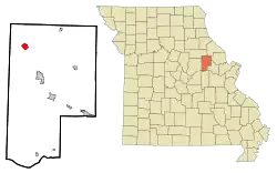 Location of Wellsville, Missouri | |
| Coordinates: 39°4′26″N 91°34′5″W | |
| Country | United States |
| State | Missouri |
| County | Montgomery |
| Area | |
| • Total | 1.54 sq mi (3.99 km2) |
| • Land | 1.54 sq mi (3.98 km2) |
| • Water | 0.00 sq mi (0.01 km2) |
| Elevation | 817 ft (249 m) |
| Population | |
| • Total | 1,217 |
| • Estimate (2019)[3] | 1,159 |
| • Density | 754.07/sq mi (291.20/km2) |
| Time zone | UTC-6 (Central (CST)) |
| • Summer (DST) | UTC-5 (CDT) |
| ZIP code | 63384 |
| Area code(s) | 573 |
| FIPS code | 29-78406[4] |
| GNIS feature ID | 0728504[5] |
History
Wellsville was platted in 1856, and named after Charles Wells who was the original owner of the land.[6] A post office called Wellsville has been in operation since 1857.[7]
Geography
Wellsville is located at 39°4′26″N 91°34′5″W (39.073782, -91.568006).[8]
According to the United States Census Bureau, the city has a total area of 1.54 square miles (3.99 km2), all land.[9]
Demographics
| Historical population | |||
|---|---|---|---|
| Census | Pop. | %± | |
| 1880 | 867 | — | |
| 1890 | 1,138 | 31.3% | |
| 1900 | 1,160 | 1.9% | |
| 1910 | 1,194 | 2.9% | |
| 1920 | 1,551 | 29.9% | |
| 1930 | 1,525 | −1.7% | |
| 1940 | 1,314 | −13.8% | |
| 1950 | 1,519 | 15.6% | |
| 1960 | 1,523 | 0.3% | |
| 1970 | 1,565 | 2.8% | |
| 1980 | 1,546 | −1.2% | |
| 1990 | 1,430 | −7.5% | |
| 2000 | 1,423 | −0.5% | |
| 2010 | 1,217 | −14.5% | |
| 2019 (est.) | 1,159 | [3] | −4.8% |
| U.S. Decennial Census[10] | |||
2010 census
As of the census[2] of 2010, there were 1,217 people, 446 households, and 289 families residing in the city. The population density was 790.3 inhabitants per square mile (305.1/km2). There were 564 housing units at an average density of 366.2 per square mile (141.4/km2). The racial makeup of the city was 95.6% White, 2.8% African American, 0.5% Native American, 0.1% Pacific Islander, 0.2% from other races, and 0.8% from two or more races. Hispanic or Latino of any race were 0.7% of the population.
There were 446 households, of which 34.1% had children under the age of 18 living with them, 47.1% were married couples living together, 11.2% had a female householder with no husband present, 6.5% had a male householder with no wife present, and 35.2% were non-families. 31.2% of all households were made up of individuals, and 15.5% had someone living alone who was 65 years of age or older. The average household size was 2.54 and the average family size was 3.15.
The median age in the city was 41 years. 25.9% of residents were under the age of 18; 6.2% were between the ages of 18 and 24; 22.2% were from 25 to 44; 24.6% were from 45 to 64; and 21.2% were 65 years of age or older. The gender makeup of the city was 49.5% male and 50.5% female.
2000 census
As of the census[4] of 2000, there were 1,423 people, 533 households, and 346 families residing in the city. The population density was 999.8 people per square mile (386.9/km2). There were 604 housing units at an average density of 424.4 per square mile (164.2/km2). The racial makeup of the city was 93.18% White, 4.43% African American, 0.21% Native American, 0.07% Asian, 0.35% from other races, and 1.76% from two or more races. Hispanic or Latino of any race were 1.05% of the population.
There were 533 households, out of which 32.6% had children under the age of 18 living with them, 49.9% were married couples living together, 11.4% had a female householder with no husband present, and 34.9% were non-families. 30.4% of all households were made up of individuals, and 15.6% had someone living alone who was 65 years of age or older. The average household size was 2.48 and the average family size was 3.08.
In the city, the population was spread out, with 26.7% under the age of 18, 7.7% from 18 to 24, 25.7% from 25 to 44, 18.3% from 45 to 64, and 21.6% who were 65 years of age or older. The median age was 38 years. For every 100 females, there were 91.0 males. For every 100 females age 18 and over, there were 83.3 males.
The median income for a household in the city was $27,260, and the median income for a family was $32,917. Males had a median income of $28,750 versus $18,750 for females. The per capita income for the city was $11,817. About 14.8% of families and 20.3% of the population were below the poverty line, including 31.7% of those under age 18 and 14.2% of those age 65 or over.
Education
Public education in Wellsville is administered by Wellsville-Middletown R-I School District.[11]
Wellsville has a lending library, the Wellsville Public Library.[12]
References
- "2019 U.S. Gazetteer Files". United States Census Bureau. Retrieved July 26, 2020.
- "U.S. Census website". United States Census Bureau. Retrieved 2012-07-08.
- "Population and Housing Unit Estimates". United States Census Bureau. May 24, 2020. Retrieved May 27, 2020.
- "U.S. Census website". United States Census Bureau. Retrieved 2008-01-31.
- "US Board on Geographic Names". United States Geological Survey. 2007-10-25. Retrieved 2008-01-31.
- "Post Offices". Jim Forte Postal History. Retrieved 13 November 2016.
- "Montgomery County Place Names, 1928–1945". The State Historical Society of Missouri. Archived from the original on June 24, 2016. Retrieved November 13, 2016.
- "US Gazetteer files: 2010, 2000, and 1990". United States Census Bureau. 2011-02-12. Retrieved 2011-04-23.
- "US Gazetteer files 2010". United States Census Bureau. Retrieved 2012-07-08.
- "Census of Population and Housing". Census.gov. Retrieved June 4, 2015.
- "Homepage". Wellsville Middletown R-I School District. Retrieved 5 June 2019.
- "Missouri Public Libraries". PublicLibraries.com. Archived from the original on 10 June 2017. Retrieved 5 June 2019.
External links
- Historic maps of Wellsville in the Sanborn Maps of Missouri Collection at the University of Missouri
Municipalities and communities of Montgomery County, Missouri, United States | ||
|---|---|---|
| Cities | 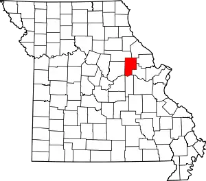 Map of Missouri highlighting Montgomery County | |
| Village | ||
| Townships | ||
| CDPs | ||
| Other unincorporated communities | ||
| ||
| Authority control |
|---|