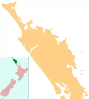
Whirinaki, Northland
Whirinaki is a locality on the Whirinaki River in the south Hokianga, in Northland, New Zealand. The name means "to lean against a support".[1] Highway 12 runs through it. Opononi lies to the south west, and Rawene lies to the north east.[2][3]
Whirinaki | |
|---|---|
 Whirinaki | |
| Coordinates: 35°28′26″S 173°27′45″E | |
| Country | New Zealand |
| Region | Northland Region |
| District | Far North District |
| Population (c.2005) | |
| • Total | 200 |
It is part of the Hokianga South statistical area, which covers the southern side of Hokianga Harbour between Rawene and Koutu. For demographics of this area, see Rawene.
History and culture
Whirinaki was raided by Te Roroa in 1810 or 1811, during the Musket Wars. All the inhabitants of Opara village were killed.[4]
The area has three marae associated with Ngāpuhi hapū:[5]
- Mātai Aranui Marae are affiliated with Ngāti Kairewa, Ngāti Kerewheti, Ngāti Te Pou, Te Hikutu and Te Whānau Whero.
- Mōria Marae are affiliated with Ngāti Kairewa, Ngāti Kerewheti, Ngāti Te Pou, Ngāti Tuapango, Te Hikutu and Te Whānau Whero.
- Pā te Aroha Marae are affiliated with Ngāti Kairewa, Ngāti Kerewheti, Ngāti Te Pou, Ngāti Tuapango, Te Hikutu and Te Whānau Whero.[6]
Education
Te Kura Kaupapa Maori o Te Tonga o Hokianga is a coeducational full primary (years 1-8) school[7] has a roll of 106 It is a Kura Kaupapa Māori school which teaches fully in the Māori language.
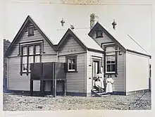
There was a Whirinaki Native School during the early-mid 20th century.[8]
Notes
- "Ngā Puhi - Ancestors". Te Ara: The Encyclopedia of New Zealand.
- Peter Dowling (editor) (2004). Reed New Zealand Atlas. Reed Books. pp. map 6. ISBN 0-7900-0952-8.CS1 maint: extra text: authors list (link)
- Roger Smith, GeographX (2005). The Geographic Atlas of New Zealand. Robbie Burton. pp. map 22. ISBN 1-877333-20-4.
- Smith, Stephenson Percy (1910). "Further Wars on the Border-Land". Maori Wars of the Nineteenth Century. p. 52.
- "Māori Maps". maorimaps.com. Te Potiki National Trust.
- "Te Kāhui Māngai directory". tkm.govt.nz. Te Puni Kōkiri.
- Education Counts: Te Kura Kaupapa Maori o Te Tonga o Hokianga
- Lange, Raeburn (1999). May the People Live: a history of Maori health development, 1900-1920. p. 76. ISBN 1869402146.
