Whispering Pines, North Carolina
Whispering Pines is a village in Moore County, North Carolina, United States. The population was 2,928 at the 2010 census.
Whispering Pines, North Carolina | |
|---|---|
 Location in Moore County and the state of North Carolina. | |
| Coordinates: 35°15′20″N 79°22′15″W | |
| Country | United States |
| State | North Carolina |
| County | Moore |
| Government | |
| • Mayor | Alexa Roberts |
| • Manager | Rich Lambdin |
| Area | |
| • Total | 4.32 sq mi (11.20 km2) |
| • Land | 3.70 sq mi (9.58 km2) |
| • Water | 0.63 sq mi (1.62 km2) |
| Elevation | 371 ft (113 m) |
| Population (2010) | |
| • Total | 2,928 |
| • Estimate (2019)[2] | 3,399 |
| • Density | 919.39/sq mi (354.95/km2) |
| Time zone | UTC-5 (Eastern (EST)) |
| • Summer (DST) | UTC-4 (EDT) |
| ZIP code | 28327 |
| Area code(s) | 910 |
| FIPS code | 37-73140[3] |
| GNIS feature ID | 1023195[4] |
| Website | https://www.whisperingpinesnc.net |
Geography
Whispering Pines is located at 35°15′20″N 79°22′15″W (35.255583, -79.370890).[5]
According to the United States Census Bureau, the village has a total area of 3.7 square miles (9.6 km2), of which, 3.0 square miles (7.8 km2) of it is land and 0.6 square miles (1.6 km2) of it (17.44%) is water.
Demographics
| Historical population | |||
|---|---|---|---|
| Census | Pop. | %± | |
| 1970 | 362 | — | |
| 1980 | 1,160 | 220.4% | |
| 1990 | 1,243 | 7.2% | |
| 2000 | 2,090 | 68.1% | |
| 2010 | 2,928 | 40.1% | |
| 2019 (est.) | 3,399 | [2] | 16.1% |
| U.S. Decennial Census[6] | |||
As of the census[3] of 2000, there were 2,090 people, 970 households, and 770 families residing in the village. The population density was 689.9 people per square mile (266.3/km2). There were 1,054 housing units at an average density of 347.9 per square mile (134.3/km2). The racial makeup of the village was 97.89% White, 1.15% African American, 0.24% Native American, 0.33% Asian, 0.10% Pacific Islander, 0.05% from other races, and 0.24% from two or more races. Hispanic or Latino of any race were 1.15% of the population.
There were 970 households, out of which 14.6% had children under the age of 18 living with them, 76.7% were married couples living together, 2.4% had a female householder with no husband present, and 20.6% were non-families. 19.3% of all households were made up of individuals, and 13.3% had someone living alone who was 65 years of age or older. The average household size was 2.15 and the average family size was 2.43.
In the village, the population was spread out, with 13.0% under the age of 18, 1.5% from 18 to 24, 13.9% from 25 to 44, 25.4% from 45 to 64, and 46.2% who were 65 years of age or older. The median age was 63 years. For every 100 females, there were 89.5 males. For every 100 females age 18 and over, there were 91.4 males.
The median income for a household in the village was $60,035, and the median income for a family was $66,587. Males had a median income of $48,906 versus $33,750 for females. The per capita income for the village was $33,086. About 0.5% of families and 1.2% of the population were below the poverty line, including 2.0% of those under age 18 and 1.0% of those age 65 or over.
Notable residents
- Shannon Moore, TNA wrestler
References
- "2019 U.S. Gazetteer Files". United States Census Bureau. Retrieved July 27, 2020.
- "Population and Housing Unit Estimates". United States Census Bureau. May 24, 2020. Retrieved May 27, 2020.
- "U.S. Census website". United States Census Bureau. Retrieved 2008-01-31.
- "US Board on Geographic Names". United States Geological Survey. 2007-10-25. Retrieved 2008-01-31.
- "US Gazetteer files: 2010, 2000, and 1990". United States Census Bureau. 2011-02-12. Retrieved 2011-04-23.
- "Census of Population and Housing". Census.gov. Retrieved June 4, 2015.
External links
Municipalities and communities of Moore County, North Carolina, United States | ||
|---|---|---|
| City | 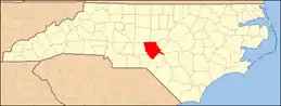 | |
| Towns | ||
| Villages | ||
| CDP | ||
| Unincorporated communities | ||
| ||