Whitefish Township, Michigan
Whitefish Township is a civil township of Chippewa County in the U.S. state of Michigan. The population was 575 at the 2010 census.[3]
Whitefish Township, Michigan | |
|---|---|
 Whitefish Point Light at the northern edge of the township at Whitefish Point | |
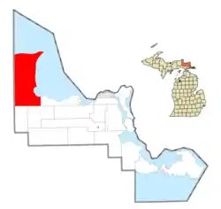 Location within Chippewa County | |
 Whitefish Township Location within the state of Michigan | |
| Coordinates: 46°37′17″N 85°05′23″W | |
| Country | United States |
| State | Michigan |
| County | Chippewa |
| Founded | 1925 |
| Government | |
| • Supervisor | Darryl Ertel, Jr. |
| Area | |
| • Total | 293.6 sq mi (760.5 km2) |
| • Land | 241.5 sq mi (625.5 km2) |
| • Water | 52.1 sq mi (135.0 km2) |
| Elevation | 686 ft (209 m) |
| Population (2010) | |
| • Total | 575 |
| • Density | 2/sq mi (0.9/km2) |
| Time zone | UTC-5 (Eastern (EST)) |
| • Summer (DST) | UTC-4 (EDT) |
| ZIP code(s) | |
| Area code(s) | 906 |
| FIPS code | 26-86700[1] |
| GNIS feature ID | 1627260[2] |
| Website | Official website |
Communities
- Emerson is an unincorporated community located within the eastern portion along the shore of Lake Superior. The end of the Tahquamenon River is in Emerson.
- Paradise is an unincorporated community located at 46°37′39″N 85°02′15″W within the eastern portion of the township along the shore of Lake Superior.
- Shelldrake is a ghost town located at 46°40′40″N 85°02′01″W within the eastern portion of the township along the shore of Lake Superior.
- Whitefish Point is an unincorporated community located at 46°46′14″N 84°57′24″W within the northeastern portion of the township along the shore of Lake Superior on Vermilion Point. The Great Lakes Shipwreck Museum, Whitefish Point Bird Observatory and Whitefish Point Light are located in Whitefish Point.
- Vermilion is an unincorporated community located at 46°45′47″N 85°08′56″W within the northern portion of the township along the shore of Lake Superior on Vermilion Point.
Geography
Whitefish Township occupies the northwest corner of Chippewa County on the Upper Peninsula of Michigan. It is bordered to the east by Whitefish Bay on Lake Superior and to the north, beyond Whitefish Point, by Lake Superior proper. The township's western border is the Chippewa County/Luce County line.
According to the United States Census Bureau, the township has a total area of 293.6 square miles (760.5 km2), of which 241.5 square miles (625.5 km2) is land and 52.1 square miles (135.0 km2), or 17.76%, is water.[3] The Tahquamenon River flows eastward across the center of the township, entering Whitefish Bay at the community of Emerson, just north of Tahquamenon Bay. The river drops over Lower Tahquamenon Falls within the township; Tahquamenon Falls State Park occupies a large portion of the township on either side of the river.
Demographics
As of the census[1] of 2000, there were 588 people, 285 households, and 196 families residing in the township. The population density was 2.4 per square mile (0.9/km2). There were 1,087 housing units at an average density of 4.5 per square mile (1.7/km2). The racial makeup of the township was 95.41% White, 0.17% African American, 2.72% Native American, 0.17% from other races, and 1.53% from two or more races. Hispanic or Latino of any race were 0.68% of the population.
There were 285 households, out of which 15.4% had children under the age of 18 living with them, 58.9% were married couples living together, 6.0% had a female householder with no husband present, and 31.2% were non-families. 28.8% of all households were made up of individuals, and 12.6% had someone living alone who was 65 years of age or older. The average household size was 2.06 and the average family size was 2.47.
In the township the population was spread out, with 14.8% under the age of 18, 2.9% from 18 to 24, 20.6% from 25 to 44, 35.0% from 45 to 64, and 26.7% who were 65 years of age or older. The median age was 53 years. For every 100 females, there were 101.4 males. For every 100 females age 18 and over, there were 98.0 males.
The median income for a household in the township was $29,432, and the median income for a family was $34,659. Males had a median income of $28,542 versus $27,708 for females. The per capita income for the township was $18,154. About 5.7% of families and 12.5% of the population were below the poverty line, including 28.7% of those under age 18 and 8.9% of those age 65 or over.
References
- "U.S. Census website". United States Census Bureau. Retrieved 2008-01-31.
- U.S. Geological Survey Geographic Names Information System: Whitefish Township, Michigan
- "Geographic Identifiers: 2010 Demographic Profile Data (G001): Whitefish township, Chippewa County, Michigan". U.S. Census Bureau, American Factfinder. Archived from the original on February 12, 2020. Retrieved September 26, 2014.
External links
Municipalities and communities of Chippewa County, Michigan, United States | ||
|---|---|---|
| City | 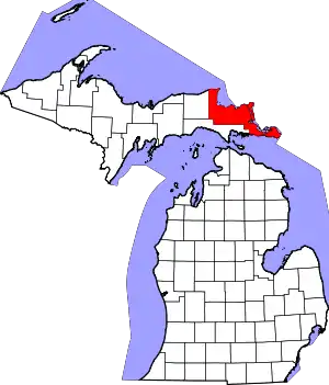 Map of Michigan highlighting Chippewa County.svg | |
| Village | ||
| Charter township | ||
| Civil townships | ||
| Unincorporated communities | ||
| Indian reservations | ||
| Ghost towns | ||
| Footnotes | ‡This populated place also has portions in an adjacent county or counties | |
| ||