Whiting, Kansas
Whiting is a city in Jackson County, Kansas, United States. As of the 2010 census, the city population was 187.[6]
Whiting, Kansas | |
|---|---|
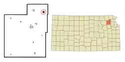 Location within Jackson County and Kansas | |
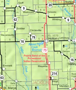 KDOT map of Jackson County (legend) | |
| Coordinates: 39°35′24″N 95°36′47″W} | |
| Country | United States |
| State | Kansas |
| County | Jackson |
| Founded | 1866 |
| Named for | Martha Whiting |
| Area | |
| • Total | 1.01 sq mi (2.61 km2) |
| • Land | 1.01 sq mi (2.61 km2) |
| • Water | 0.00 sq mi (0.00 km2) |
| Elevation | 1,109 ft (338 m) |
| Population | |
| • Total | 187 |
| • Estimate (2019)[3] | 183 |
| • Density | 181.73/sq mi (70.18/km2) |
| Time zone | UTC-6 (CST) |
| • Summer (DST) | UTC-5 (CDT) |
| ZIP code | 66552 |
| Area code | 785 |
| FIPS code | 20-78100 [4] |
| GNIS ID | 0473464 [5] |
History
Whiting was founded in 1866. It was named for Mrs. Martha S. Whiting, who became the second wife of Senator Samuel C. Pomeroy.[7]
The first post office in Whiting was established in June 1869.[8]
Geography
Whiting is located at 39°35′24″N 95°36′47″W (39.590001, -95.613116).[9] According to the United States Census Bureau, the city has a total area of 1.00 square mile (2.59 km2), all of it land.[10]
Demographics
| Historical population | |||
|---|---|---|---|
| Census | Pop. | %± | |
| 1880 | 221 | — | |
| 1890 | 381 | 72.4% | |
| 1900 | 384 | 0.8% | |
| 1910 | 426 | 10.9% | |
| 1920 | 433 | 1.6% | |
| 1930 | 351 | −18.9% | |
| 1940 | 343 | −2.3% | |
| 1950 | 267 | −22.2% | |
| 1960 | 233 | −12.7% | |
| 1970 | 256 | 9.9% | |
| 1980 | 270 | 5.5% | |
| 1990 | 213 | −21.1% | |
| 2000 | 206 | −3.3% | |
| 2010 | 187 | −9.2% | |
| 2019 (est.) | 183 | [3] | −2.1% |
| U.S. Decennial Census | |||
Whiting is part of the Topeka, Kansas, Metropolitan Statistical Area.
2010 census
As of the census[2] of 2010, there were 187 people, 84 households, and 51 families residing in the city. The population density was 187.0 inhabitants per square mile (72.2/km2). There were 95 housing units at an average density of 95.0 per square mile (36.7/km2). The racial makeup of the city was 91.4% White, 1.6% Native American, and 7.0% from two or more races.
There were 84 households, of which 26.2% had children under the age of 18 living with them, 44.0% were married couples living together, 7.1% had a female householder with no husband present, 9.5% had a male householder with no wife present, and 39.3% were non-families. 34.5% of all households were made up of individuals, and 16.7% had someone living alone who was 65 years of age or older. The average household size was 2.23 and the average family size was 2.80.
The median age in the city was 41.3 years. 21.9% of residents were under the age of 18; 6.9% were between the ages of 18 and 24; 25.7% were from 25 to 44; 30% were from 45 to 64; and 15.5% were 65 years of age or older. The gender makeup of the city was 48.1% male and 51.9% female.
2000 census
As of the census[4] of 2000, there were 206 people, 91 households, and 55 families residing in the city. The population density was 204.6 people per square mile (78.7/km2). There were 109 housing units at an average density of 108.3 per square mile (41.7/km2). The racial makeup of the city was 95.63% White, 3.40% Native American, and 0.97% from two or more races.
There were 91 households, out of which 26.4% had children under the age of 18 living with them, 49.5% were married couples living together, 6.6% had a female householder with no husband present, and 38.5% were non-families. 37.4% of all households were made up of individuals, and 15.4% had someone living alone who was 65 years of age or older. The average household size was 2.26 and the average family size was 2.93.
In the city, the population was spread out, with 23.8% under the age of 18, 9.2% from 18 to 24, 29.1% from 25 to 44, 22.3% from 45 to 64, and 15.5% who were 65 years of age or older. The median age was 38 years. For every 100 females, there were 87.3 males. For every 100 females age 18 and over, there were 86.9 males.
The median income for a household in the city was $24,792, and the median income for a family was $39,167. Males had a median income of $30,694 versus $19,792 for females. The per capita income for the city was $18,353. About 9.6% of families and 14.8% of the population were below the poverty line, including 15.6% of those under the age of eighteen and 16.0% of those 65 or over.
Education
The community is served by North Jackson USD 335 public school district.[11]
Whiting High School was closed through school unification. The Whiting High School mascot was Eagles.[12]
Notable people
- Anna Estelle Arnold (1879-1942), school teacher, administrator, textbook publisher
References
- "2019 U.S. Gazetteer Files". United States Census Bureau. Retrieved July 24, 2020.
- "U.S. Census website". United States Census Bureau. Retrieved 2012-07-06.
- "Population and Housing Unit Estimates". United States Census Bureau. May 24, 2020. Retrieved May 27, 2020.
- "U.S. Census website". United States Census Bureau. Retrieved 2008-01-31.
- "US Board on Geographic Names". United States Geological Survey. 2007-10-25. Retrieved 2008-01-31.
- "2010 City Population and Housing Occupancy Status". U.S. Census Bureau. Retrieved March 17, 2012.
- Kansas State Historical Society (1916). Biennial Report of the Board of Directors of the Kansas State Historical Society. Kansas State Printing Plant. pp. 208.
- "Kansas Post Offices, 1828-1961 (archived)". Kansas Historical Society. Archived from the original on October 9, 2013. Retrieved 11 June 2014.
- "US Gazetteer files: 2010, 2000, and 1990". United States Census Bureau. 2011-02-12. Retrieved 2011-04-23.
- "US Gazetteer files 2010". United States Census Bureau. Retrieved 2012-07-06.
- "Cobra Connection". USD 335. Retrieved 10 January 2017.
- "Whiting High School - Eagle Yearbook". E-YEARBOOK.COM. Retrieved 10 January 2017.
Further reading
External links
Municipalities and communities of Jackson County, Kansas, United States | ||
|---|---|---|
| Cities |  Map of Kansas highlighting Jackson County | |
| Unincorporated communities | ||
| Indian reservations | ||
| Townships | ||
| Footnotes | ‡This populated place also has portions in an adjacent county or counties | |
| ||