Whittingham, Northumberland
Whittingham is a village and civil parish in Northumberland, England. It is situated on the banks of the River Aln, roughly 4.5 miles (7 km) east of its source at Alnham and 7.3 miles (12 km) west of Alnwick.

| Whittingham | |
|---|---|
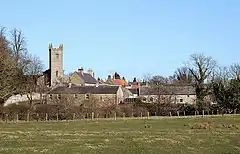 Whittingham village | |
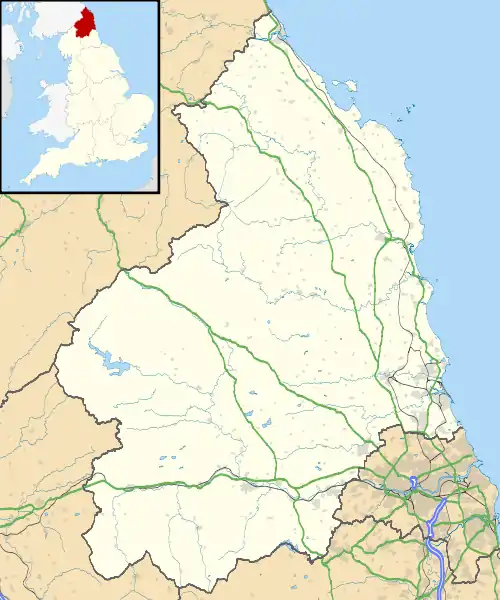 Whittingham Location within Northumberland | |
| Population | 525 (2011 census. including Alnham)[1] |
| OS grid reference | NU065115 |
| District | |
| Shire county | |
| Region | |
| Country | England |
| Sovereign state | United Kingdom |
| Post town | ALNWICK |
| Postcode district | NE66 |
| Dialling code | 01665 |
| Police | Northumbria |
| Fire | Northumberland |
| Ambulance | North East |
| UK Parliament | |
| River Aln Settlements |
|---|
The thirteenth/fourteenth century pele tower, Whittingham Tower, was converted into almshouses in 1845 and is now in private ownership.
History
The village name is thought to derive from Anglo-Saxon times, meaning 'the meeting place of Hwita's people'. The double ford at the west of the village has led some historians to suggest this is the location of 'Twyford' mentioned in the writings of the Venerable Bede.
Governance
Whittingham is in the parliamentary constituency of Berwick-upon-Tweed.
Geography
The village sits in the valley of the River Aln; characterised by gentle rolling hills and fertile soils this area is frequently referred to as the Vale of Whittingham. There are road bridges over the river at either end of the village and a footbridge in the centre. At the western end of the village the River Aln meets Callaly Burn and there is a double ford at the confluence with two footbridges alongside.
Economy
The village no longer has shops or a pub. The nearest shops are in Glanton (a post office) and at Powburn. There is a pub in Glanton.
Landmarks
Two Roman roads passed close to the village – to the east is the Devil's Causeway and south of the village is the road from High Rochester. These met at Learchild fort about 2 km east of the village.
Education
The village has a primary school - Whittingham Church of England First School - with around 100 pupils (6 January 2019).
Religious sites
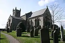
The parish church is dedicated to St Bartholomew, shown in a stained-glass window. There is Anglo-Saxon stonework in the tower that dates from around 900 AD, but a church was recorded here in 735. The tower arch is plain and massive; the medieval work has been subject to much later alteration. The 19th-century redecoration includes plain lead-glazing in the windows.[2]
There are several gravestones in the churchyard that have skulls incised on them, these are known as Memento Mori stones and are listed monuments.
Halfway between the village and Glanton, situated in a small copse, is St. Mary's Roman Catholic church.
Gallery
 The fountain memorial to Athole, 3rd Earl of Ravensworth
References
- "Parish population 2011". Retrieved 1 July 2015.
- Betjeman, John, ed. (1968) Collins Pocket Guide to English Parish Churches; the North. London: Collins; p. 220
External links
| Wikimedia Commons has media related to Whittingham, Northumberland. |
| Authority control |
|---|