Wickwar
Wickwar is a village and civil parish in Gloucestershire, England, located between Yate and Charfield. At the 2001 census, the parish had a population of 1,943.[2]
| Wickwar | |
|---|---|
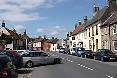 Wickwar High Street | |
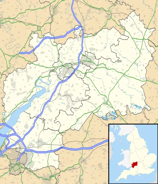 Wickwar Location within Gloucestershire | |
| Population | 1,978 (2011)[1] |
| OS grid reference | ST7288 |
| Civil parish |
|
| Unitary authority | |
| Ceremonial county | |
| Region | |
| Country | England |
| Sovereign state | United Kingdom |
| Post town | WOTTON-UNDER-EDGE |
| Postcode district | GL12 |
| Dialling code | 01454 |
| Police | Avon and Somerset |
| Fire | Avon |
| Ambulance | South Western |
| UK Parliament | |
The village is on the main Bristol–Birmingham railway line, and once had a station, but this closed in January 1965. To the south, the line passes through a tunnel 1,401 yards (1,281 m) long. The village also used to have a shop which, in 2018, closed its doors. Wickwar lies near to the source of the Little Avon River, which rises in woodland to the east.
History
The place-name 'Wickwar' is first attested in the Domesday Book of 1086, where it appears as 'Wichen', meaning 'dairy farm or settlement'.[3] The manor was given to John la Warre by King John and was held by Roger la Warre in 1285, when it was referred to as 'Warre Wyke'. Warre is a Norman family name which gave its name to Wickwar.[4] The village originally lay on the Old Saltway from Droitwich to Chipping Sodbury and Pucklechurch, and was developed in the late 13th century by the de la Warre family with the establishment of a market in 1285. The main street, the present High Street, was laid out around the market place with uniform burgage plots and rear access lanes. Burghers paid an annual fixed rent to the overlord, but they could sell their tenancies much as in the free market today. In addition, they often carried on trades and crafts which, together with their property rights, distinguished them from the feudal peasant. Livestock were often kept on the burgage plots behind the house, and this necessitated the rear access lane.
The original settlement of Wickwar was located around the church and Poole Court, a 16th-century Manor House demolished in the 19th century, to the north of the village. All that remains of the Manor is its terraced garden, south-west of the church, which formerly stood on the edge of a lake. The Parish Church of the Holy Trinity is set on a small hill and is of 12th-century origin. It was extensively remodelled in the 14th and 15th centuries and was restored c.1881 by W L Bernard. Inside there is a sculpture of St John the Baptist dated 1496, which was originally housed at Poole Court.
To the north of the church, within the churchyard is the Sunday School, built in 1837 in a Gothic revival style. The churchyard also has a number of chest tombs, which represent a collection of local and classical tomb forms.
The Old Rectory to the west of the church dates from 1864 and was built by George Devey for the Earl of Ducie. The doorway is surmounted by the Earl of Ducie's coronet.
The Old Grammar School was founded in 1684 by Alexander Hosea for children of the village.
The High Street has a collection of mostly 18th-century fronted, rendered or stuccoed houses, including Albert House and the Police station. The Town Hall c.1795 has arched openings and a bellcote with pinnacle. The Town Hall clock mechanism is also important, thought to date from 1660.[5]
In April 2020, one of the new home developments was attacked by suspected arson, with the home builders repairing a severely burnt-out home. https://www.bristolpost.co.uk/news/bristol-news/fire-damages-house-near-bristol-4040431
Governance
The village is the most populous part of 'Ladden Brook' electoral ward. This ward stretches south east to Iron Acton and east to Tytherington. The total population of the ward taken from the 2011 census was 3,858.[6]
1987 gas explosion
On the morning of 9 January 1987, a gas pipe running underneath the High Street exploded, demolishing a house and damaging others nearby. However, an off-duty policeman returning from a late-night game of backgammon smelt the gas and raised the alarm, evacuating the street to the local Social Club before the explosion. His house was destroyed, and others significantly damaged, but no-one was harmed. As he said at the time, had he been in bed at the usual time, it would have been far worse.
As a result of the explosion, a ban on heavy vehicles was introduced throughout the village, as it was thought that frequent use of the road by lorries, coupled with freezing weather conditions, had caused the 1950s pipes to break.
Meteorite impact
Spherules are found lying unconformably over Carboniferous limestone in Wickwar Quarry. These are possibly tektite deposits, formed as molten material ejected by a meteorite impact that may have fallen back to Earth.[7]
References
- "Parish population 2011". Retrieved 20 March 2015.
- "Census 2001: Parish Headcounts: South Gloucestershire". Neighbourhood Statistics. Office for National Statistics. Retrieved 14 July 2012.
- http://opendomesday.org/place/ST7288/wickwar/ Open Domesday: Wickwar (formerly Wichen)
- Eilert Ekwall, Concise Oxford Dictionary of English Place-names, p.517.
- "A Brief History of Wickwar". Wickwar. Retrieved 23 August 2020.
- "Ladden Brook ward 2011". Retrieved 20 March 2015.
- Kirkham, A. 2003. Glauconitic spherules from the Triassic of the Bristol area, SW England: probable microtektite pseudomorphs. Proceedings of the Geologists' Association, 114, 11–21
https://www.bristolpost.co.uk/news/bristol-news/fire-damages-house-near-bristol-4040431 House fire destroys home under construction at Tyndale Reach, Wickwar
External links
| Wikimedia Commons has media related to Wickwar. |
| Unitary authorities | |
|---|---|
| Boroughs or districts | |
| Major settlements |
|
| Rivers | |
| Topics | |