Wieda
Wieda is a village and a former municipality in the district of Göttingen, in Lower Saxony, Germany. Since 1 November 2016, it is part of the municipality Walkenried.
Wieda | |
|---|---|
Ortsteil of Walkenried | |
 Coat of arms | |
Location of Wieda 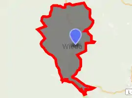
| |
 Wieda 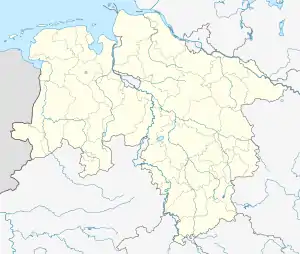 Wieda | |
| Coordinates: 51°37′57″N 10°35′09″E | |
| Country | Germany |
| State | Lower Saxony |
| District | Göttingen |
| Municipality | Walkenried |
| Area | |
| • Total | 6.53 km2 (2.52 sq mi) |
| Elevation | 375 m (1,230 ft) |
| Population (2015-12-31) | |
| • Total | 1,295 |
| • Density | 200/km2 (510/sq mi) |
| Time zone | UTC+01:00 (CET) |
| • Summer (DST) | UTC+02:00 (CEST) |
| Postal codes | 37447 |
| Dialling codes | 05586 |
| Vehicle registration | GÖ, OHA |
Wieda is on River Wieda, a tributary of Zorge in the southern part of the Harz mountains.
Sights
There are many well-preserved half-timbered houses in the center of Wieda, for example in the High Street close to the wooden Town Hall. The Old Clock Tower is on the top of a hill offering a scenic view of the municipality and its surroundings. Lutherkirche is the protestant town church which was built in 1770.[1]
 Protestant Church
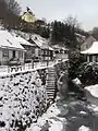 Clock Tower
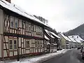 Half-timbered houses in the High Street
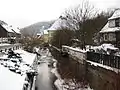 River Wieda
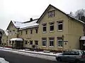 Town Hall
References
| Wikimedia Commons has media related to Wieda. |
- Ulrich Großmann: Hannover und Südniedersachsen, p. 192. Köln 1999
This article is issued from Wikipedia. The text is licensed under Creative Commons - Attribution - Sharealike. Additional terms may apply for the media files.