Wobulenzi
Wobulenzi is a town in Luweero District in the Central Region of Uganda.
Wobulenzi
Wobulenzi Municipality | |
|---|---|
 Wobulenzi Location in Uganda | |
| Coordinates: 00°43′12″N 32°31′48″E | |
| Country | |
| Region | Central Region of Uganda |
| District | Luweero District |
| Population (2014 Census) | |
| • Total | 27,027[1] |
Location
Wobulenzi is approximately 47 kilometres (29 mi), by road, north of Kampala, Uganda's capital and largest city, on the highway to Karuma.[2] The road is a busy, all-weather tarmac highway, referred to as the Kampala–Gulu Highway. The coordinates of the town are 0°43'12.0"N, 32°31'48.0"E (Latitude:0.7200; Longitude:32.5300).[3]
Population
The population of Wobulenzi was enumerated at 18,846 in the 2002 national census. In 2010, the Uganda Bureau of Statistics (UBOS) estimated the population at 23,100. In 2011, UBOS estimated the mid-year population at 23,700.[4] In 2014, the national population census put the population at 27,027.[1]
Points of interest
In Wobulenzi or near the town, there are several points of interest, including the following:
References
- UBOS (29 November 2014). "The Population of The Regions of the Republic of Uganda And All Cities And Towns of More Than 15,000 Inhabitants". Citypopulation.de Quoting Uganda Bureau of Statistics (UBOS). Retrieved 28 February 2015.
- Google (1 January 2021). "Road Distance Between Kampala, Uganda And Wobulenzi, Uganda" (Map). Google Maps. Google. Retrieved 1 January 2021.
- Google (1 January 2021). "Location of Wobulenzi, Luweero District, Central Region, Uganda" (Map). Google Maps. Google. Retrieved 1 January 2021.
- UBOS (2012). "Estimated Population of Wobulenzi In 2002, 2010 & 2011" (PDF). Uganda Bureau of Statistics (UBOS). Retrieved 28 February 2015.
External links
| Authority control |
|
|---|
Capital: Luweero | ||
| Towns and villages | 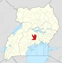 | |
| Economy | ||
| Education |
| |
| Notable landmarks | ||
| Health | ||
| Transport |
| |
| Notable people | ||
