Wolfhurst, Ohio
Wolfhurst is a census-designated place (CDP) in Belmont County, Ohio, United States. It is part of the Wheeling, West Virginia Metropolitan Statistical Area. The population was 1,239 at the 2010 census.[3]
Wolfhurst, Ohio | |
|---|---|
 Wolfhurst | |
| Coordinates: 40°4′9″N 80°47′1″W | |
| Country | United States |
| State | Ohio |
| County | Belmont |
| Area | |
| • Total | 0.50 sq mi (1.30 km2) |
| • Land | 0.49 sq mi (1.26 km2) |
| • Water | 0.02 sq mi (0.04 km2) |
| Elevation | 690 ft (210 m) |
| Population (2010) | |
| • Total | 1,239 |
| • Density | 2,550/sq mi (984.5/km2) |
| Time zone | UTC-5 (Eastern (EST)) |
| • Summer (DST) | UTC-4 (EDT) |
| Area code(s) | 740 |
| FIPS code | 39-86282[2] |
| GNIS feature ID | 1048055[1] |
Geography
Wolfhurst is located in eastern Belmont County at 40°1′43″N 80°48′57″W (40.028736, -80.815811),[4] in the valley of Wheeling Creek. It is bordered to the northwest by Lansing, and the village of Brookside is 1 mile (1.6 km) to the east. U.S. Route 40, the National Road, passes through the center of Wolfhurst, leading east 4 miles (6 km) to downtown Wheeling, West Virginia.
According to the United States Census Bureau, the Wolfhurst CDP has a total area of 0.50 square miles (1.30 km2), of which 0.015 square miles (0.04 km2), or 3.38%, is water.[3]
References
- "US Board on Geographic Names". United States Geological Survey. 2007-10-25. Retrieved 2008-01-31.
- "U.S. Census website". United States Census Bureau. Retrieved 2008-01-31.
- "Geographic Identifiers: 2010 Demographic Profile Data (G001): Wolfhurst CDP, Ohio". U.S. Census Bureau, American Factfinder. Archived from the original on February 12, 2020. Retrieved February 19, 2014.
- "US Gazetteer files: 2010, 2000, and 1990". United States Census Bureau. 2011-02-12. Retrieved 2011-04-23.
Municipalities and communities of Belmont County, Ohio, United States | ||
|---|---|---|
| Cities | 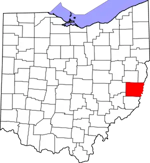 Map of Ohio highlighting Belmont County | |
| Villages | ||
| Townships | ||
| CDPs | ||
| Unincorporated communities |
| |
| Ghost town | ||
| Footnotes | ‡This populated place also has portions in an adjacent county or counties | |
| ||