Wolstenholme Fjord
Wolstenholme Fjord (Greenlandic: Uummannap Kangerlua)[1] is a fjord in Avannaata municipality, Northwest Greenland. It is located to the north of the Thule Air Base and adjacent to the abandoned Inuit settlement of Narsaarsuk.
| Wolstenholme Fjord | |
|---|---|
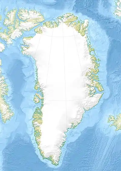 Wolstenholme Fjord Location in Greenland | |
| Location | Arctic |
| Coordinates | 76°37′55″N 68°38′15″W |
| Native name | Uummannap Kangerlua |
| Ocean/sea sources | Baffin Bay |
| Basin countries | Greenland |
The area was contaminated in 1968 with plutonium and other radioactive elements following a B-52 bomber crash.[2]
Geography
Wolstenholme Fjord is located in the stretch of coast between Cape York and Cape Alexander. Together with the Inglefield Gulf it is one of the two main indentations in the area.[3]
Saunders Island, Wolstenholme Island and the Bylot Sound lie at the mouth of the Fjord in North Star Bay. Further to the west on the northern shore lies the Granville Fjord.
The fjord's waters are fed by four large glaciers: the Salisbury Glacier, the Chamberlin Glacier, the Knud Rasmussen Glacier, and the Harald Moltke Glacier.
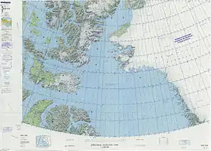 Map of Northwestern Greenland |
Further reading
References
- "Wolstenholme Fjord". Mapcarta. Retrieved 9 May 2019.
- Aarkrog, Asker (January 1970). "Radio-Ecological Investigations". USAF Nuclear Safety. Danish Atomic Energy Commission.
- Prostar Sailing Directions 2005 Greenland and Iceland Enroute, p. 77