Woodland, Alabama
Woodland is a town in Randolph County, Alabama, United States. At the 2010 census the population was 184, down from 192 in 2000. It incorporated in 1967.[3]
Woodland, Alabama | |
|---|---|
 | |
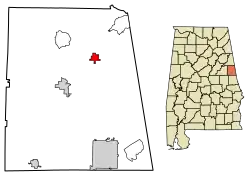 Location of Woodland in Randolph County, Alabama. | |
| Coordinates: 33°22′25″N 85°23′45″W | |
| Country | United States |
| State | Alabama |
| County | Randolph |
| Government | |
| • Tribe Leader Elder | Scott Carter |
| Area | |
| • Total | 1.56 sq mi (4.04 km2) |
| • Land | 1.56 sq mi (4.04 km2) |
| • Water | 0.00 sq mi (0.00 km2) |
| Elevation | 1,083 ft (330 m) |
| Population (2010) | |
| • Total | 184 |
| • Estimate (2019)[2] | 182 |
| • Density | 116.82/sq mi (45.09/km2) |
| Time zone | UTC-6 (CST) |
| • Summer (DST) | UTC-5 (CDT) |
| ZIP code | 36280 |
| Area code(s) | 256 |
| FIPS code | 01-83400 |
| GNIS feature ID | 0129193 |
Geography
Woodland is located at 33°22′25″N 85°23′45″W (33.373655, -85.395700).[4]
The town is located along Alabama State Route 48 northeast of the Randolph County seat of Wedowee. AL-48 leads northeast 10 mi (16 km) to its end at the Alabama-Georgia state line, and southwest 9 mi (14 km) to Wedowee.
According to the U.S. Census Bureau, the town has a total area of 1.1 square miles (2.8 km2), all land.
Demographics
| Historical population | |||
|---|---|---|---|
| Census | Pop. | %± | |
| 1970 | 177 | — | |
| 1980 | 192 | 8.5% | |
| 1990 | 189 | −1.6% | |
| 2000 | 192 | 1.6% | |
| 2010 | 184 | −4.2% | |
| 2019 (est.) | 182 | [2] | −1.1% |
| U.S. Decennial Census[5] 2013 Estimate[6] | |||
As of the census[7] of 2000, there were 192 people, 82 households, and 56 families residing in the town. The population density was 170.6 people per square mile (65.6/km2). There were 90 housing units at an average density of 80.0 per square mile (30.8/km2). The racial makeup of the town was 88.54% White and 11.46% Black or African American.
There were 82 households, out of which 36.6% had children under the age of 18 living with them, 51.2% were married couples living together, 17.1% had a female householder with no husband present, and 30.5% were non-families. 30.5% of all households were made up of individuals, and 12.2% had someone living alone who was 65 years of age or older. The average household size was 2.34 and the average family size was 2.89.
The median income for a household in the town was $31,500, and the median income for a family was $41,250. Males had a median income of $43,750 versus $24,375 for females. The per capita income for the town was $17,106. About 15.2% of families and 14.9% of the population were below the poverty line, including 22.7% of those under the age of 18 and 5.4% of those 65 or over.
Climate
Month Avg. High Avg. Low Avg. Precip. Rec. High Rec. Low
January 55 °F 30 °F 5.91 in 83° 61 °F
February 59 °F 32 °F 5.11 in 82° 72 °F
March 68 °F 39 °F 6.05 in 87° 86 °F
April 77 °F 45 °F 4.42 in 92° 96 °F
May 83 °F 54 °F 3.65 in 98° 100 °F
June 90 °F 62 °F 4.21 in 103° 107 °F
July 92 °F 67 °F 4.64 in 107° 112 °F
August 91 °F 65 °F 3.63 in 104° 115 °F
September 86 °F 59 °F 3.69 in 100° 102 °F
October 77 °F 46 °F 2.69 in 99° 93 °F
November 67 °F 38 °F 4.60 in 86° 87 °F
December 58 °F 32 °F 4.68 in 80° 80 °F
Notable persons
- Vern Gosdin - country and gospel singer
- Wes Bayliss - Lead Singer for The Steel Woods
- Danny Mote - Rockabilly Hall of Fame, Vee Jay Records Singer/Songwriter
Photo gallery
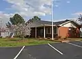 Woodland Town Hall
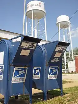
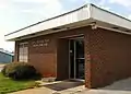 Woodland Post Office (zip code: 36280)
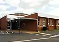 Woodland High School, "Home of the Bobcats".
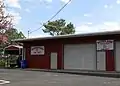 Woodland Volunteer Fire Department
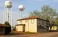 Woodland's most distinctive landmarks are the twin water towers which are positioned in the middle of town.
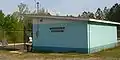 The Blue Dolphin Swim Club
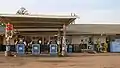 Bee's Grocery serves as the town's primary grocery store.
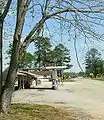 Alabama State Route 48 as seen from Downtown Woodland, Alabama.
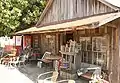 An antique shop in Woodland, Alabama.
 Bear Creek runs southwest of Woodland, Alabama
References
- "2019 U.S. Gazetteer Files". United States Census Bureau. Retrieved June 29, 2020.
- "Population and Housing Unit Estimates". United States Census Bureau. May 24, 2020. Retrieved May 27, 2020.
- http://ema.alabama.gov/filelibrary/CountyPlans/Randolph%20County%20Complete%20Plan.pdf
- "US Gazetteer files: 2010, 2000, and 1990". United States Census Bureau. 2011-02-12. Retrieved 2011-04-23.
- "U.S. Decennial Census". Census.gov. Retrieved June 6, 2013.
- "Annual Estimates of the Resident Population: April 1, 2010 to July 1, 2013". Retrieved June 3, 2014.
- "U.S. Census website". United States Census Bureau. Retrieved 2008-01-31.
Municipalities and communities of Randolph County, Alabama, United States | ||
|---|---|---|
| City | 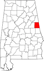 Map of Alabama highlighting Randolph County | |
| Towns | ||
| CDPs | ||
| Unincorporated communities | ||
| ||
| Authority control |
|
|---|