Woolsey, Georgia
Woolsey is a town in Fayette County, Georgia, United States. The population was 158 at the 2010 census.[5]
Woolsey, Georgia | |
|---|---|
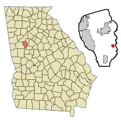 Location in Fayette County and the state of Georgia | |
| Coordinates: 33°21′48″N 84°24′29″W | |
| Country | United States |
| State | Georgia |
| County | Fayette |
| Area | |
| • Total | 0.84 sq mi (2.18 km2) |
| • Land | 0.82 sq mi (2.12 km2) |
| • Water | 0.02 sq mi (0.06 km2) |
| Elevation | 837 ft (255 m) |
| Population (2010) | |
| • Total | 158 |
| • Estimate (2019)[2] | 167 |
| • Density | 204.16/sq mi (78.84/km2) |
| Time zone | UTC-5 (Eastern (EST)) |
| • Summer (DST) | UTC-4 (EDT) |
| ZIP code | 30214 |
| Area code(s) | 770 |
| FIPS code | 13-84288[3] |
| GNIS feature ID | 0333466[4] |
| Website | woolseyga |
Geography
Woolsey is located in southeastern Fayette County at 33°21′48″N 84°24′29″W (33.363354, -84.407942),[6] along Georgia State Route 92. Fayetteville, the county seat, is 7 miles (11 km) to the north, and Griffin is 18 miles (29 km) to the southeast.
According to the United States Census Bureau, Woolsey has a total area of 0.84 square miles (2.18 km2), of which 0.82 square miles (2.12 km2) is land and 0.02 square miles (0.06 km2), or 2.76%, is water.[5]
History
The Georgia General Assembly incorporated Woolsey as a town in 1893.[7] Woolsey is named after a prominent doctor who served in the Confederacy before being injured.[8]
Demographics
| Historical population | |||
|---|---|---|---|
| Census | Pop. | %± | |
| 1910 | 162 | — | |
| 1920 | 148 | −8.6% | |
| 1930 | 122 | −17.6% | |
| 1940 | 115 | −5.7% | |
| 1950 | 90 | −21.7% | |
| 1960 | 114 | 26.7% | |
| 1970 | 91 | −20.2% | |
| 1980 | 99 | 8.8% | |
| 1990 | 120 | 21.2% | |
| 2000 | 175 | 45.8% | |
| 2010 | 158 | −9.7% | |
| 2019 (est.) | 167 | [2] | 5.7% |
| U.S. Decennial Census[9] | |||
As of the census[3] of 2000, there were 175 people, 57 households, and 49 families residing in the town. The population density was 213.6 people per square mile (82.4/km2). There were 62 housing units at an average density of 75.7 per square mile (29.2/km2). The racial makeup of the town was 55.43% White, 43.43% African American and 1.14% Asian. Hispanic or Latino of any race were 0.57% of the population.
There were 57 households, out of which 42.1% had children under the age of 18 living with them, 78.9% were married couples living together, 3.5% had a female householder with no husband present, and 14.0% were non-families. 10.5% of all households were made up of individuals, and 3.5% had someone living alone who was 65 years of age or older. The average household size was 3.07 and the average family size was 3.29.
In the town, the population was spread out, with 28.0% under the age of 18, 8.0% from 18 to 24, 21.7% from 25 to 44, 29.1% from 45 to 64, and 13.1% who were 65 years of age or older. The median age was 41 years. For every 100 females, there were 98.9 males. For every 100 females age 18 and over, there were 93.8 males.
The median income for a household in the town was $84,103, and the median income for a family was $83,224. Males had a median income of $76,250 versus $62,813 for females. The per capita income for the town was $42,177. About 4.5% of families and 3.0% of the population were below the poverty line, including 4.2% of those under the age of eighteen and none of those 65 or over.
References
- "2019 U.S. Gazetteer Files". United States Census Bureau. Retrieved July 9, 2020.
- "Population and Housing Unit Estimates". United States Census Bureau. May 24, 2020. Retrieved May 27, 2020.
- "U.S. Census website". United States Census Bureau. Retrieved 2008-01-31.
- "US Board on Geographic Names". United States Geological Survey. 2007-10-25. Retrieved 2008-01-31.
- "Geographic Identifiers: 2010 Census Summary File 1 (G001), Woolsey town, Georgia". American FactFinder. U.S. Census Bureau. Archived from the original on February 13, 2020. Retrieved April 27, 2016.
- "US Gazetteer files: 2010, 2000, and 1990". United States Census Bureau. 2011-02-12. Retrieved 2011-04-23.
- Acts Passed by the General Assembly of Georgia. J. Johnston. 1894. p. 353.
- Krakow, Kenneth K. (1975). Georgia Place-Names: Their History and Origins. Macon, GA: Winship Press. p. 257. ISBN 0-915430-00-2.
- "Census of Population and Housing". Census.gov. Retrieved June 4, 2015.
Municipalities and communities of Fayette County, Georgia, United States | ||
|---|---|---|
| Cities | 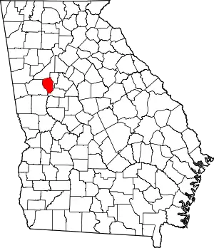 Map of Georgia highlighting Fayette County | |
| Towns | ||
| Unincorporated communities | ||
| ||
| Authority control |
|---|
