Wyoming, New York
Wyoming is a village in Wyoming County, New York. As of the 2010 census, the village has a total population of 434.
Wyoming, New York | |
|---|---|
| Nickname(s): Gaslight Village | |
 Wyoming, New York Location within the state of New York | |
| Coordinates: 42°49′31″N 78°5′7″W | |
| Country | United States |
| State | New York |
| County | Wyoming |
| Settled | 1809 |
| Incorporated | July 31, 1875 |
| Named for | Lenape word meaning "broad bottom lands" |
| Government | |
| • Mayor | Nathan Norton |
| • Town Council | Village Board (5 members) |
| Area | |
| • Total | 0.67 sq mi (1.73 km2) |
| • Land | 0.67 sq mi (1.73 km2) |
| • Water | 0.00 sq mi (0.00 km2) |
| Elevation | 988 ft (301 m) |
| Population (2010) | |
| • Total | 434 |
| • Estimate (2019)[2] | 417 |
| • Density | 623.32/sq mi (240.72/km2) |
| Time zone | UTC-5 (Eastern (EST)) |
| • Summer (DST) | UTC-4 (EDT) |
| ZIP code | 14591 |
| Area code(s) | 585 |
| FIPS code | 36-83371[3] |
| GNIS feature ID | 0971788[4] |
| Website | www |
The Village of Wyoming lies within the Town of Middlebury by the eastern town line. Wyoming is located on New York State Route 19.
History
The Village of Newell's Settlement was founded in 1809 by Silas Newell . It was later renamed to Wyoming in 1829, to be incorporated in 1875 . However, on Revolutionary War muster roll taken for March, April, May, and June 1779, of Lieutenant Colonel William Smith's company, a regiment of foot it states the regiment was mustered in Wyoming . Signed and dated by Nehemiah Wade, D.C.M. on June 30, 1779 . It was one of the earliest locations where natural gas was developed . While the field was never a large producer, it still provides gas for the village streetlights and some homes to this day. The downtown historic district is known as the "Gaslight Village."
Middlebury Academy was built in 1817 and was chartered by the NY Regents in 1819, and is believed to be the first institution of higher education west of the Genesee in New York. It still stands in downtown Wyoming, maintained as a museum by the Middlebury Historical Society. It is listed on the National Register of Historic Places as of 1980.[5] Also on the National Register of Historic Places are the Bryant Fleming House and Wyoming Village Historic District.[5]
Another historic place is Hillside Inn, a classic Greek revival mansion built by Dr. Pliny Hayes as a Water Cure establishment in 1851 . It overlooks the Village of Wyoming, and until 2012, was a bed and breakfast inn. The Hillside Inn was auctioned on August 17, 2012 at 3:00 p.m. by Bontrager Auctioneers. It also has been a spa (with mineral springs) and has hosted many famous people including Susan B. Anthony, John Muir, and Presidents Theodore and Franklin D. Roosevelt .
Geography
Wyoming is located at 42°49′31″N 78°5′7″W (42.825204, -78.085227).[6]
Oatka Creek flows northward past the east side of the village.
According to the United States Census Bureau, the village has a total area of 0.7 square miles (1.8 km2), all land.
Demographics
| Historical population | |||
|---|---|---|---|
| Census | Pop. | %± | |
| 1870 | 338 | — | |
| 1880 | 387 | 14.5% | |
| 1890 | 525 | 35.7% | |
| 1920 | 386 | — | |
| 1930 | 376 | −2.6% | |
| 1940 | 430 | 14.4% | |
| 1950 | 508 | 18.1% | |
| 1960 | 526 | 3.5% | |
| 1970 | 514 | −2.3% | |
| 1980 | 507 | −1.4% | |
| 1990 | 478 | −5.7% | |
| 2000 | 513 | 7.3% | |
| 2010 | 434 | −15.4% | |
| 2019 (est.) | 417 | [2] | −3.9% |
| U.S. Decennial Census[7] | |||
As of the census[3] of 2000, there were 513 people, 176 households, and 133 families residing in the village. The population density was 763.2 people per square mile (295.6/km2). There were 179 housing units at an average density of 266.3 per square mile (103.2/km2). The racial makeup of the village was 96.88% White, 0.39% African American, 0.58% Native American, 0.97% from other races, and 1.17% from two or more races. Hispanic or Latino of any race were 0.39% of the population.
There were 176 households, out of which 44.9% had children under the age of 18 living with them, 60.2% were married couples living together, 10.2% had a female householder with no husband present, and 24.4% were non-families. 17.6% of all households were made up of individuals, and 10.8% had someone living alone who was 65 years of age or older. The average household size was 2.90 and the average family size was 3.33.
In the village, the population was spread out, with 32.6% under the age of 18, 6.4% from 18 to 24, 30.2% from 25 to 44, 20.1% from 45 to 64, and 10.7% who were 65 years of age or older. The median age was 33 years. For every 100 females, there were 94.3 males. For every 100 females age 18 and over, there were 92.2 males.
The median income for a household in the village was $38,750, and the median income for a family was $46,875. Males had a median income of $34,643 versus $25,357 for females. The per capita income for the village was $14,925. About 6.4% of families and 6.0% of the population were below the poverty line, including 3.6% of those under age 18 and none of those age 65 or over.
References
- "2019 U.S. Gazetteer Files". United States Census Bureau. Retrieved July 27, 2020.
- "Population and Housing Unit Estimates". United States Census Bureau. May 24, 2020. Retrieved May 27, 2020.
- "U.S. Census website". United States Census Bureau. Retrieved 2008-01-31.
- "US Board on Geographic Names". United States Geological Survey. 2007-10-25. Retrieved 2008-01-31.
- "National Register Information System". National Register of Historic Places. National Park Service. March 13, 2009.
- "US Gazetteer files: 2010, 2000, and 1990". United States Census Bureau. 2011-02-12. Retrieved 2011-04-23.
- "Census of Population and Housing". Census.gov. Retrieved June 4, 2015.
External links
| Wikimedia Commons has media related to Wyoming, New York. |
Municipalities and communities of Wyoming County, New York, United States | ||
|---|---|---|
| Towns | 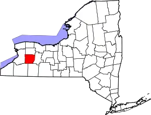 | |
| Villages | ||
| CDPs | ||
| Other hamlets | ||
| Footnotes | ‡This populated place also has portions in an adjacent county or counties | |
| ||
