Wyoming Highway 351
Wyoming Highway 351 (WYO 351) is a 24.18-mile-long (38.91 km) east-west Wyoming state road located in central Sublette County. It connects U.S. Route 189 (US 189) with US 191 and mainly serves the hugely important Big Piney-Rock Springs corridor.[2]
| ||||
|---|---|---|---|---|
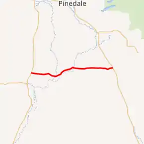
WYO 351 highlighted in red | ||||
| Route information | ||||
| Maintained by WYDOT | ||||
| Length | 24.18 mi[1] (38.91 km) | |||
| Major junctions | ||||
| West end | ||||
| East end | ||||
| Location | ||||
| Counties | Sublette | |||
| Highway system | ||||
State highways in Wyoming
| ||||

Route description
Wyoming Highway 351 begins its western end east of the Big Piney-Marbleton Airport at U.S. Route 189, 2 miles north of Marbleton and 3 miles north of Big Piney.[3] Highway 351 travels east and crosses the Green River at 7.30 miles (11.7 km) and shortly after intersects Sublette CR 110 and 175.[4] Now WYO 351 runs along the north side of the New Fork River, a tributary of the Green River, and parallels it for a few miles before crossing it at approximately 12.90 miles (20.8 km). WYO 351 reaches its eastern terminus at US 191 at just over 24 miles, 11 miles south of Boulder.[3][5]
Major intersections
The entire route is in Sublette County. [6]
| Location[6] | mi[1] | km | Destinations | Notes | |
|---|---|---|---|---|---|
| | 0.00 | 0.00 | |||
| | 24.18 | 38.91 | |||
| 1.000 mi = 1.609 km; 1.000 km = 0.621 mi | |||||
References
- Wyoming Department of Transportation Reference Marker Book (PDF) (Map). WYDOT. November 2004. Archived from the original (PDF) on July 17, 2011. Retrieved February 28, 2012.
- WYO 351
- Google (March 1, 2012). "Overview Map of Wyoming Highway 351" (Map). Google Maps. Google. Retrieved March 1, 2012.
- Sublette County GIS MapServer
- Wyoming @ AARoads.com - Wyoming Routes 300-399
- Geography Division (2016). "Wyoming Governmental Unit Reference Map". United States Census Bureau. Retrieved January 24, 2017.
External links
| Wikimedia Commons has media related to Wyoming Highway 351. |