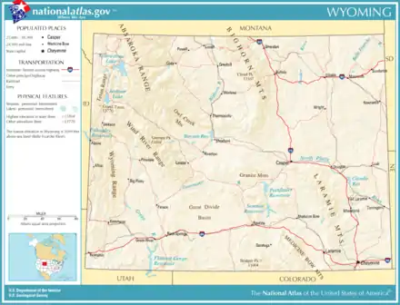
Wyoming
Wyoming (/waɪˈoʊmɪŋ/ (![]() listen)) is a landlocked state in the western United States. The 10th largest state by area, it is also the least populous and least densely populated state in the contiguous United States.[lower-alpha 1] It is bordered by Montana to the north and northwest, South Dakota and Nebraska to the east, Idaho to the west, Utah to the southwest, and Colorado to the south. The state population was estimated at 578,759 in 2019. The state capital and the most populous city is Cheyenne, which had an estimated population of 63,957 in 2018.[6]
listen)) is a landlocked state in the western United States. The 10th largest state by area, it is also the least populous and least densely populated state in the contiguous United States.[lower-alpha 1] It is bordered by Montana to the north and northwest, South Dakota and Nebraska to the east, Idaho to the west, Utah to the southwest, and Colorado to the south. The state population was estimated at 578,759 in 2019. The state capital and the most populous city is Cheyenne, which had an estimated population of 63,957 in 2018.[6]
Wyoming | |
|---|---|
| State of Wyoming | |
| Nickname(s): Equality State (official); Cowboy State; Big Wyoming[1] | |
| Motto(s): Equal Rights | |
| Anthem: "Wyoming" | |
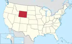 Map of the United States with Wyoming highlighted | |
| Country | United States |
| Before statehood | Wyoming Territory |
| Admitted to the Union | July 10, 1890 (44th) |
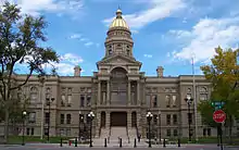
| Capital (and largest city) | Cheyenne |
| Largest metro | Cheyenne Metro Area |
| Government | |
| • Governor | Mark Gordon (R) |
| • Secretary of State | Edward Buchanan (R) |
| Legislature | Wyoming Legislature |
| • Upper house | Senate |
| • Lower house | House of Representatives |
| Judiciary | Wyoming Supreme Court |
| U.S. senators | John Barrasso (R) Cynthia Lummis (R) |
| U.S. House delegation | Liz Cheney (R) (list) |
| Area | |
| • Total | 97,914[1] sq mi (253,600 km2) |
| Area rank | 10th |
| Dimensions | |
| • Length | 280 mi (452 km) |
| • Width | 372.8 mi (600 km) |
| Elevation | 6,700 ft (2,040 m) |
| Highest elevation | 13,809 ft (4,209.1 m) |
| Lowest elevation | 3,101 ft (945 m) |
| Population (2019) | |
| • Total | 578,759 |
| • Rank | 50th |
| • Density | 5.97/sq mi (2.31/km2) |
| • Density rank | 49th |
| • Median household income | $62,268[5] |
| • Income rank | 20th |
| Demonym(s) | Wyomingite |
| Language | |
| • Official language | English |
| Time zone | UTC−07:00 (Mountain) |
| • Summer (DST) | UTC−06:00 (MDT) |
| USPS abbreviation | WY |
| ISO 3166 code | US-WY |
| Traditional abbreviation | Wyo. |
| Latitude | 41°N to 45°N |
| Longitude | 104°3'W to 111°3'W |
| Website | wyoming |
| Wyoming state symbols | |
|---|---|
 | |
 | |
| Living insignia | |
| Bird | Western meadowlark (Sturnella neglecta) |
| Fish | Cutthroat trout (Oncorhynchus clarki) |
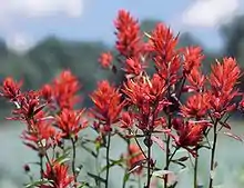
| Flower | Wyoming Indian paintbrush (Castilleja linariifolia) |
| Grass | Western wheatgrass (Pascopyrum smithii) |
| Mammal | American bison (Bison bison) |
| Reptile | Horned lizard (Phrynosoma douglassi brevirostre) |
| Tree | Plains cottonwood (Populus sargentii) |
| Inanimate insignia | |
| Dinosaur | Triceratops |
| Fossil | Knightia |
| Mineral | Nephrite |
| Soil | Forkwood (unofficial) |
| State route marker | |
 | |
| State quarter | |
 Released in 2007 | |
| Lists of United States state symbols | |
Wyoming's western half is mostly covered by the ranges and rangelands of the Rocky Mountains, while the eastern half of the state is high-elevation prairie called the High Plains. It is drier and windier than the rest of the country, being split between semi-arid and continental climates with greater temperature extremes. Almost half of the land in Wyoming is owned by the federal government, leading the state to rank sixth by area and fifth by proportion of a state's land owned by the federal government.[7] Federal lands include two national parks—Grand Teton and Yellowstone—two national recreation areas, two national monuments, several national forests, historic sites, fish hatcheries, and wildlife refuges.
Original inhabitants of the region include the Arapaho, Crow, Lakota, and Shoshone. Southwest Wyoming was claimed by the Spanish Empire and then as Mexican territory until it was ceded to the U.S. in 1848 at the end of the Mexican–American War. The region acquired the name "Wyoming" when a bill was introduced to Congress in 1865 to provide a temporary government for the territory of Wyoming. The name had been used earlier for the Wyoming Valley in Pennsylvania, and is derived from the Munsee word xwé:wamənk, meaning "at the big river flat".[8][9]
Wyoming's economy is driven by tourism and the extraction of minerals such as coal, natural gas, oil, and trona. Agricultural commodities include barley, hay, livestock, sugar beets, wheat, and wool. It was the first state to allow women the right to vote and become politicians, as well as the first state to elect a female governor. Due to this part of its history, its main nickname is "The Equality State" and its official state motto is "Equal Rights".[1] It has been a politically conservative state since the 1950s, with the Republican presidential nominee carrying the state in every election since 1968.[10] A notable exception is Teton County, which has achieved notability for being Wyoming's most Democratic county and the only county in the state to be won by a Democrat in every election since 2004.[11][12]
Geography
Climate
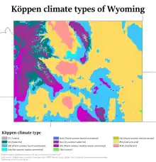
Wyoming's climate is generally semi-arid and continental (Köppen climate classification BSk), and is drier and windier in comparison to most of the United States with greater temperature extremes. Much of this is due to the topography of the state. Summers in Wyoming are warm with July high temperatures averaging between 85 and 95 °F (29 and 35 °C) in most of the state. With increasing elevation, however, this average drops rapidly with locations above 9,000 feet (2,700 m) averaging around 70 °F (21 °C). Summer nights throughout the state are characterized by a rapid cooldown with even the hottest locations averaging in the 50–60 °F (10–16 °C) range at night. In most of the state, most of the precipitation tends to fall in the late spring and early summer. Winters are cold, but are variable with periods of sometimes extreme cold interspersed between generally mild periods, with Chinook winds providing unusually warm temperatures in some locations.
Wyoming is a dry state with much of the land receiving less than 10 inches (250 mm) of rainfall per year. Precipitation depends on elevation with lower areas in the Big Horn Basin averaging 5–8 inches (130–200 mm), making the area nearly a true desert. The lower areas in the North and on the eastern plains typically average around 10–12 inches (250–300 mm), making the climate there semi-arid. Some mountain areas do receive a good amount of precipitation, 20 inches (510 mm) or more, much of it as snow, sometimes 200 inches (510 cm) or more annually. The state's highest recorded temperature is 114 °F (46 °C) at Basin on July 12, 1900 and the lowest recorded temperature is −66 °F (−54 °C) at Riverside on February 9, 1933.
The number of thunderstorm days vary across the state with the southeastern plains of the state having the most days of thunderstorm activity. Thunderstorm activity in the state is highest during the late spring and early summer. The southeastern corner of the state is the most vulnerable part of the state to tornado activity. Moving away from that point and westwards, the incidence of tornadoes drops dramatically with the west part of the state showing little vulnerability. Tornadoes, where they occur, tend to be small and brief, unlike some of those that occur farther east.
| Casper climate: Average maximum and minimum temperatures, and average rainfall. | |||||||||||||
|---|---|---|---|---|---|---|---|---|---|---|---|---|---|
| Month | Jan | Feb | Mar | Apr | May | Jun | Jul | Aug | Sep | Oct | Nov | Dec | Year |
| Average max. temperature °F (°C) | 32 (0) |
37 (3) |
45 (7) |
56 (13) |
66 (19) |
78 (26) |
87 (31) |
85 (29) |
74 (23) |
60 (16) |
44 (7) |
34 (1) |
58 (14) |
| Average min. temperature °F (°C) |
12 (−11) |
16 (−9) |
21 (−6) |
28 (−2) |
37 (3) |
46 (8) |
54 (12) |
51 (11) |
41 (5) |
32 (0) |
21 (−6) |
14 (−10) |
31 (-1) |
| Average rainfall inches (mm) |
0.6 (15.2) |
0.6 (15.2) |
1.0 (25.4) |
1.6 (40.6) |
2.1 (53.3) |
1.5 (38.1) |
1.3 (33.0) |
0.7 (17.8) |
0.9 (22.9) |
1.0 (25.4) |
0.8 (20.3) |
0.7 (17.8) |
12.8 (325.1) |
| Source:[13] | |||||||||||||
| Jackson climate: Average maximum and minimum temperatures, and average rainfall. | |||||||||||||
|---|---|---|---|---|---|---|---|---|---|---|---|---|---|
| Month | Jan | Feb | Mar | Apr | May | Jun | Jul | Aug | Sep | Oct | Nov | Dec | Year |
| Average max. temperature °F (°C) | 24 (−4) |
28 (−2) |
37 (3) |
47 (8) |
58 (14) |
68 (20) |
78 (26) |
77 (25) |
67 (19) |
54 (12) |
37 (3) |
24 (−4) |
49 (9) |
| Average min. temperature °F (°C) |
-1 (−18) |
2 (−17) |
10 (−12) |
21 (−6) |
30 (−1) |
36 (2) |
41 (5) |
38 (3) |
31 (−1) |
22 (−6) |
14 (−10) |
0 (−18) |
20 (-7) |
| Average rainfall inches (mm) |
2.6 (66.0) |
1.9 (48.3) |
1.6 (40.6) |
1.4 (35.6) |
1.9 (48.3) |
1.8 (45.7) |
1.3 (33.0) |
1.3 (33.0) |
1.5 (38.1) |
1.3 (33.0) |
2.3 (58.4) |
2.5 (63.5) |
21.4 (543.6) |
| Source:[14] | |||||||||||||
Location and size
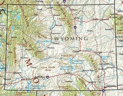
As specified in the designating legislation for the Territory of Wyoming, Wyoming's borders are lines of latitude 41°N and 45°N, and longitude 104°3'W and 111°3'W (27 and 34 west of the Washington Meridian)—a geodesic quadrangle.[15] Wyoming is one of only three states (the others being Colorado and Utah) to have borders defined by only "straight" lines. Due to surveying inaccuracies during the 19th century, Wyoming's legal border deviates from the true latitude and longitude lines by up to half of a mile (0.8 km) in some spots, especially in the mountainous region along the 45th parallel.[16] Wyoming is bordered on the north by Montana, on the east by South Dakota and Nebraska, on the south by Colorado, on the southwest by Utah, and on the west by Idaho. It is the tenth largest state in the United States in total area, containing 97,814 square miles (253,340 km2) and is made up of 23 counties. From the north border to the south border it is 276 miles (444 km);[17] and from the east to the west border is 365 miles (587 km) at its south end and 342 miles (550 km) at the north end.
Mountain ranges
.jpg.webp)
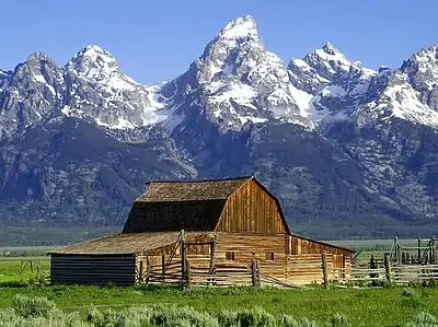
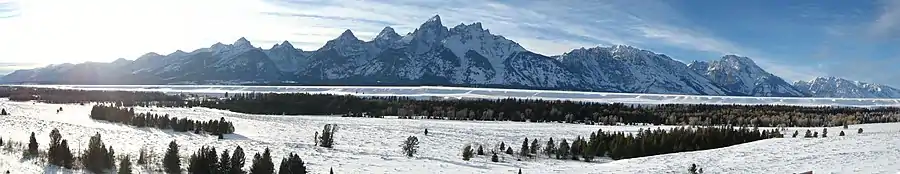
The Great Plains meet the Rocky Mountains in Wyoming. The state is a great plateau broken by many mountain ranges. Surface elevations range from the summit of Gannett Peak in the Wind River Mountain Range, at 13,804 feet (4,207 m), to the Belle Fourche River valley in the state's northeast corner, at 3,125 feet (952 m). In the northwest are the Absaroka, Owl Creek, Gros Ventre, Wind River, and the Teton ranges. In the north central are the Big Horn Mountains; in the northeast, the Black Hills; and in the southern region the Laramie, Snowy, and Sierra Madre ranges.
The Snowy Range in the south central part of the state is an extension of the Colorado Rockies both in geology and in appearance. The Wind River Range in the west central part of the state is remote and includes more than 40 mountain peaks in excess of 13,000 ft (4,000 m) tall in addition to Gannett Peak, the highest peak in the state. The Big Horn Mountains in the north central portion are somewhat isolated from the bulk of the Rocky Mountains.
The Teton Range in the northwest extends for 50 miles (80 km), part of which is included in Grand Teton National Park. The park includes the Grand Teton, the second highest peak in the state.
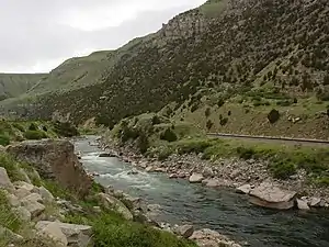
The Continental Divide spans north–south across the central portion of the state. Rivers east of the divide drain into the Missouri River Basin and eventually the Gulf of Mexico. They are the North Platte, Wind, Big Horn and the Yellowstone rivers. The Snake River in northwest Wyoming eventually drains into the Columbia River and the Pacific Ocean, as does the Green River through the Colorado River Basin.
The Continental Divide forks in the south central part of the state in an area known as the Great Divide Basin where water that precipitates onto or flows into it cannot reach an ocean—it all sinks into the soil and eventually evaporates.
Several rivers begin in or flow through the state, including the Yellowstone River, Bighorn River, Green River, and the Snake River.
Islands
Wyoming has 32 named islands; the majority are in Jackson Lake and Yellowstone Lake, within Yellowstone National Park in the northwest portion of the state. The Green River in the southwest also contains a number of islands.
Counties
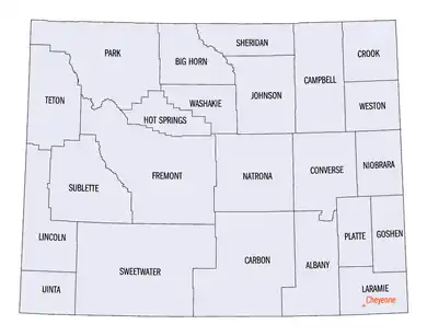
The state of Wyoming has 23 counties.
| Rank | County | Population | Rank | County | Population |
|---|---|---|---|---|---|
| 1 | Laramie | 98,327 | 13 | Converse | 13,809 |
| 2 | Natrona | 79,547 | 14 | Goshen | 13,378 |
| 3 | Campbell | 46,242 | 15 | Big Horn | 11,906 |
| 4 | Sweetwater | 43,534 | 16 | Sublette | 9,799 |
| 5 | Fremont | 39,803 | 17 | Platte | 8,562 |
| 6 | Albany | 38,332 | 18 | Johnson | 8,476 |
| 7 | Sheridan | 30,210 | 19 | Washakie | 8,064 |
| 8 | Park | 29,568 | 20 | Crook | 7,410 |
| 9 | Teton | 23,265 | 21 | Weston | 6,927 |
| 10 | Uinta | 20,495 | 22 | Hot Springs | 4,696 |
| 11 | Lincoln | 19,265 | 23 | Niobrara | 2,397 |
| 12 | Carbon | 15,303 | Wyoming Total | 579,315 | |
Wyoming license plates have a number on the left that indicates the county where the vehicle is registered, ranked by an earlier census.[19] Specifically, the numbers are representative of the property values of the counties in 1930.[20] The county license plate numbers are:
| License Plate Prefix |
County | License Plate Prefix |
County | License Plate Prefix |
County |
|---|---|---|---|---|---|
| 1 | Natrona | 9 | Big Horn | 17 | Campbell |
| 2 | Laramie | 10 | Fremont | 18 | Crook |
| 3 | Sheridan | 11 | Park | 19 | Uinta |
| 4 | Sweetwater | 12 | Lincoln | 20 | Washakie |
| 5 | Albany | 13 | Converse | 21 | Weston |
| 6 | Carbon | 14 | Niobrara | 22 | Teton |
| 7 | Goshen | 15 | Hot Springs | 23 | Sublette |
| 8 | Platte | 16 | Johnson |
Cities and towns
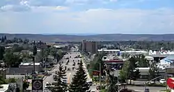
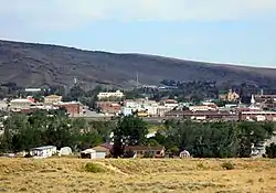
The State of Wyoming has 99 incorporated municipalities.
| Rank | City | County | Population |
|---|---|---|---|
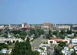
| 1 | Cheyenne | Laramie | 63,957 |
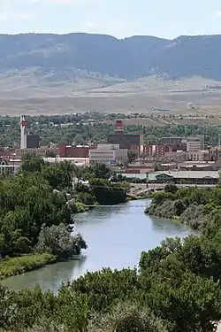
| 2 | Casper | Natrona | 57,461 |
| 3 | Laramie | Albany | 32,473 |
| 4 | Gillette | Campbell | 31,903 |
| 5 | Rock Springs | Sweetwater | 23,082 |
| 6 | Sheridan | Sheridan | 17,849 |
| 7 | Green River | Sweetwater | 11,978 |
| 8 | Evanston | Uinta | 11,704 |
| 9 | Riverton | Fremont | 10,996 |
| 10 | Jackson | Teton | 10,429 |
| 11 | Cody | Park | 9,828 |
| 12 | Rawlins | Carbon | 8,658 |
| 13 | Lander | Fremont | 7,503 |
| 14 | Torrington | Goshen | 6,701 |
| 15 | Powell | Park | 6,310 |
| 16 | Douglas | Converse | 6,273 |
In 2005, 50.6% of Wyomingites lived in one of the 13 most populous Wyoming municipalities.
Metropolitan areas
The United States Census Bureau has defined two Metropolitan Statistical Areas (MSA) and seven Micropolitan Statistical Areas (MiSA) for the State of Wyoming. In 2008, 30.4% of Wyomingites lived in either of the Metropolitan Statistical Areas, and 73% lived in either a Metropolitan Statistical Area or a Micropolitan Statistical Area.
| Census Area | County | Population |
|---|---|---|
| Cheyenne | Laramie | 98,976 |
| Casper | Natrona | 79,115 |
| Gillette | Campbell | 46,140 |
| Rock Springs | Sweetwater | 43,051 |
| Riverton | Fremont | 39,531 |
| Laramie | Albany | 38,601 |
| Jackson | Teton County, Wyoming | 23,081 |
| Teton County, Idaho | 11,640 | |
| Total | 34,721 | |
| Sheridan | Sheridan | 30,233 |
| Evanston | Uinta | 20,299 |
Wind River Indian Reservation
The Wind River Indian Reservation is shared by the Eastern Shoshone and Northern Arapaho tribes of Native Americans in the central western portion of the state near Lander. The reservation is home to 2,500 Eastern Shoshone and 5,000 Northern Arapaho.[23]
Chief Washakie established the reservation in 1868[24] as the result of negotiations with the federal government in the Fort Bridger Treaty.[25] However, the Northern Arapaho were forced onto the Shoshone reservation in 1876 by the federal government after the government failed to provide a promised separate reservation.[25]
Today the Wind River Indian Reservation is jointly owned, with each tribe having a 50% interest in the land, water, and other natural resources.[26] The reservation is a sovereign, self-governed land with two independent governing bodies: the Eastern Shoshone Tribe and the Northern Arapaho Tribe. Until 2014, the Shoshone Business Council and Northern Arapaho Business Council met jointly as the Joint Business Council to decide matters that affect both tribes.[24] Six elected council members from each tribe served on the joint council.
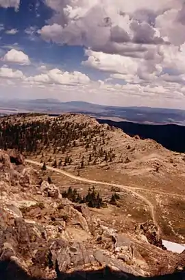
Public lands
Nearly half the land in Wyoming (about 30,099,430 acres (121,808.1 km2)) is owned by the federal government; the state owns another 3,864,800 acres (15,640 km2).[7] Most of it is administered by the Bureau of Land Management and U.S. Forest Service in numerous national forests and a national grassland, not to mention vast swaths of "public" land and an air force base near Cheyenne.
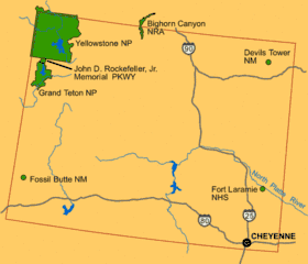
There are also areas managed by the National Park Service and agencies such as the U.S. Fish and Wildlife Service.
- National parks
- Grand Teton National Park
- Yellowstone National Park—first designated national park in the world[27]
- Memorial parkway
- The John D. Rockefeller Jr. Memorial Parkway connects Yellowstone and Grand Teton.
- National recreation areas
- Bighorn Canyon National Recreation Area
- Flaming Gorge National Recreation Area (managed by the Forest Service as part of Ashley National Forest)
- National monuments
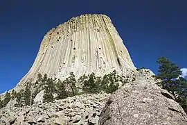
- Devils Tower National Monument—first national monument in the U.S.[27]
- Fossil Butte National Monument
- National historic trails, landmarks and sites
- California National Historic Trail
- Fort Laramie National Historic Site
- Independence Rock National Historic Landmark
- Medicine Wheel/Medicine Mountain National Historic Landmark
- Mormon Pioneer National Historic Trail
- National Register of Historic Places listings in Wyoming
- Oregon National Historic Trail
- Pony Express National Historic Trail
- National fish hatcheries
- National wildlife refuges
.jpg.webp)
History
Several Native American groups originally inhabited the region now known as Wyoming. The Crow, Arapaho, Lakota, and Shoshone were but a few of the original inhabitants white explorers encountered when they first visited the region. What is now southwestern Wyoming became a part of the Spanish Empire, and later Mexican territory, of Alta California, until it was ceded to the United States in 1848 at the end of the Mexican–American War.
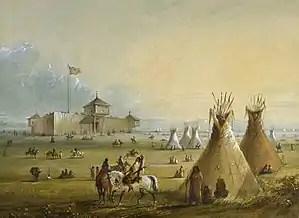
French-Canadian trappers from Québec and Montréal ventured into the area in the late 18th century, leaving French toponyms such as Téton and La Ramie. John Colter, a member of the Lewis and Clark Expedition, itself guided by French Canadian Toussaint Charbonneau and his young Shoshone wife, Sacagawea, first described the region in 1807. At the time, his reports of the Yellowstone area were considered to be fictional.[28] Robert Stuart and a party of five men, returning from Astoria, discovered South Pass in 1812. The Oregon Trail later followed that route. In 1850, Jim Bridger located what is now known as Bridger Pass, which the Union Pacific Railroad used in 1868, as did Interstate 80, 90 years later. Bridger also explored Yellowstone and filed reports on the region that, like those of Colter, were largely regarded at the time as tall tales.
The region acquired the name Wyoming by 1865, when Representative James Mitchell Ashley of Ohio introduced a bill to Congress to provide a "temporary government for the territory of Wyoming". The territory was named after the Wyoming Valley in Pennsylvania, made famous by the 1809 poem Gertrude of Wyoming by Thomas Campbell, based on the Battle of Wyoming in the American Revolutionary War. The name ultimately derives from the Munsee word xwé:wamənk, meaning "at the big river flat".[8][9]
The region's population grew steadily after the Union Pacific Railroad reached the town of Cheyenne in 1867, and the federal government established the Wyoming Territory on July 25, 1868.[29] Wyoming lacked significant deposits of gold and silver, unlike mineral-rich Colorado, and did not experience Colorado's related population boom. However, South Pass City did have a short-lived boom after the Carissa Mine began producing gold in 1867.[30] Furthermore, copper was mined in some areas between the Sierra Madre Mountains and the Snowy Range near Grand Encampment.[31]
Once government-sponsored expeditions to the Yellowstone country began, reports by Colter and Bridger, previously believed to be apocryphal, were found to be true. That led to the creation of Yellowstone National Park, which became the world's first national park in 1872. Nearly all of Yellowstone National Park lies within the far northwestern borders of Wyoming.
On December 10, 1869, territorial Governor John Allen Campbell extended the right to vote to women, making Wyoming the first territory and, later, United States state, to grant suffrage to women. Wyoming was also a pioneer in welcoming women into politics. Women first served on juries in Wyoming (Laramie in 1870). Wyoming had the first female court bailiff (Mary Atkinson, Laramie, in 1870), and the first female justice of the peace in the country (Esther Hobart Morris, South Pass City, in 1870). As well, in 1924, Wyoming became the first state to elect a female governor, Nellie Tayloe Ross, who took office in January 1925.[32] Due to its civil-rights history, one of Wyoming's state nicknames is "The Equality State", and the official state motto is "Equal Rights".[1]
Wyoming's constitution included women's suffrage and a pioneering article on water rights.[33] Congress admitted Wyoming into the Union as the 44th state on July 10, 1890.[1]
Wyoming was the location of the Johnson County War of 1892, which erupted between competing groups of cattle ranchers. The passage of the federal Homestead Act led to an influx of small ranchers. A range war broke out when either or both of the groups chose violent conflict over commercial competition in the use of the public land.
Demographics
| Historical population | |||
|---|---|---|---|
| Census | Pop. | %± | |
| 1870 | 9,118 | — | |
| 1880 | 20,789 | 128.0% | |
| 1890 | 62,555 | 200.9% | |
| 1900 | 92,531 | 47.9% | |
| 1910 | 145,965 | 57.7% | |
| 1920 | 194,402 | 33.2% | |
| 1930 | 225,565 | 16.0% | |
| 1940 | 250,742 | 11.2% | |
| 1950 | 290,529 | 15.9% | |
| 1960 | 330,066 | 13.6% | |
| 1970 | 332,416 | 0.7% | |
| 1980 | 469,557 | 41.3% | |
| 1990 | 453,588 | −3.4% | |
| 2000 | 493,782 | 8.9% | |
| 2010 | 563,626 | 14.1% | |
| 2019 (est.) | 578,759 | 2.7% | |
| Sources: 1910–2010[34][35][19] 2019 estimate[36] | |||
Population
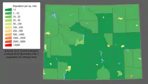
The United States Census Bureau estimates the population of Wyoming was 578,759 in 2019,[36] The center of population of Wyoming is in Natrona County.[37][38]
In 2014, the United States Census Bureau estimated the population's racial composition was 92.7% white (82.9% non-Hispanic white), 2.7% American Indian and Alaska Native, 1.6% Black or African American, 1.0% Asian American, and 0.1% Native Hawaiian or Pacific Islander.[39] As of 2011, 24.9% of Wyoming's population younger than age 1 were minorities.[40]
According to the 2010 census, the racial composition of the population was 90.7% white, 0.8% black or African American, 2.4% American Indian and Alaska Native, 0.8% Asian American, 0.1% Native Hawaiian and other Pacific Islander, 2.2% from two or more races, and 3.0% from some other race. Ethnically, 8.9% of the total population was of Hispanic or Latino origin (they may be of any race) and 91.1% Non-Hispanic, with non-Hispanic whites constituting the largest non-Hispanic group at 85.9%.[41]
As of 2015, Wyoming had an estimated population of 586,107, which was an increase of 1,954, or 0.29%, from the prior year and an increase of 22,481, or 3.99%, since the 2010 census. This includes a natural increase since the last census of 12,165 (33,704 births minus 21,539 deaths) and an increase from net migration of 4,035 into the state. Immigration resulted in a net increase of 2,264 and migration within the country produced a net increase of 1,771. In 2004, the foreign-born population was 11,000 (2.2%). In 2005, total births in Wyoming were 7,231 (birth rate of 14.04 per thousand).[42] Sparsely populated, Wyoming is the least populous state of the United States. Wyoming has the second-lowest population density in the country (behind Alaska) and is the sparsest-populated of the 48 contiguous states. It is one of only two states (Vermont) with a population smaller than that of the nation's capital.
According to the 2000 census, the largest ancestry groups in Wyoming are: German (26.0%), English (16.0%), Irish (13.3%), Norwegian (4.3%), and Swedish (3.5%).[43]
Birth data
Note: Births in table don't add up, because Hispanics are counted both by their ethnicity and by their race, giving a higher overall number.
| Race | 2013[44] | 2014[45] | 2015[46] | 2016[47] | 2017[48] | 2018[49] |
|---|---|---|---|---|---|---|
| White: | 7,090 (92.7%) | 7,178 (93.2%) | 7,217 (92.9%) | ... | ... | ... |
| Non-Hispanic White | 6,136 (80.3%) | 6,258 (81.3%) | 6,196 (79.8%) | 5,763 (78.0%) | 5,426 (78.6%) | 5,078 (77.4%) |
| American Indian | 305 (4.0%) | 294 (3.8%) | 294 (3.8%) | 200 (2.7%) | 206 (3.0%) | 219 (3.3%) |
| Asian | 124 (1.6%) | 108 (1.4%) | 135 (1.7%) | 100 (1.3%) | 79 (1.1%) | 72 (1.1%) |
| Black | 125 (1.6%) | 116 (1.5%) | 119 (1.5%) | 63 (0.9%) | 45 (0.7%) | 57 (0.9%) |
| Hispanic (of any race) | 926 (12.1%) | 895 (11.6%) | 963 (12.4%) | 973 (13.2%) | 892 (12.9%) | 851 (13.0%) |
| Total Wyoming | 7,644 (100%) | 7,696 (100%) | 7,765 (100%) | 7,386 (100%) | 6,903 (100%) | 6,562 (100%) |
- Since 2016, data for births of White Hispanic origin are not collected, but included in one Hispanic group; persons of Hispanic origin may be of any race.
Government and politics
State government
Wyoming's Constitution established three branches of government: the executive, legislative, and judicial branches. The state legislature comprises a House of Representatives with 60 members and a Senate with 30 members. The executive branch is headed by the governor and includes a secretary of state, auditor, treasurer and superintendent of public instruction. Wyoming does not have a lieutenant governor. The secretary of state is first in the line of succession.
Wyoming's sparse population warrants it only one at-large seat in the U.S. House of Representatives, and hence only three votes in the Electoral College.
The Wyoming State Liquor Association is the state's sole legal wholesale distributor of spirits, making it an alcoholic beverage control state. With the exception of wine, state law prohibits the purchase of alcoholic beverages for resale from any other source.[50]
Judicial system
Wyoming's highest court is the Supreme Court of Wyoming, with five justices presiding over appeals from the state's lower courts. Wyoming is unusual in that it does not have an intermediate appellate court, like most states. This is largely attributable to the state's population and correspondingly lower caseload. Appeals from the state district courts go directly to the Wyoming Supreme Court. Wyoming also has state circuit courts (formerly county courts), of limited jurisdiction, which handle certain types of cases, such as civil claims with lower dollar amounts, misdemeanor criminal offenses, and felony arraignments. Circuit court judges also commonly hear small claims cases as well.
Before 1972, Wyoming judges were selected by popular vote on a nonpartisan ballot. This earlier system was criticized by the state bar who called for the adoption of the Missouri Plan, a system designed to balance judiciary independence with judiciary accountability. In 1972, an amendment to Article 5 of the Wyoming Constitution, which incorporated a modified version of the plan, was adopted by the voters. Since the adoption of the amendment, all state court judges in Wyoming are nominated by the Judicial Nominating Commission and appointed by the Governor. They are then subject to a retention vote by the electorate one year after appointment.[51]
Political history
| Party | Registered Voters[52] | Percent | 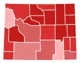
Party registration by county Republican >= 40%
Republican >= 50%
Republican >= 60%
Republican >= 70%
Republican >= 80% | |
|---|---|---|---|---|
| Republican | 176,355 | 67.18% | ||
| Democratic | 47,108 | 17.94% | ||
| No party affiliation | 35,745 | 13.62% | ||
| Libertarian Party | 2,386 | 0.91% | ||
| Constitution Party | 793 | 0.30% | ||
| Other | 137 | 0.05% | ||
| Total Voters | 262,524 | 100.00% |
Wyoming's political history defies easy classification. The state was the first to grant women the right to vote and to elect a woman governor.[53] On December 10, 1869, John Allen Campbell, the first Governor of the Wyoming Territory, approved the first law in United States history explicitly granting women the right to vote. This day was later commemorated as Wyoming Day.[53] On November 5, 1889, voters approved the first constitution in the world granting full voting rights to women.[54]
While the state elected notable Democrats to federal office in the 1960s and 1970s, politics have become decidedly more conservative since the 1980s as the Republican Party came to dominate the state's congressional delegation. Today, Wyoming is represented in Washington by its two Senators, John Barrasso and Cynthia Lummis, and its one member of the House of Representatives, Congresswoman Liz Cheney. All three are Republicans; a Democrat has not represented Wyoming in the Senate since 1977 or in the House since 1978. The state has not voted for a Democrat for president since 1964, one of only eight times since statehood. At present, there is only one relatively reliably Democratic county, affluent Teton, and one swing county, college county Albany. In the 2004 presidential election, George W. Bush won his second-largest victory, with 69% of the vote. Former Vice President Dick Cheney is a Wyoming resident and represented the state in Congress from 1979 to 1989.
Republicans are no less dominant at the state level. They have held a majority in the state senate continuously since 1936 and in the state house since 1964. However, Democrats held the governorship for all but eight years between 1975 and 2011. Uniquely, Wyoming elected Democrat Nellie Tayloe Ross as the first woman in United States history to serve as state governor. She served from 1925 to 1927, winning a special election after her husband, William Bradford Ross, unexpectedly died a little more than a year into his term.[55]
Voter registration by county
Republicans have a majority of registered votes in all but two counties: Albany and Teton, where they have a plurality of registered voters.
| Republican | Democratic | NPA | Libertarian | Constitution | Others | Margin | Total | ||||||||
|---|---|---|---|---|---|---|---|---|---|---|---|---|---|---|---|
| County | Voters | % | Voters | % | Voters | % | Voters | % | Voters | % | Voters | % | Voters | % | Voters |
| Albany | 7,862 | 45.38% | 5,541 | 31.98% | 3,585 | 20.69% | 298 | 1.72% | 39 | 0.23% | 1 | 0.00% | 2,321 | 13.40% | 17,326 |
| Big Horn | 4,597 | 82.84% | 451 | 8.13% | 432 | 7.79% | 29 | 0.52% | 40 | 0.72% | 0 | 0.00% | 4,146 | 74.71% | 5,549 |
| Campbell | 15,458 | 82.90% | 1,073 | 5.75% | 1,851 | 9.93% | 186 | 1.00% | 51 | 0.27% | 27 | 0.14% | 14,385 | 77.15% | 18,646 |
| Carbon | 4,118 | 62.36% | 1,336 | 20.23% | 1,064 | 16.11% | 72 | 1.09% | 13 | 0.20% | 1 | 0.02% | 2,782 | 42.13% | 6,604 |
| Converse | 5,499 | 81.45% | 565 | 8.37% | 630 | 9.33% | 30 | 0.44% | 24 | 0.36% | 3 | 0.04% | 4,934 | 73.08% | 6,751 |
| Crook | 3,394 | 86.38% | 227 | 5.78% | 270 | 6.87% | 18 | 0.46% | 20 | 0.51% | 0 | 0.00% | 3,167 | 80.60% | 3,929 |
| Fremont | 11,546 | 66.16% | 3,516 | 20.15% | 2,187 | 12.53% | 148 | 0.85% | 51 | 0.29% | 3 | 0.02% | 8,030 | 46.01% | 17,451 |
| Goshen | 4,472 | 74.45% | 867 | 14.43% | 614 | 10.22% | 36 | 0.60% | 18 | 0.30% | 0 | 0.00% | 3,605 | 60.02% | 6,007 |
| Hot Springs | 2,095 | 78.41% | 311 | 11.64% | 244 | 9.13% | 14 | 0.52% | 8 | 0.30% | 0 | 0.00% | 1,784 | 66.77% | 2,672 |
| Johnson | 3,857 | 84.07% | 319 | 6.95% | 376 | 8.20% | 23 | 0.50% | 13 | 0.28% | 0 | 0.00% | 3,538 | 77.12% | 4,588 |
| Laramie | 25,325 | 60.35% | 9,728 | 23.18% | 6,421 | 15.30% | 347 | 0.83% | 99 | 0.24% | 45 | 0.11% | 15,597 | 37.17% | 41,965 |
| Lincoln | 6,957 | 76.01% | 874 | 9.55% | 1,217 | 13.30% | 75 | 0.82% | 27 | 0.29% | 3 | 0.03% | 6,083 | 66.46% | 9,153 |
| Natrona | 22,800 | 67.23% | 5,630 | 16.60% | 4,973 | 14.66% | 363 | 1.07% | 145 | 0.43% | 0 | 0.00% | 17,170 | 50.63% | 33,911 |
| Niobrara | 1,199 | 88.81% | 73 | 5.41% | 71 | 5.26% | 4 | 0.30% | 3 | 0.22% | 0 | 0.00% | 1,126 | 83.40% | 1,350 |
| Park | 12,133 | 77.82% | 1,495 | 9.59% | 1,808 | 11.60% | 109 | 0.70% | 46 | 0.03% | 1 | 0.01% | 10,638 | 68.23% | 15,592 |
| Platte | 3,384 | 72.62% | 707 | 15.17% | 492 | 10.56% | 45 | 0.97% | 32 | 0.69% | 0 | 0.00% | 2,677 | 57.45% | 4,660 |
| Sheridan | 10,593 | 70.76% | 2,300 | 15.36% | 1,891 | 12.63% | 125 | 0.83% | 27 | 0.18% | 35 | 0.23% | 8,293 | 55.40% | 14,971 |
| Sublette | 3,717 | 82.25% | 393 | 8.70% | 381 | 8.43% | 24 | 0.53% | 6 | 0.13% | 1 | 0.02% | 3,324 | 73.55% | 4,519 |
| Sweetwater | 9,804 | 56.22% | 4,894 | 28.06% | 2,485 | 14.25% | 198 | 1.14% | 56 | 0.32% | 2 | 0.01% | 4,910 | 28.16% | 17,439 |
| Teton | 5,102 | 38.90% | 4,841 | 36.91% | 3,048 | 23.24% | 111 | 0.85% | 11 | 0.08% | 4 | 0.03% | 261 | 1.99% | 13,117 |
| Uinta | 6,273 | 71.94% | 1,264 | 14.50% | 1,050 | 12.04% | 83 | 0.95% | 40 | 0.46% | 10 | 0.11% | 5,009 | 57.44% | 8,720 |
| Washakie | 3,158 | 79.47% | 435 | 10.95% | 342 | 8.61% | 27 | 0.68% | 12 | 0.30% | 0 | 0.00% | 2,723 | 68.52% | 3,974 |
| Weston | 3,015 | 83.06% | 268 | 7.38% | 313 | 8.62% | 21 | 0.58% | 12 | 0.33% | 1 | 0.03% | 2,837 | 75.68% | 3,630 |
| State Total | 176,355 | 67.18% | 47,108 | 17.94% | 35,745 | 13.62% | 2,386 | 0.91% | 793 | 0.30% | 137 | 0.05% | 129,247 | 49.24% | 262,524 |
Culture
Languages
In 2010, 93.39% (474,343) of Wyomingites over the age of 5 spoke English as their primary language. 4.47% (22,722) spoke Spanish, 0.35% (1,771) spoke German, and 0.28% (1,434) spoke French. Other common non-English languages included Algonquian (0.18%), Russian (0.10%), Tagalog, and Greek (both 0.09%).[56]
In 2007, the American Community Survey reported 6.2% (30,419) of Wyoming's population over five spoke a language other than English at home. Of those, 68.1% were able to speak English very well, 16.0% spoke English well, 10.9% did not speak English well, and 5.0% did not speak English at all.[57]
Religion
According to a 2013 Gallup Poll, the religious affiliations of the people of Wyoming were: 49% Protestants, 18% Catholics, 9% Latter-day Saints (Mormons) and less than 1% Jewish.[59]
A 2010 ARDA report recognized as the largest denominations in Wyoming the Church of Jesus Christ of Latter-day Saints (Mormons) with 62,804 (11%), the Catholic Church with 61,222 (10.8%) and the Southern Baptist Convention with 15,812 adherents (2.8%). The same report counted 59,247 Evangelical Protestants (10.5%), 36,539 Mainline Protestants (6.5%), 785 Eastern Orthodox Christians; 281 Black Protestants, as well as 65,000 adhering to other traditions and 340,552 not claiming any tradition.[60]
Sports
Due to its sparse population, Wyoming lacks any major professional sports teams. However, the Wyoming Cowboys and Cowgirls—particularly the football and basketball teams—are quite popular. Their stadiums in Laramie are about 7,200 feet (2,200 m) above sea level, the highest in NCAA Division I. The Wyoming High School Activities Association also sponsors twelve sports.
Casper has hosted the College National Finals Rodeo since 2001.
State symbols
List of all Wyoming state symbols:[1]
- State bird: western meadowlark (Sturnella neglecta)
- State coin: Sacagawea dollar
- State dinosaur: Triceratops
- State emblem: Bucking Horse and Rider
- State fish: cutthroat trout (Oncorhynchus clarki)
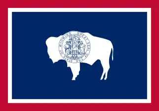
- State flag: Flag of the State of Wyoming
- State flower: Wyoming Indian paintbrush (Castilleja linariifolia)
- State fossil: Knightia
- State gemstone: Wyoming nephrite jade
- State grass: western wheatgrass (Pascopyrum smithii)
- State insect: Sheridan's green hairstreak butterfly (Callophrys sheridanii)
- State mammal: American bison (Bison bison)
- State motto: Equal Rights
- State nicknames: Equality State; Cowboy State; Big Wyoming
- State reptile: horned lizard (Phrynosoma douglassi brevirostre)
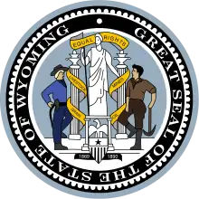
- State seal: Great Seal of the State of Wyoming
- State song: "Wyoming" by Charles E. Winter & George E. Knapp
- State sport: rodeo
- State tree: plains cottonwood (Populus sargentii)
Economy and infrastructure
According to the 2012 United States Bureau of Economic Analysis report, Wyoming's gross state product was $38.4 billion.[61] As of 2014 the population was growing slightly with the most growth in tourist-oriented areas such as Teton County. Boom conditions in neighboring states such as North Dakota were drawing energy workers away. About half of Wyoming's counties showed population losses.[62] The state makes active efforts through Wyoming Grown, an internet-based recruitment program, to find jobs for young people educated in Wyoming who have emigrated but may wish to return.[63]
The mineral extraction industry and travel and tourism sector are the main drivers behind Wyoming's economy. The federal government owns about 50% of its landmass, while 6% is controlled by the state. Total taxable values of mining production in Wyoming for 2001 was over $6.7 billion. The tourism industry accounts for over $2 billion in revenue for the state.
In 2002, more than six million people visited Wyoming's national parks and monuments. The key tourist attractions in Wyoming include Grand Teton National Park, Yellowstone National Park, Devils Tower National Monument, Independence Rock and Fossil Butte National Monument. Each year Yellowstone National Park, the world's first national park, receives three million visitors.
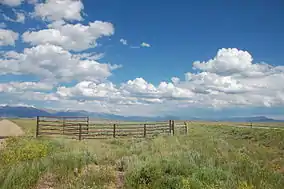
Historically, agriculture has been an important component of Wyoming's economy. Its overall importance to the performance of Wyoming's economy has waned. However, agriculture is still an essential part of Wyoming's culture and lifestyle. The main agricultural commodities produced in Wyoming include livestock (beef), hay, sugar beets, grain (wheat and barley), and wool. More than 91% of land in Wyoming is classified as rural.
Wyoming is the home of only a handful of companies with a regional or national presence. Taco John's and Sierra Trading Post, both in Cheyenne, are privately held. Cloud Peak Energy in Gillette and U.S. Energy Corp. (NASDAQ: USEG) in Riverton are Wyoming's only publicly traded companies.
Mineral and energy production
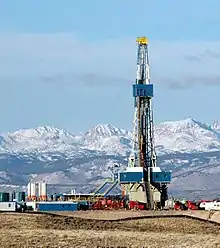
Wyoming's mineral commodities include coal, natural gas, coalbed methane, crude oil, uranium, and trona.
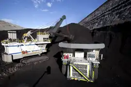
- Coal: Wyoming produced 395.5 million short tons (358.8 million metric tons) of coal in 2004, greater than any other state.[65] Wyoming possesses a reserve of 68.7 billion tons (62.3 billion metric tons) of coal. Major coal areas include the Powder River Basin and the Green River Basin
- Coalbed methane (CBM): The boom for CBM began in the mid-1990s. CBM is characterized as methane gas that is extracted from Wyoming's coal bed seams. It is another means of natural gas production. There has been substantial CBM production in the Powder River Basin. In 2002, the CBM production yield was 327.5 billion cubic feet (9.3 km3).
- Crude oil: Wyoming produced 53.4 million barrels (8.49×10⁶ m3) of crude oil in 2007. The state ranked fifth nationwide in oil production in 2007.[66] Petroleum is most often used as a motor fuel, but it is also utilized in the manufacture of plastics, paints, and synthetic rubber.
- Diamonds: The Kelsey Lake Diamond Mine, located in Colorado less than 1,000 feet (300 m) from the Wyoming border, produced gem quality diamonds for several years. The Wyoming craton, which hosts the kimberlite volcanic pipes that were mined, underlies most of Wyoming.
- Natural gas: Wyoming produced 1.77 trillion cubic feet (50.0 billion m3) of natural gas in 2016. The state ranked 6th nationwide for natural gas production in 2016.[67] The major markets for natural gas include industrial, commercial, and domestic heating.
- Trona: Wyoming possesses the world's largest known reserve of trona,[68] a mineral used for manufacturing glass, paper, soaps, baking soda, water softeners, and pharmaceuticals. In 2008, Wyoming produced 46 million short tons (41.7 million metric tons) of trona, 25% of the world's production.[68]
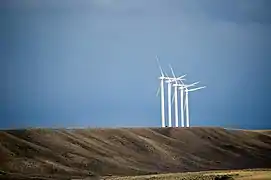
- Wind power: Because of Wyoming's geography and high-altitude, the potential for wind power in Wyoming is one of the highest of any state in the US. The Chokecherry and Sierra Madre Wind Energy Project is the largest commercial wind generation facility under development in North America.[69] Carbon County is home to the largest proposed wind farm in the US. However, construction plans have been halted because of proposed new taxes on wind power energy production.[70]
- Uranium: Although uranium mining in Wyoming is much less active than it was in previous decades, recent increases in the price of uranium have generated new interest in uranium prospecting and mining.
Taxes
Unlike most other states, Wyoming does not levy an individual or corporate income tax. In addition, Wyoming does not assess any tax on retirement income earned and received from another state. Wyoming has a state sales tax of 4%. Counties have the option of collecting an additional 1% tax for general revenue and a 1% tax for specific purposes, if approved by voters. Food for human consumption is not subject to sales tax.[71] There also is a county lodging tax that varies from 2% to 5%. The state collects a use tax of 5% on items purchased elsewhere and brought into Wyoming. All property tax is based on the assessed value of the property and Wyoming's Department of Revenue's Ad Valorem Tax Division supports, trains, and guides local government agencies in the uniform assessment, valuation and taxation of locally assessed property. "Assessed value" means taxable value; "taxable value" means a percent of the fair market value of property in a particular class. Statutes limit property tax increases. For county revenue, the property tax rate cannot exceed 12 mills (or 1.2%) of assessed value. For cities and towns, the rate is limited to eight mills (0.8%). With very few exceptions, state law limits the property tax rate for all governmental purposes.
Personal property held for personal use is tax-exempt. Inventory if held for resale, pollution control equipment, cash, accounts receivable, stocks and bonds are also exempt. Other exemptions include property used for religious, educational, charitable, fraternal, benevolent and government purposes and improvements for handicapped access. Mine lands, underground mining equipment, and oil and gas extraction equipment are exempt from property tax but companies must pay a gross products tax on minerals and a severance tax on mineral production.[72][73]
Wyoming does not collect inheritance taxes. There is limited estate tax related to federal estate tax collection.
In 2008, the Tax Foundation ranked Wyoming as having the single most "business friendly" tax climate of all 50 states.[74] Wyoming state and local governments in fiscal year 2007 collected $2.242 billion in taxes, levies, and royalties from the oil and gas industry. The state's mineral industry, including oil, gas, trona, and coal provided $1.3 billion in property taxes from 2006 mineral production.[66] Wyoming receives more federal tax dollars per capita in aid than any other state except Alaska. The federal aid per capita in Wyoming is more than double the United States average.[75]
As of 2016, Wyoming does not require the beneficial owners of LLCs to be disclosed in the filing, which creates an opportunity for a tax haven, according to Clark Stith of Clark Stith & Associates in Rock Springs, Wyoming, a former Republican candidate for Wyoming secretary of state.[76]
Transportation
The largest airport in Wyoming is Jackson Hole Airport, with more than 500 employees.[77] Three interstate highways and thirteen United States highways pass through Wyoming. In addition, the state is served by the Wyoming state highway system.
Interstate 25 enters the state south of Cheyenne and runs north, intersecting Interstate 80 immediately west of Cheyenne. It passes through Casper and ends at Interstate 90 near Buffalo. Interstate 80 crosses the Utah border west of Evanston and runs east through the southern third of the state, passing through Cheyenne before entering Nebraska near Pine Bluffs. Interstate 90 comes into Wyoming near Parkman and cuts through the northeastern part of the state. It serves Gillette and enters South Dakota east of Sundance.
U.S. Routes 14, 16, and the eastern section of U.S. 20 all have their western terminus at the eastern entrance to Yellowstone National Park and pass through Cody. U.S. 14 travels eastward before joining I-90 at Gillette. U.S. 14 then follows I-90 to the South Dakota border. U.S. 16 and 20 split off of U.S. 14 at Greybull and U.S. 16 turns east at Worland while U.S. 20 continues south Shoshoni. U.S. Route 287 carries traffic from Fort Collins, Colorado into Laramie, Wyoming through a pass between the Laramie Mountains and the Medicine Bow Mountains, merges with US 30 and I-80 until it reaches Rawlins, where it continues north, passing Lander. Outside of Moran, U.S. 287 is part of a large interchange with U.S. Highways 26, 191, and 89, before continuing north to the southern entrance of Yellowstone. U.S. 287 continues north of Yellowstone, but the two sections are separated by the national park.
Other U.S. highways that pass through the state are 18, 26, 30, 85, 87, 89, 189, 191, 212, and 287.
Wyoming is one of only two states (South Dakota) in the 48 contiguous states not served by Amtrak.[78] It was once served by Amtrak's San Francisco Zephyr and Pioneer lines.
Education
Public education is directed by the state superintendent of public instruction, an elected state official. Educational policies are set by the State Board of Education, a nine-member board appointed by the governor. The constitution prohibits the state from establishing curriculum and textbook selections; these are the prerogatives of local school boards. The Wyoming School for the Deaf was the only in-state school dedicated to supporting deaf students in Wyoming before its closure in the summer of 2000.[79]
Higher education
Wyoming has one public four-year institution, the University of Wyoming in Laramie and one private four-year college, Wyoming Catholic College, in Lander, Wyoming. In addition, there are seven two-year community colleges spread throughout the state.
Before the passing of a new law in 2006, Wyoming had hosted unaccredited institutions, many of them suspected diploma mills.[80] The 2006 law is forcing unaccredited institutions to make one of three choices: move out of Wyoming, close down, or apply for accreditation. The Oregon State Office of Degree Authorization predicted in 2007 that in a few years the problem of diploma mills in Wyoming might be resolved.[81]
Media
Wyoming's media market consists of 16 broacast TV stations, radio stations and dozens of small to medium sized newspapers.[82][83][84] There are also a few small independent news sources such as Wyofile.com, a non-profit news site[85] and Oil City News.[86]
Notes
- Wyoming is the second least densely populated state overall, behind only Alaska, which is the least densely populated state but is non-contiguous.
References
- "Wyoming Facts and Symbols". State of Wyoming. 2013. Archived from the original on September 20, 2016. Retrieved October 12, 2016.
- "Gannett Peak Cairn". NGS data sheet. U.S. National Geodetic Survey. Retrieved October 24, 2011.
- "Elevations and Distances in the United States". United States Geological Survey. 2001. Archived from the original on July 22, 2012. Retrieved October 24, 2011.
- Elevation adjusted to North American Vertical Datum of 1988.
- "Median Annual Household Income". The US Census Bureau. Archived from the original on December 20, 2016. Retrieved December 9, 2016.
- "City and Town Population Totals: 2010-2018". United States Census Bureau. Retrieved March 1, 2020.
- MainEnvironment.org Archived May 25, 2017, at the Wayback Machine Public Land Ownership by State, 1995 Main Environment.org
- Bright, William (2004). Native American Place Names of the United States. Norman: University of Oklahoma Press, pg. 576
- State of Wyoming—Narrative Archived May 15, 2008, at the Wayback Machine
- "Dave Leip's Atlas of U.S. Presidential Elections". Archived from the original on July 9, 2018. Retrieved November 18, 2016.
- Leip, Dave. "Atlas of US Presidential Elections". uselectionatlas.org. Retrieved December 19, 2016.
- "2016 election results: Wyoming". www.cnn.com. Retrieved November 26, 2016.
- "CountryStudies.us". CountryStudies.us. Archived from the original on June 29, 2011. Retrieved July 31, 2010.
- "Countrystudies.us". Countrystudies.us. Archived from the original on June 29, 2011. Retrieved July 31, 2010.
- Willam J. Gribb; Lawrence M. Ostrech. "Databases and Algorithms to Determine the Boundary of Wyoming" (PDF). University of Wyoming, Department of Geography. Archived from the original (PDF) on December 17, 2008. Retrieved December 14, 2008. Cite journal requires
|journal=(help) - Ivars Peterson. "Rectangular States and Kinky Borders". Archived from the original on July 5, 2008. Retrieved December 14, 2008.
- Distance Calculator Archived September 27, 2011, at the Wayback Machine. Javascripter.net. Retrieved July 12, 2013.
- "County Population Totals and Components of Change: 2010-2017". 2017 Population Estimates. United States Census Bureau, Population Division. March 14, 2019. Archived from the original on March 6, 2019. Retrieved March 14, 2019.
- "Historical decennial census population for Wyoming counties, cities, and towns". U.S. Census, State of Wyoming. Archived from the original on July 8, 2017. Retrieved September 24, 2012.
- "TetonAT.com—Interesting Wyoming License Plate Fact". Tetonat.com. Archived from the original on September 4, 2017. Retrieved September 4, 2017.
- "City and Town Population Totals: 2010-2018". 2018 Population Estimates. U.S. Census Bureau, Population Division. March 1, 2020. Retrieved March 1, 2020.
- "Metropolitan and Micropolitan Statistical Areas Population Totals: 2010-2017". 2017 Population Estimates. U.S. Census Bureau, Population Division. March 14, 2019. Archived from the original on September 26, 2018. Retrieved March 14, 2019.
- "Wind River Country: Wind River Indian Reservation". Archived from the original on March 19, 2009.
- Background of Wind River Reservation Archived February 27, 2009, at the Wayback Machine
- "Chiefe: The Rez". Archived from the original on October 16, 2012. Retrieved September 18, 2017. PBS. Independent Lens
- "Background—Northern Arapaho Tribe". Northernarapaho.com. Archived from the original on September 15, 2017. Retrieved September 4, 2017.
- "Listing of National Park System Areas by State". National Park Service. Archived from the original on June 29, 2011. Retrieved June 30, 2011.
- The Yellowstone National Park at Project Gutenberg
- State of Wyoming—General Facts About Wyoming Archived September 27, 2007, at the Wayback Machine
- "South Pass City Historic Site" (PDF). Wyoming State Parks, Historic Sites & Trails. Archived from the original (PDF) on February 27, 2009.
- Stevens, Horace Jared; Weed, Walter Harvey; et al. (1911). Mines Register: Successor to the Mines Handbook and the Copper Handbook, Describing the Non-ferrous Metal Mining Companies in the Western Hemisphere.
- Larson, T. A. (1990). History of Wyoming. University of Nebraska Press. ISBN 978-0-803-27936-0.
- Sodaro, Craig; Adams, Randy (1996). Frontier Spirit: The Story of Wyoming. Johnson Books. pp. 136–39. ISBN 978-1-55566-163-2.
- Resident Population Data. "Resident Population Data—2010 Census". 2010.census.gov. Archived from the original on October 19, 2013. Retrieved December 24, 2012.
- Archived October 19, 2013, at the Wayback Machine
- "QuickFacts Wyoming; UNITED STATES". 2019 Population Estimates. United States Census Bureau, Population Division. March 14, 2019. Archived from the original on December 29, 2018. Retrieved March 14, 2019.
- "State & County QuickFacts". U.S. Census Bureau. 2013. Archived from the original on July 3, 2011. Retrieved May 6, 2013.
- "Centers of Population by State". U.S. Census Bureau. 2013. Archived from the original on January 3, 2014. Retrieved May 9, 2013.
- "Wyoming QuickFacts". US Census Bureau. United States Census Bureau. 2014. Archived from the original on July 7, 2013. Retrieved January 12, 2016.
- Exner, Rich (June 3, 2012). "Americans under age 1 now mostly minorities, but not in Ohio: Statistical Snapshot". The Plain Dealer. Archived from the original on July 14, 2016. Retrieved August 16, 2012.
- Wyoming QuickFacts from the US Census Bureau Archived July 7, 2013, at the Wayback Machine. Quickfacts.census.gov. Retrieved July 12, 2013.
- "Hispanics fastest growing ethnic group in Wyoming". Billings Gazette via AP. May 21, 2007. Archived from the original on July 21, 2012. Retrieved May 7, 2008.
- "Census 2000 Summary file 3—Wyoming". United States Census Bureau. Retrieved March 18, 2016.
- "Births: Final Data for 2013" (PDF). Cdc.gov. Archived (PDF) from the original on September 11, 2017. Retrieved September 4, 2017.
- "Births: Final Data for 2014" (PDF). Cdc.gov. Archived (PDF) from the original on February 14, 2017. Retrieved September 4, 2017.
- "Births: Final Data for 2015" (PDF). Cdc.gov. Archived (PDF) from the original on August 31, 2017. Retrieved September 4, 2017.
- "data" (PDF). www.cdc.gov. Archived (PDF) from the original on June 3, 2018. Retrieved May 7, 2018.
- "Archived copy" (PDF). Archived (PDF) from the original on February 1, 2019. Retrieved February 22, 2019.CS1 maint: archived copy as title (link)
- "Data" (PDF). www.cdc.gov. Retrieved December 21, 2019.
- WSLA. "WSLA common questions". Wyoming State Liquor Association. Archived from the original on February 12, 2014. Retrieved February 18, 2014.
- Hubble, Larry; et al. (2008). The Equality State: Government and Politics in Wyoming (6th ed.). Peosta, Iowa: Eddie Bowers Publishing Co. pp. 91–92. ISBN 978-1-57879-076-0.
- "Statewide Summary : Wyoming Voter Registration" (PDF). Soswy.state.wy.us. January 2017. Archived (PDF) from the original on July 26, 2017. Retrieved September 4, 2017.
- "Today in History". The Library of Congress. Archived from the original on June 8, 2012. Retrieved July 20, 2012.
- "Today in History". The Library of Congress. Archived from the original on June 8, 2012. Retrieved July 27, 2012.
- Teva J. Scheer (2005). Governor lady: the life and times of Nellie Tayloe Ross. Columbia: University of Missouri Press. p. 73. ISBN 978-0-8262-1626-7.
- "Most Spoken Languages in Wyoming in 2010". Modern Language Association. Archived from the original on June 19, 2006. Retrieved December 15, 2013.
- Hyon B. Shin; Robert A. Kominski (April 2010). "Language Use in the United States: 2007" (PDF). United States Census Bureau. United States Department of Commerce. Archived (PDF) from the original on June 14, 2013. Retrieved May 27, 2013.
- "Religion in America: U.S. Religious Data, Demographics and Statistics—Pew Research Center". Archived from the original on December 2, 2017. Retrieved December 3, 2017.
- "Mississippi and Alabama Most Protestant States in U.S". Gallup.com. Archived from the original on April 14, 2016. Retrieved June 4, 2014.
- "State Membership Report: Wyoming". Association of Religion Data Archives. Archived from the original on December 15, 2013. Retrieved December 15, 2013.
- "GDP by State". Bureau of Economic Analysis. Archived from the original on April 13, 2013. Retrieved July 14, 2013.
- Star-Tribune staff writers (March 29, 2015). "Wyoming's population growth slows". Casper Star-Tribune. Archived from the original on October 19, 2017. Retrieved July 16, 2015.
... according to Wyoming's Economic Analysis Division
- Julie Turkewitz (July 15, 2015). "Wyoming, Long on Pride but Short on People, Hopes to Lure Some Back". The New York Times. Archived from the original on July 19, 2015. Retrieved July 16, 2015.
This effort has taken the form of an Internet-based recruitment program called Wyoming Grown. Young Wyomingites who have left the state sign up on the program's website, and quickly receive a call from a recruiter who helps link them to work here.
- Praveen Duddu (October 20, 2013). "The 10 biggest coal mines in the world" Archived October 31, 2018, at the Wayback Machine. mining-technology.com. Verdict Media Limited. Retrieved October 31, 2018.
- "EIA State Energy Profiles: Wyoming". June 12, 2008. Archived from the original on November 17, 2010. Retrieved June 24, 2008.
- "Petroleum Association of Wyoming". Archived from the original on September 20, 2008.
- US Energy Information Administration, Natural Gas Production Archived June 23, 2017, at the Wayback Machine, accessed 14 June 2017.
- Gearino, Jeff (February 16, 2009). "Soda ash companies enjoy record year". Casper Star Tribune. Archived from the original on January 12, 2013.
- "Power Company of Wyoming: Chokecherry and Sierra Madre Wind Energy Project". Powercompanyofwyoming.com. Archived from the original on September 4, 2017. Retrieved September 4, 2017.
- Paterson, Leigh (June 14, 2016). "Construction of Largest U.S. Wind Farm Is on Hold". wyomingpublicmedia.org. Archived from the original on June 18, 2016. Retrieved June 21, 2016.
- Votes back repeal of food tax Archived April 14, 2006, at the Wayback Machine, Billings Gazette, March 3, 2006
- "Getting the Story Right; Mineral Taxation in Wyoming and West Virginia". West Virginia Center on Budget and Policy Blog. Archived from the original on January 17, 2013. Retrieved November 10, 2012.
- Wyoming Statutes Section 39-13-103
- "The Tax Foundation—Tax Research Areas—Wyoming". Taxfoundation.org. Archived from the original on January 30, 2010. Retrieved July 31, 2010.
- "Federal Aid to States for Fiscal Year 2010" (PDF). Archived (PDF) from the original on June 11, 2014. Retrieved June 4, 2014.
- Hamilton, Amy (April 5, 2016). "Panama Papers Include Nevada, Wyoming Among Offshore Tax Havens". taxnotes.com. Tax Analysts. Archived from the original on October 31, 2018. Retrieved October 31, 2018.
- "Airport Improvement Projects—Jackson Hole Airport (JAC), Jackson Hole, Wyoming". Jacksonholeairport.com. Archived from the original on January 13, 2012. Retrieved September 4, 2017.
- "Amtrak National Facts". Amtrak.com. Archived from the original on March 10, 2016. Retrieved March 18, 2016.
- Watt, Meghan (October 1, 2007). "Deaf alumni saddened by school's fate". Casper Star-Tribune. Archived from the original on December 5, 2017. Retrieved April 8, 2017.
- Alleged "diploma mills" flocking to Wyoming Archived December 23, 2007, at the Wayback Machine, by Mead Gruver, The Seattle Times, February 9, 2005
- Unaccredited Colleges Archived July 15, 2007, at the Wayback Machine, Potential problems with degree suppliers located in these states—Wyoming, Oregon State Office of Degree Authorization
- "Wyoming Newspapers Online". w3newspapers.com. January 17, 2021. Retrieved January 17, 2021.
- "Television Stations". stationindex.com. January 17, 2021. Retrieved January 17, 2021.
- "Radio Stations in Wyoming". radio-locator.com. January 17, 2021. Retrieved January 17, 2021.
- "About us". wyofile.com. Wyofile. January 17, 2021. Retrieved January 17, 2021.
- "About us". oilcity.news. Oil City News. January 17, 2021. Retrieved January 17, 2021.
External links
- State of Wyoming government official website
- Official Wyoming State Travel Website
- Wyoming State Facts from USDA
- Wyoming at Curlie
 Geographic data related to Wyoming at OpenStreetMap
| Preceded by Idaho |
List of U.S. states by date of statehood Admitted on July 10, 1890 (44th) |
Succeeded by Utah |