Xanxerê
Xanxerê is a city in Santa Catarina, southern Brazil. Italian and German are the mainstream cultures, having been brought by immigrants in the early 20th century through the migration of the "gauchos".
Xanxerê | |
|---|---|
 City's central church | |
 Flag  Seal | |
| Nickname(s): Portuguese: Capital Estadual do Milho (The state capital of corn) | |
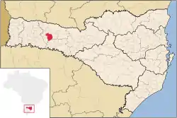 Location in Santa Catarina | |
 Xanxerê Location in Brazil | |
| Coordinates: 26°52′37″S 52°24′14″W | |
| Country | |
| Region | South |
| State | |
| Mesoregion | West of Santa Catarina |
| Microregion | Xanxerê |
| Founded | 27 February 1954 |
| Government | |
| • Mayor | Ademiri 'Miri' Gasparini |
| Area | |
| • Total | 377.764 km2 (145.855 sq mi) |
| Elevation | 800 m (2,600 ft) |
| Population (2020 [2]) | |
| • Total | 51,642 |
| • Density | 140/km2 (350/sq mi) |
| Demonym(s) | Xanxerenses |
| Time zone | UTC-3 (UTC-3) |
| • Summer (DST) | UTC-2 (UTC-2) |
| CEP postal code | 89820-000 |
| Area code | 49 |
| HDI (2010) [3] | 0,775 |
| Website | Municipality official website |
The city is one of the main production centers of corn in Brazil and serves as an important industrial, commercial and service center for western Santa Catarina. It is located in a key position for trades via Mercosul.
Xanxerê is the headquarters of the Association of Cities of Alto Irani (AMAI), composed of 17 "municípios".
On April 20, 2015, two tornadoes struck the city; two people died and another 120 were injured, according to the news. These tornadoes was most likely an F3 on the Fujita Scale, according to Mamedes Luiz Melo, an INMET meteorologist. At least 2,600 homes were damaged.[4][5]
| Month | Jan | Feb | Mar | Apr | May | Jun | Jul | Aug | Sep | Oct | Nov | Dec | Year |
|---|---|---|---|---|---|---|---|---|---|---|---|---|---|
| Record high °C (°F) | 36.2 (97.2) |
34.0 (93.2) |
34.0 (93.2) |
30.8 (87.4) |
29.6 (85.3) |
28.1 (82.6) |
28.2 (82.8) |
30.6 (87.1) |
32.5 (90.5) |
33.2 (91.8) |
34.8 (94.6) |
35.0 (95.0) |
36.2 (97.2) |
| Average high °C (°F) | 27.8 (82.0) |
27.8 (82.0) |
26.6 (79.9) |
24.0 (75.2) |
21.6 (70.9) |
19.4 (66.9) |
20.3 (68.5) |
21.5 (70.7) |
22.6 (72.7) |
24.1 (75.4) |
25.8 (78.4) |
27.1 (80.8) |
24.1 (75.3) |
| Daily mean °C (°F) | 21.2 (70.2) |
21.3 (70.3) |
20.3 (68.5) |
17.5 (63.5) |
15.1 (59.2) |
13.2 (55.8) |
13.7 (56.7) |
14.7 (58.5) |
16.0 (60.8) |
17.5 (63.5) |
19.2 (66.6) |
20.7 (69.3) |
17.5 (63.6) |
| Average low °C (°F) | 16.3 (61.3) |
16.6 (61.9) |
15.5 (59.9) |
12.4 (54.3) |
10.2 (50.4) |
8.6 (47.5) |
8.9 (48.0) |
9.7 (49.5) |
11.0 (51.8) |
11.9 (53.4) |
13.6 (56.5) |
15.5 (59.9) |
12.5 (54.5) |
| Record low °C (°F) | 4.0 (39.2) |
3.0 (37.4) |
3.6 (38.5) |
0.0 (32.0) |
−3.8 (25.2) |
−11.6 (11.1) |
−11.1 (12.0) |
−7.9 (17.8) |
−3.8 (25.2) |
0.0 (32.0) |
1.6 (34.9) |
4.4 (39.9) |
−11.6 (11.1) |
| Average rainfall mm (inches) | 223.9 (8.81) |
222.3 (8.75) |
192.4 (7.57) |
141.8 (5.58) |
148.6 (5.85) |
164.4 (6.47) |
162.2 (6.39) |
186.3 (7.33) |
220.7 (8.69) |
221.8 (8.73) |
170.5 (6.71) |
172.6 (6.80) |
2,227.5 (87.68) |
| Average rainy days (≥ 0.01 mm) | 13 | 13 | 12 | 8 | 8 | 9 | 9 | 10 | 12 | 11 | 9 | 10 | 124 |
| Average relative humidity (%) | 80.3 | 80.7 | 81.0 | 79.9 | 79.7 | 80.2 | 77.1 | 76.9 | 76.2 | 76.2 | 75.1 | 77.4 | 78.4 |
| Source: Instituto Nacional de Meteorologia (INMET),[6] | |||||||||||||
Notes
References
- "Área territorial oficial" [Official Territorial Area] (in Portuguese). Brazilian Institute of Geography and Statistics (IBGE). 2002-10-10. Retrieved 2014-12-03.
- IBGE 2020
- "Ranking decrescente do IDH-M dos municípios do Brasil" [Ranking of HDI-M of Brazilian Municipalities] (PDF) (in Portuguese). United Nations Development Programme (UNDP). 2010. Retrieved 2013-08-03.
- Fritz, Angela (22 April 2015). "Deadly tornado destroys parts of Xanxere city in Brazil (Video)". Washington Post. Retrieved 11 May 2015.
- http://g1.globo.com/sc/santa-catarina/noticia/2015/04/inmet-confirma-tornado-em-xanxere-no-oeste-catarinense.html
- "Instituto Nacional de Meteorologia". Instituto Nacional de Meteorologia. Retrieved 2015-06-23.