Yaraka
Yaraka is a rural town in the south of the locality of Isisford in Longreach Region, Queensland, Australia.[1]
| Yaraka Queensland | |
|---|---|
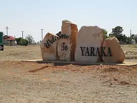 Welcome to Yaraka sign | |
 Yaraka | |
| Coordinates | 24.8819°S 144.0780°E |
| Postcode(s) | 4731 |
| Elevation | 210 m (689 ft) |
| Time zone | AEST (UTC+10:00) |
| Location |
|
| LGA(s) | Longreach Region |
| State electorate(s) | Gregory |
| Federal Division(s) | Maranoa |
Geography
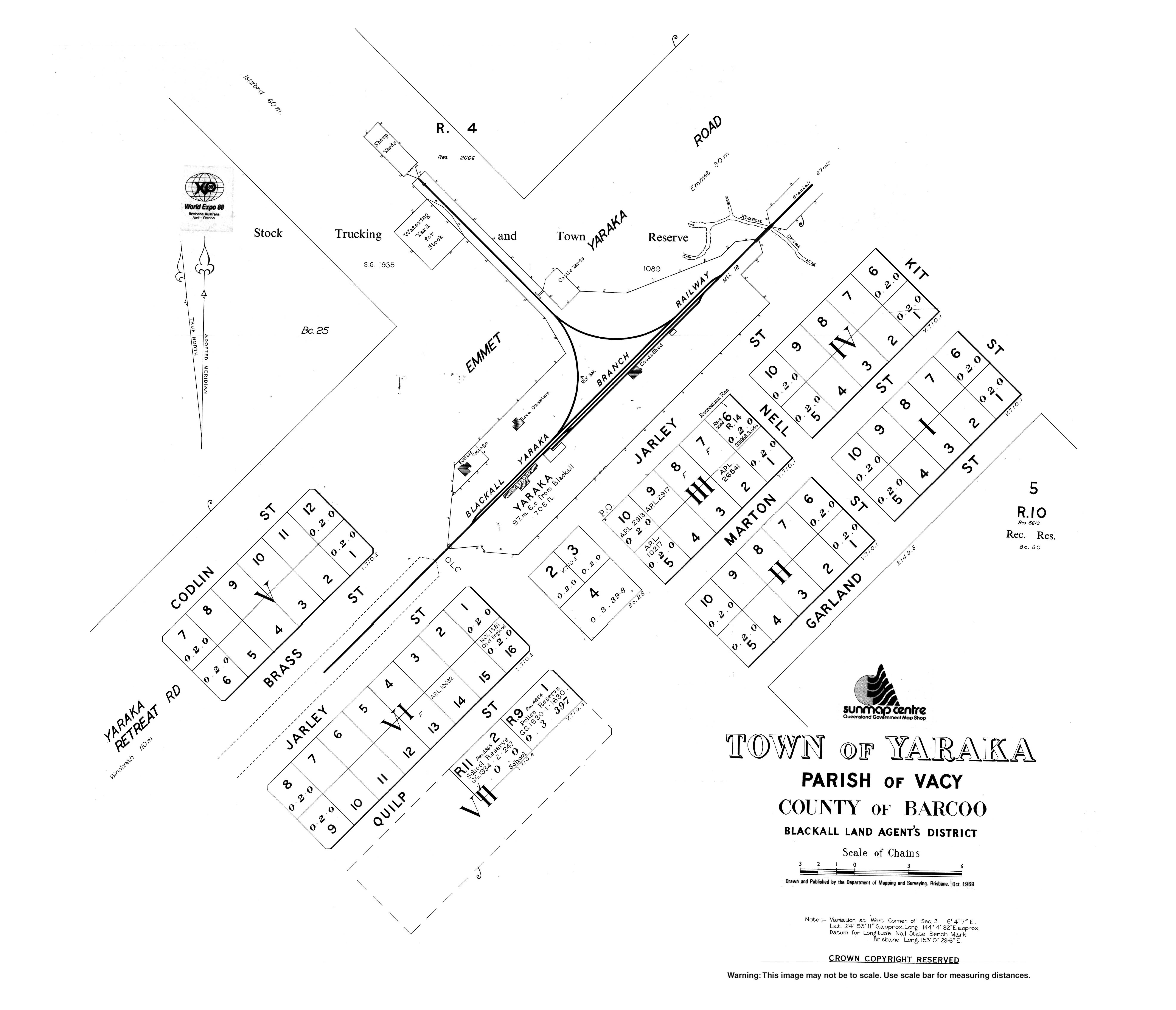
Yaraka is in Central West Queensland, Australia. It was the terminus of a Yaraka branch railway line. It is located 220 kilometres (140 mi) south of Longreach, 165 kilometres (103 mi) west of Blackall and 100 kilometres (62 mi) south of the town of Isisford.
The landscape is open Mitchell grass downs country, which provides good grazing country. Grey Range is located near Yaraka and is characterised by rocky ridges, spinifex grass and mulga.
History
The first European to pass through the area was Edmund Kennedy in 1847. In 1860, graziers began to populate the area and farm sheep and cattle. In 1910, the Queensland Government authorised the building of the 2,060-kilometre (1,280 mi) railway line in Western Queensland to support the pastoral industry. However, only a quarter of the line was built and Yaraka became the end of the Yaraka branch railway line.
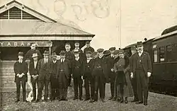
Yaraka became a town when the Yaraka branch railway line from Emmet opened in April 1917.[2] The station was called Yaraka by the Queensland Railway Department who said it was the Aboriginal name meaning "of white spear grass which grows in the district"[3] or referring to button grass Eleusine aegyptica.[1]
Yaraka State School opened on 5 March 1920.[4] It closed in 2009.[5]
The town prospered for the next twenty years and in the 1930s had a population of about 100.[6] In 1932 a journalist toured this area and described the town in the following terms.
"Yaraka: This little place is the end of the line, and enjoys the privilege of seeing one train a week. It is situated well down the Barcoo, about one hundred miles from where the rivers meet, and becomes Cooper's Creek.
No doubt people who live and work in isolated places such as this are entitled to more consideration than they receive. They certainly have courage and endurance above the average."[7]
On Saturday 19 March 1932 a strong gale of wind during a storm blew the Church of England off its blocks and three houses lost their roof.[8]
In the 1950s Yaraka railway station became a major centre for the transportation of cattle. In November 1953 over 5,442 cattle were handled which was the largest number since the line opened in 1917. It was noted that this was unusual in these country yards and that Yaraka was unsurpassed in this respect.[9]
The line was officially closed on 14 October 2005 and has been dismantled.[10] These days however Yaraka has become known as one of Queensland's 'vanishing towns' and its population is declining. In 2009, the school closed due to low student numbers. In 2014, the school building was gifted to the local community. In 2016 the community reopened the school with the children enrolled at Longreach School of Distance Education but locally assisted by a governess employed by the families.[5]
Tourist attractions
Mount Slocombe Lookout (24.8427°S 144.0580°E) is off the Emmet Yaraka Road has been described as "an ideal place to enjoy the stunning outback sunset or the glorious colours of a sunrise".[11] The view takes in the Yanyang Range (24.9092°S 144.0997°E),[12] Mount Brookes at 379 metres (1,243 ft) above sea level (24.8036°S 144.0781°E)[13] and Fort Douglas at 321 metres (1,053 ft) above sea level (24.8975°S 143.9989°E),[14] all with ever changing colours, shadows and shades. There is a sealed road and electric barbeque and picnic area at the summit. Nearby waterholes offer an abundance of bird and wildlife.[15]
Magee’s Shanty is the historic site of the shanty immortalised in Banjo Paterson's poem "A Bush Christening", There is also the ruins of the Cobb & Co pub and the lonely grave of goldminer Richard Magoffin who perished in 1885.[16]
Yaraka Opal Field encompasses the mines within and west of the Macedon Range including Harlequin and Mount Tighe. It is known for top patterns and various types of opal in as many as eight levels. Mines include Spur, Polykettle, Cockatoo and Pretty Gully.[17]
There are two national parks near Yaraka. Welford National Park is notable for golden-green spinifex, white-barked ghost gums and red sand dunes.[18] A highlight of Idalia National Park are the dense Mulga woodlands and views.[19]
Other activities include exploring, fishing, tennis and golf.[15]
Facilities
There is a hotel providing accommodation.
Occasional services are held at the Anglican church in Quilp Street (24.8851°S 144.0757°E).[20]
Other amenities operated by the Longreach Regional Council include a community hall, showgrounds, swimming pool, tennis courts and camping facilities.[21]
There are free caravan sites with water and electricity near the Yaraka Community Hall.[22]
Climate
Summer Average (day) Min temp=35.8⁰, Max temp=37.1⁰ Summer Average (night) Min temp=21.9⁰, Max temp=22.9⁰
Winter Average (day) Min temp=22.5⁰, Max Temp=25.1⁰ Winter Average (night) Min temp=6.5⁰, Max Temp=7.9⁰
Average annual rainfall 451mm
Education
There are no schools in Yaraka nor nearby. The nearest primary school is Isisford State School in Isisford, 102 kilometres (63 mi) to the north. The nearest secondary school is Blackall State School in Blackall, 162 kilometres (101 mi) to the north-east.[23] Distance education and boarding schools are the alternatives. The former Yaraka State School building a 11 Quilp Street (24.8860°S 144.0754°E) is available for children undertaking distance education to study together with the assistance of a governess.[5]
References
- "Yaraka – town in Longreach Region (entry 38459)". Queensland Place Names. Queensland Government. Retrieved 18 September 2020.
- The Western Champion and General Advertiser for the Central – Western Districts, 14 April 1917, p. 7. Online reference
- The Queenslander, 7 October 1916, p. 33. Online reference
- Queensland Family History Society (2010), Queensland schools past and present (Version 1.01 ed.), Queensland Family History Society, ISBN 978-1-921171-26-0
- Moore, Blythe (22 January 2016). "Yaraka students back in the classroom". ABC News. Retrieved 29 February 2020.
- Queensland Museum, 2003 "Discovery guide to outback Queensland", p. 174.
- Worker (Brisbane), 4 May 1932, p. 17. Online reference
- "DISTRICT RAINFALLS". The Evening News (3282). Queensland, Australia. 21 March 1932. p. 8. Retrieved 16 October 2020 – via National Library of Australia.
- The Longreach Leader, 18 December 1953, p. 10. Online reference
- "Jericho Blackall Yaraka branch closing". Railpage. Retrieved 20 August 2013.
- Queensland Tourism website. Online reference
- "Yanyang Range – range in the Longreach Region (entry 38448)". Queensland Place Names. Queensland Government. Retrieved 8 January 2021.
- "Mount Brookes – mountain in the Longreach Region (entry 4674)". Queensland Place Names. Queensland Government. Retrieved 16 October 2020.
- "Fort Douglas – mountain in the Shire of Barcoo (entry 12928)". Queensland Place Names. Queensland Government. Retrieved 16 October 2020.
- Yaraka: On the outer Barcoo website. Online reference
- Barcoo Shire Council website Magee’s Shanty. Online reference
- Opals Information webpage. Online reference
- Welford National Park website. Online reference
- Idalia National Park website. Online reference
- "Parish of Barcoo". Anglican Church of Central Queensland. Retrieved 16 October 2020.
- "Council to close most remaining public facilities amid national shutdown". Longreach Regional Council. Retrieved 16 October 2020.
- Yaraka Town Caravan Park website. Online reference
- "Queensland Globe". State of Queensland. Retrieved 16 October 2020.
External links
| Wikimedia Commons has media related to Yaraka. |
