Yezupil
Yezupil (Ukrainian: Єзупіль, Polish: Jezupol) is an urban-type settlement in western Ukraine. It is located in Tysmenytsia Raion (district) of Ivano-Frankivsk Oblast (region), approximately 14 km north of the oblast capital, Ivano-Frankivsk. Population: 2,803 (2020 est.)[1]
Yezupil
Єзупіль | |
|---|---|
Town | |
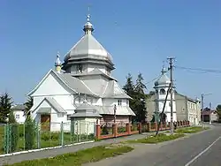 Yezupil main road | |
 Flag  Coat of arms | |
 Yezupil | |
| Coordinates: 49°02′N 24°47′E | |
| Country | Ukraine |
| Oblast | Ivano-Frankivsk |
| Founded | 1435 |
| urban-type settlement | 1940 |
| Government | |
| • Mayor | Hanna Kushnir |
| Area | |
| • Total | 28.220 km2 (10.896 sq mi) |
| Elevation | 260 m (850 ft) |
| Population (2020) | |
| • Total | 2,803 |
| • Density | 99/km2 (260/sq mi) |
| Postal code | 77411 |
| Area code(s) | +380 3436 |
| Website | Ukrainian Parliament website |
Yezupil was previously referred to as part of the Halych Powiat (county). It is also a part of the historic region of Pokuttya in Galicia.
At the turn of the century, town Jezupol (former Zhovten) was a fair size town (with its own Jewish Kahil and Roman Catholic Church and Greek Catholic Church) in Galicia/Halychyna in Austro-Hungarian Empire.
It is approximately 7 km from Halych, the former capital of the Principality of Halych Volhynia in the 10/12th centuries. In 1352 – 1772 it was a part of Ruthenia Voivodeship in the Kingdom of Poland. First written in 1435. Up until the 16th century it was a village named Tzaishibesi, which had a wooden fortress. When the fort was destroyed during one of the Tatar incursions, Jakub Potocki, the voivode of Wroclaw and private owner of the town, renamed it Jesupol, after Jesus in 1597. In 1598, a fortress and Dominican monastery was erected, and the town developed next to it. The monastery had a rich and famous library of ancient scriptures and prints.
Upon the partition of the Polish–Lithuanian Commonwealth in 1772 the Kingdom of Galicia and Lodomeria, or simply Galicia, became the largest, most populous, and northernmost province of the Austrian Empire, where it remained until the dissolution of Austria-Hungary at the end of World War I.
In the prelude to the Second World War, the Molotov-Ribbentrop pact divided Poland roughly along the Curzon line. Thus, all territory east of the San, Bug and Neman rivers were annexed into the USSR, approximating the former territory of East Galicia. This territory was divided into four administrative districts (oblasts): Lvov, Stanislav, Drohobych and Tarnopol (the latter including parts of Volhynia) of the Ukrainian Soviet Socialist Republic. Since September 17, 1939, it was a part of the USSR. Since June 22, 1941, the Soviet regime discontinued when Germany had occupied East Galicia during Operation Barbarossa.
In 1945, the town became a part of the Ukrainian SSR as part of the Soviet Union; since 1991, the town has been a part of Ukraine. The first Jezupil (Jesupol) named town was renamed to Zhovten (Ukrainian: Жовтень); it received the status of an urban-type settlement in 1940. On July 9, 2003, the town was officially renamed again to Jezupil.
References
- "Чисельність наявного населення України (Actual population of Ukraine)" (PDF) (in Ukrainian). State Statistics Service of Ukraine. Retrieved September 30, 2020.
External links
| Wikimedia Commons has media related to Yezupil. |
- wikimapia
- Photographs of Jewish sites in Yezupil in Jewish History in Galicia and Bukovina
- Yezupil's Music School, Yezupil's Music School
Places adjacent to Yezupil | ||||||||||
|---|---|---|---|---|---|---|---|---|---|---|
| ||||||||||
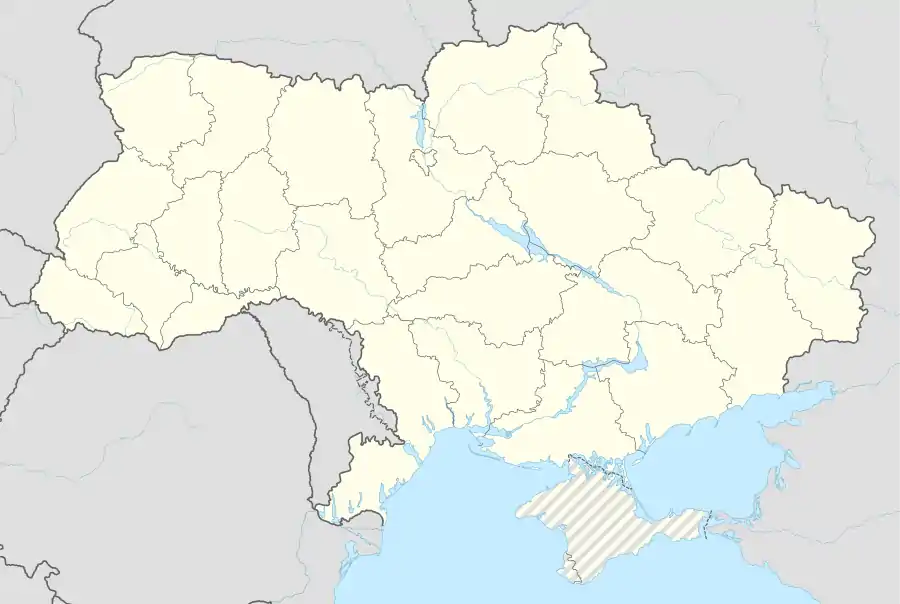
| Cities | Coat of arms of Tysmenytsia Raion | |
|---|---|---|
| Settlements | ||