Youngsville, Louisiana
Youngsville is a city in Lafayette Parish, Louisiana, United States, and is part of the Lafayette Metropolitan Statistical Area. The population was 8,105 as of the 2010 census[3] and an estimated 14,077 in 2018.[4]
Youngsville, Louisiana | |
|---|---|
City | |
| City of Youngsville | |
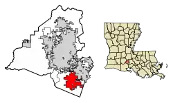 Location in Lafayette Parish, Louisiana | |
.svg.png.webp) Location of Louisiana in the United States | |
| Coordinates: 30°06′02″N 91°59′27″W | |
| Country | United States |
| State | Louisiana |
| Parish | Lafayette |
| Government | |
| • Mayor | Ken Ritter |
| • Chief administrative officer | Simone B. Champagne |
| Area | |
| • Total | 12.07 sq mi (31.26 km2) |
| • Land | 12.07 sq mi (31.26 km2) |
| • Water | 0.00 sq mi (0.00 km2) |
| Elevation | 26 ft (8 m) |
| Population (2010) | |
| • Total | 8,105 |
| • Estimate (2019)[2] | 14,704 |
| • Density | 1,218.33/sq mi (470.40/km2) |
| Time zone | UTC-6 (CST) |
| • Summer (DST) | UTC-5 (CDT) |
| Area code(s) | 337 |
| FIPS code | 22-83335 |
| Website | www |
Youngsville was the birthplace of the colorful Louisiana businessman and politician Dudley J. LeBlanc, the entrepreneur of the Hadacol fortune of the 1950s.
Bernard LeBas of Ville Platte has represented Evangeline and St. Landry parishes in the Louisiana House of Representatives since 2008. He is a former resident of Youngsville.[5][6]
Geography
Youngsville is located in southeastern Lafayette Parish at 30°6′2″N 91°59′27″W (30.100595, -91.990707).[7] It is bordered to the north by Lafayette, the parish seat, and to the east by the city of Broussard.
The center of Lafayette is 10 miles (16 km) to the north, Abbeville is 16 miles (26 km) to the southwest, and New Iberia is 16 miles to the southeast.
According to the United States Census Bureau, Youngsville has a total land area of 12.07 square miles (31.26 km2), all of it recorded as land.[8]
History
Youngsville today still reflects its history in its people, culture, traditions, and architecture. It was settled in the early 19th century by French Acadian farmers. Prior to 1839, George Roy and his son, Desire, laid out the area and named the community "Royville". The settlement had grown large enough by 1859 to establish one of the oldest Catholic churches in Lafayette Parish: St. Anne Church, on the community's oldest street, Church Street. In 1908, the U.S. Postal Service asked village leaders to change the name because the town was being confused with the north Louisiana town of Rayville. So in 1908, the village of Youngsville was incorporated, with the name meaning "young village". It chose a government of a mayor and three aldermen.
On January 20, 1983, Louisiana Governor David C. Treen declared Youngsville a town. The town increased its governing body to a mayor and five aldermen to accommodate its population.
Youngsville has been the fastest growing town in Louisiana from 1990 to 2005. Its population has increased by over 300 percent. According to the 2010 Census, Youngsville grew at a rate of 103% between year 2000 and 2010. Youngsville was declared a city by Governor Kathleen Blanco in 2006.[9] In 2007, Mayor Wilson Viator and the Youngsville City Council named Joey Langlinais as the Chairman of the Centennial Committee.[10]
Although the city has extended its boundaries and expanded its services, Youngsville has remained a rural city surrounded by sugarcane farms.[11]
Louisiana flood of 2016
On the morning of August 12, 2016, rain began to fall over Youngsville, as well as much of the south central part of the state, in what is now being considered to be the state's worst flood disaster by rainfall on record, in some areas.
The Louisiana Flood of 2016 was triggered by a complicated, slow-moving low-pressure weather system that dumped as much as two feet of rain on several parishes in 48 hours. The record two-day rainfall in some areas had a 0.1 percent chance of occurring in any year, the equivalent of a "1,000-year rain", according to the Lower Mississippi River Forecast Center, based at the Slidell office of the National Weather Service.
In the two-day period ending Saturday at 8 p.m., several areas also saw rainfall amounts equaling a 1 percent chance of occurring in any year, a so-called 100-year event.
The Red Cross called this "the worst natural disaster since Hurricane Sandy".
Schools
Public schools
Youngsville is part of the Lafayette Parish School System.
The public elementary schools in Youngsville are Green T. Lindon Elementary School[12] (located in downtown Youngsville) and Ernest Gallet Elementary School[13] (located on Highway 92 between Chemin Metairie Parkway and Bonin Road). The Youngsville Middle School[14] hosts students in sixth through eighth grades and is located at the corner of School Street and Church Street in downtown Youngsville. All public school students from Youngsville attend Southside High in Youngsville or attend Ovey Comeaux High School in southern Lafayette.
Private schools
Private schools in the city include Westminster Christian Academy,[15] located on the outskirts of Youngsville, and Youngsville Christian School, offering Kindergarten thru 12th grade in downtown Youngsville.[16] Ascension Episcopal School,[17] a private high school, is located near the Youngsville Sports Complex on Chemin Metaire Parkway across from Sugar Mill Pond.
Development
Subdivisions
The sugarcane and soybean fields that once surrounded the town of Youngsville are becoming more difficult to find. Development began in the 1990s with the original Copperfield subdivision along Highway 89 near Fortune Road. The success of this subdivision led to continuous development throughout the following decades. The Copperfield subdivisions (Copperfield, Copperfield South, Copper Ridge, and Copper Meadows) have grown until the subdivisions abutted the original, old town of Youngsville along Iberia Street, also known as Highway 92.
Many other subdivisions were also built in the former farmlands of Youngsville, including Field Crest, Oakthorn, and Sugar Mill Pond.
The creators of the River Ranch development in Lafayette have started a new mixed use planned community in Youngsville. Called Sugar Mill Pond, it is home to over 2,000 housing units, a school, and town center with commercial establishments.
Infrastructure
The city of Youngsville began construction of the Chemin Metairie Parkway Project in the spring of 2007 to improve the roads in and around Youngsville. The first segment, from the intersection of Highway 92 and Chemin Metairie, to central Youngsville, opened in early 2009. Originally called the Youngsville Parkway, the road was renamed to avoid confusion with the existing Youngsville Highway also known as Highway 89. Chemin Metairie Parkway joins Highway 90 near the Baker Hughes Complex in Broussard. A section of the parkway passes through the Sugar Mill Pond development and a new shopping complex anchored by Lafayette Parish's first Rouse's Grocery Store.
In recent years, Youngsville has become known for its roundabouts. It was the first community within Lafayette Parish to embrace the usage of traffic circles to ease the congestion of the city's rising population. Youngsville now boasts at least 10 roundabouts at the following intersections:[18]
- Highway 92 and Verot School Road
- Highway 92 and Chemin Metairie Parkway
- Highway 92 and Bonin Road
- Highway 92 and Highway 89
- Highway 89 and Chemin Metairie Parkway
- Fortune Road and Bonin Road
- Copper Meadow Boulevard and Fountain View Drive
- Prescott Boulevard and Broyles Lane
- Desbrook Lane and Annaberg Drive
- Viaulet Road and Chemin Metairie Parkway
The citizens of Youngsville voted in favor of a multi million-dollar, 70-acre sports complex along Chemin Metairie Parkway near Savoy Road. Construction to this complex began in 2012 and now has over 500,000 players and visitors coming to this state of the art facility. www.YoungsvilleSportsComplex.com.[19]
Demographics
| Historical population | |||
|---|---|---|---|
| Census | Pop. | %± | |
| 1900 | 200 | — | |
| 1910 | 328 | 64.0% | |
| 1920 | 361 | 10.1% | |
| 1930 | 536 | 48.5% | |
| 1940 | 647 | 20.7% | |
| 1950 | 769 | 18.9% | |
| 1960 | 946 | 23.0% | |
| 1970 | 1,002 | 5.9% | |
| 1980 | 1,053 | 5.1% | |
| 1990 | 1,195 | 13.5% | |
| 2000 | 3,992 | 234.1% | |
| 2010 | 8,105 | 103.0% | |
| 2019 (est.) | 14,704 | [2] | 81.4% |
| U.S. Decennial Census[20] | |||
As of the census[21] of 2010, there were 8,105 people and 2,769 households residing in the town. The population density was 740 people per square mile (230.7/km2). There were 3,043 housing units at an average density of 225.5 per square mile (87.1/km2). The racial makeup of the town was 89.80% White, 6.8% African American, 0.4% Native American, 1.1% Asian, 0.25% Pacific Islander, 0.50% from other races, and 1.1% from two or more races. Hispanic or Latino of any race were 2.9% of the population.
There were 2,769 households, out of which 47.8% had children under the age of 18 living with them, 63.4% were married couples living together, 11.0% had a female householder with no husband present, and 21.4% were non-families. 16.5% of all households were made up of individuals, and 4.3% had someone living alone who was 65 years of age or older. The average household size was 2.92 and the average family size was 3.24.
In the town the population was spread out, with 32.1% under the age of 18, 7.7% from 18 to 24, 37.3% from 25 to 44, 16.6% from 45 to 64, and 6.2% who were 65 years of age or older. The median age was 32 years. For every 100 females, there were 102.1 males. For every 100 females age 18 and over, there were 96.6 males.
The median income for a household in the town was $67,147. Males had a median income of $41,700 versus $30,710 for females. The per capita income for the town was $31,257. About 4.5% of the population were below the poverty line.
Youngsville has the highest per capita income ($31,257) in Lafayette Parish. Compare that to the Parish's largest city Lafayette ($27,532) or the Parish as a whole ($26,791). However, it is lower than the per capita income of Oak Hills Place, which at $65,938 is significantly higher. Ruston, at $34,329 per capita, is also higher.[22]
References
- "2019 U.S. Gazetteer Files". United States Census Bureau. Retrieved July 25, 2020.
- "Population and Housing Unit Estimates". United States Census Bureau. May 24, 2020. Retrieved May 27, 2020.
- "Total Population: 2010 Census DEC Summary File 1 (P1), Youngsville city, Louisiana". data.census.gov. U.S. Census Bureau. Retrieved February 18, 2020.
- "Population and Housing Unit Estimates". Retrieved August 25, 2019.
- "H. Bernard LeBas". house.louisiana.gov. Retrieved May 7, 2015.
- "Harvey Bernard LeBas". intelius.com. Retrieved May 7, 2015.
- "US Gazetteer files: 2010, 2000, and 1990". United States Census Bureau. 2011-02-12. Retrieved 2011-04-23.
- "U.S. Gazetteer Files: 2019: Places: Louisiana". U.S. Census Bureau Geography Division. Retrieved February 18, 2020.
- "Boundary Changes". Geographic Change Notes: Louisiana. Population Division, United States Census Bureau. 2006-05-19. Retrieved 2008-10-24.
- http://www.myspace.com/youngsvillehistory
- http://www.lpssonline.com/site228.php
- http://www.lpssonline.com/site226.php
- http://www.lpssonline.com/site253.php
- http://www.wcala.org/
- http://www.youngsvillecs.com/#!curriculum/c1pna
- http://aesgators.org/
- https://maps.google.com/maps?q=Youngsville,+Lafayette,+Louisiana&hl=en&sll=30.087031,-91.99183&sspn=0.020683,0.038581&hnear=Youngsville,+Lafayette,+Louisiana&t=m&z=13
- http://www.youngsville.us/business
- "Census of Population and Housing". Census.gov. Retrieved June 4, 2015.
- "U.S. Census website". United States Census Bureau. Retrieved 2008-01-31.
- http://www.youngsville.us/PageDisplay.asp?p1=4098
External links
Municipalities and communities of Lafayette Parish, Louisiana, United States | ||
|---|---|---|
| Cities | 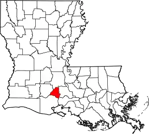 | |
| Town | ||
| CDPs | ||
| Other unincorporated communities | ||
| Footnotes | ‡This populated place also has portions in an adjacent parish or parishes | |
| ||
| Authority control |
|---|
- "Youngsville Chamber of Commerce | Shop Youngsville First!". Youngsville Chamber of Commerce. Retrieved 2019-06-09.