Zeithain
Zeithain is a municipality in the district of Meißen, in Saxony, Germany.
Zeithain | |
|---|---|
 Coat of arms | |
Location of Zeithain within Meißen district 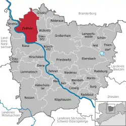 | |
 Zeithain 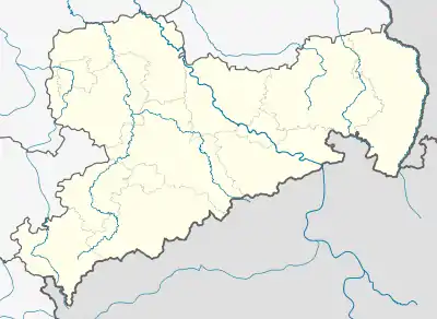 Zeithain | |
| Coordinates: 51°20′N 13°21′E | |
| Country | Germany |
| State | Saxony |
| District | Meißen |
| Subdivisions | 11 |
| Government | |
| • Mayor | Hannes Berger |
| Area | |
| • Total | 81.49 km2 (31.46 sq mi) |
| Elevation | 98 m (322 ft) |
| Population (2019-12-31)[1] | |
| • Total | 5,582 |
| • Density | 68/km2 (180/sq mi) |
| Time zone | UTC+01:00 (CET) |
| • Summer (DST) | UTC+02:00 (CEST) |
| Postal codes | 01619 |
| Dialling codes | 03525 |
| Vehicle registration | MEI, GRH, RG, RIE |
| Website | www.zeithain.de |
Historically, it is known for the Zeithain Encampment (Zeithainer Zeltlager or Zeithainer Lustlager), which was a huge agglomeration of tents and troops, involving the whole 27,000-men-strong army of August the Strong. This event took place from 1 to 26 June 1730.[2]
During World War II a large prisoner-of-war camp, Stalag IV-B/H, was located in Zeithain. A memorial and museum commemorate it.[3]
Municipality subdivisions
Zeithain includes the following subdivisions:
- Cottewitz
- Gohlis
- Jacobsthal
- Kreinitz
- Lorenzkirch
- Moritz
- Neudorf
- Promnitz
- Röderau-Bobersen
- Zschepa
Mayor
In June 2012 Ralf Hänsel was elected mayor.
Gallery
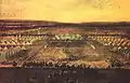 Zeithain Encampment in 1730
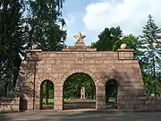 Memorial Ehrenhain, Zeithain
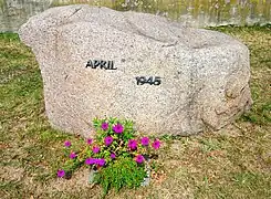 Memorial stone April 1945 in Lorenzkirch
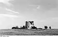 Ruin of the Holländermühle in Lorenzkirch, Zeithain
Twin towns
 Teningen, Germany
References
- "Bevölkerung des Freistaates Sachsen nach Gemeinden am 31. Dezember 2019". Statistisches Landesamt des Freistaates Sachsen (in German). July 2020.
- Holger Schuckelt: The Turkish Chamber: Oriental Splendour in the Dresden Armoury, Munich: Deutscher Kunstverlag, 2010, ISBN 978-3-422-06914-5, p. 112
- Memorial and History of Zeithain camp
Towns and municipalities in Meissen (district) | ||
|---|---|---|
Coat of arms | ||
| Authority control |
|---|
This article is issued from Wikipedia. The text is licensed under Creative Commons - Attribution - Sharealike. Additional terms may apply for the media files.
