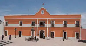
Zempoala, Hidalgo
Zempoala is a town and one of the 84 municipalities of Hidalgo, in central-eastern Mexico. The municipality covers an area of 305.8 km².
Zempoala | |
|---|---|
Municipality and town | |
 | |
Zempoala Location in Mexico | |
| Coordinates: 19°55′N 98°40′W | |
| Country | |
| State | Hidalgo |
| Municipal seat | Zempoala |
| Area | |
| • Total | 305.8 km2 (118.1 sq mi) |
| Population (2005) | |
| • Total | 27,333 |
As of 2005, the municipality had a total population of 27,333.[1]
Climate
| Climate data for Zempoala | |||||||||||||
|---|---|---|---|---|---|---|---|---|---|---|---|---|---|
| Month | Jan | Feb | Mar | Apr | May | Jun | Jul | Aug | Sep | Oct | Nov | Dec | Year |
| Average high °C (°F) | 19.4 (66.9) |
20.8 (69.4) |
24.1 (75.4) |
26.0 (78.8) |
26.2 (79.2) |
24.5 (76.1) |
23.4 (74.1) |
23.2 (73.8) |
23 (73) |
22.0 (71.6) |
20.7 (69.3) |
19.3 (66.7) |
22.7 (72.9) |
| Average low °C (°F) | 2 (36) |
3.1 (37.6) |
4.7 (40.5) |
6.3 (43.3) |
7.3 (45.1) |
7.6 (45.7) |
7.7 (45.9) |
7.4 (45.3) |
7 (45) |
6.0 (42.8) |
4.2 (39.6) |
3.1 (37.6) |
5.6 (42.1) |
| Average precipitation mm (inches) | 13 (0.5) |
10 (0.4) |
20 (0.8) |
41 (1.6) |
58 (2.3) |
86 (3.4) |
97 (3.8) |
84 (3.3) |
64 (2.5) |
30 (1.2) |
15 (0.6) |
5.1 (0.2) |
520 (20.6) |
| Source: Weatherbase [2] | |||||||||||||
References
- "Zempoala". Enciclopedia de los Municipios de México. Instituto Nacional para el Federalismo y el Desarrollo Municipal. Retrieved December 27, 2008.
- "Weatherbase: Historical Weather for Zempoala, Hidalgo". Weatherbase. 2011. Retrieved on November 24, 2011.

This article is issued from Wikipedia. The text is licensed under Creative Commons - Attribution - Sharealike. Additional terms may apply for the media files.