Zhifu District
Zhifu District is an urban district of the prefecture-level city of Yantai in Shandong Province, China.
Zhifu District
芝罘区 Chefoo | |
|---|---|
 | |
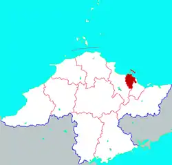 Location in Yantai | |
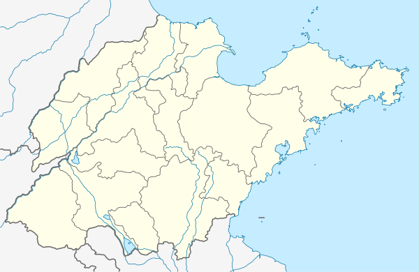 Zhifu Location in Shandong | |
| Coordinates: 37.541°N 121.400°E | |
| Country | People's Republic of China |
| Province | Shandong |
| Prefecture-level city | Yantai |
| Area | |
| • Total | 179.2 km2 (69.2 sq mi) |
| Population (2017) | |
| • Total | 701,000 |
| • Density | 3,900/km2 (10,000/sq mi) |
| Time zone | UTC+8 (China Standard) |
| Postal code | 264001 |
| Website | www |
| Zhifu District | |||||||||||||
|---|---|---|---|---|---|---|---|---|---|---|---|---|---|
| Traditional Chinese | 芝罘區 | ||||||||||||
| Simplified Chinese | 芝罘区 | ||||||||||||
| |||||||||||||
Name
As a separate city, Zhifu's name was variously romanized as Chefoo,[1] Che-foo,[2] Chi-fu,[3] and Chih-fou. Although this name was used for the city by foreigners prior to the Communist victory in the Chinese Civil War, the locals referred to the settlement as Yantai (q.v.) throughout.[2][3]
History
Formerly a small unwalled fishing village, Zhifu grew when its harbor was chosen to act as the international port for the larger city of Tengchow (now Penglai) nearby. It now forms part of the urban core of Yantai.
Administrative divisions
As 2012, this district is divided to 12 subdistricts.[4]
- Subdistricts
|
|
Education
Chefoo School previously educated foreign children.
References
Citations
- Postal Map Romanization.
- EB (1878).
- EB (1911), p. 132.
- 烟台市-行政区划网 www.xzqh.org (in Chinese). XZQH. Retrieved 2012-05-24.
Bibliography
- , Encyclopædia Britannica, 9th ed., Vol. V, New York: Charles Scribner's Sons, 1878, p. 455.
- , Encyclopædia Britannica, 11th ed., Vol. VI, Cambridge: Cambridge University Press, 1911, pp. 132–3.
This article is issued from Wikipedia. The text is licensed under Creative Commons - Attribution - Sharealike. Additional terms may apply for the media files.