Zittlestown, Maryland
Zittlestown is an unincorporated community 2.2 miles (3.5 km) southeast of Boonsboro in Washington County, Maryland. It is situated on the western slope of South Mountain below Turner's Gap, along the historic National Pike, now designated U.S. Route 40 Alternate. Zittlestown is named after Michael Zittle, Sr. (1769-1850), who in 1811 purchased tracts of land there, and subdivided them.[2]
Zittlestown, Maryland | |
|---|---|
 | |
| Coordinates: 39°29′07″N 77°37′26″W | |
| Country | United States |
| State | Maryland |
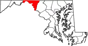
| County | Washington |
| Elevation | 997 ft (304 m) |
| Time zone | UTC−5 (Eastern (EST)) |
| • Summer (DST) | UTC−4 (EDT) |
| Area code(s) | 301 & 240 |
| GNIS feature ID | 591623[1] |
In the American Civil War, the Battle of South Mountain on 14 September 1862 was fought around Zittlestown.
References
- "Zittlestown". Geographic Names Information System. United States Geological Survey.
- Elizabeth Jayne Blair and Leona Miller Hart, The Descendants of Michael Zittle, Sr. (Anchorage, Alaska: n.p., 1995), p. 3.
This article is issued from Wikipedia. The text is licensed under Creative Commons - Attribution - Sharealike. Additional terms may apply for the media files.