Østre Toten
Østre Toten is a municipality in Innlandet (formerly Oppland) [3] county, Norway. It is part of the traditional region of Toten. The administrative centre of the municipality is the village of Lena.
Østre Toten kommune | |
|---|---|
 | |
 Coat of arms  Innlandet within Norway | |
 Østre Toten within Innlandet | |
| Coordinates: 60°36′48″N 10°54′58″E | |
| Country | Norway |
| County | Innlandet |
| District | Toten |
| Administrative centre | Lena |
| Government | |
| • Mayor (2015) | Guri Bråthen (Ap) |
| Area | |
| • Total | 562 km2 (217 sq mi) |
| • Land | 486 km2 (188 sq mi) |
| Area rank | 189 in Norway |
| Population (2004) | |
| • Total | 14,657 |
| • Rank | 64 in Norway |
| • Density | 30/km2 (80/sq mi) |
| • Change (10 years) | 3.3% |
| Demonym(s) | Østretotning[1] |
| Time zone | UTC+01:00 (CET) |
| • Summer (DST) | UTC+02:00 (CEST) |
| ISO 3166 code | NO-3442 |
| Official language form | Bokmål[2] |
| Website | www |
General information
Etymology
The Old Norse form of the name was Þótn and is assumed to be related to the noun þóttr, which means approximately "something enjoyable".[4]
Coat of arms
The coat of arms were granted on 27 March 1987. The arms show a yellow-colored potato plant on a green background. The green color symbolizes the importance of agriculture, and the potato in particular, for the municipality.[5]
| Ancestry | Number |
|---|---|
| 375 | |
| 194 | |
| 76 | |
| 62 | |
| 47 | |
| 46 | |
| 46 | |
| 44 | |
| 42 | |
| 36 |
History
According to the sagas, Halfdan Hvitbeinn (Whiteleg) was the first Yngling in Norway. He conquered Romerike, part of Hedmark, part of Vestfold, and Toten. He was killed in Toten around the year 740.[7]
In 1021, according to saga, King Olaf (reigned 1015–1028) converted Toten to Christianity. Also, King Håkon IV (reigned 1217–1263) came to Toten around the year 1226 to settle local unrest.[7]
Christian II (1481–1559) was a Danish monarch and King of Denmark, Norway (1513–1523), and Sweden (1520–1521), under the Kalmar Union. Prior to becoming king, Duke Christian was sent to Norway in 1506 by John II (also called Hans), King of Norway (1483–1513) to take charge of the kingdom. In 1507, he became aware of a revolt in Hedmark. In early 1508, he took a force there, routing the rebellion. He then rowed across lake Mjøsa to Toten, capturing residents, imprisoning them in the vaulted cellar of the rectory in Østre Toten and torturing them there. As a result, he determined that Bishop Karl of Hamar had been behind the rebellion. With Bishop Karl as his captive, he was able to suppress the unrest.[7]
Toten was a part of Akershus county until 1756, when it was reassigned to Oppland county. Lauritz Weideman, Corporal Peder Balke, and Nels Dyhren from Toten attended the 1814 constitutional convention at Eidsvold.[7]
The municipality of Østre Toten was established on 1 January 1838 (see formannskapsdistrikt). The former municipality of Kolbu was merged with Østre Toten on 1 January 1964.
Attractions
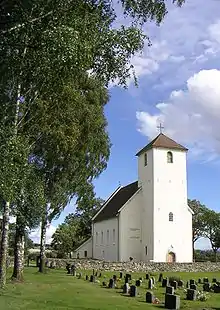
Among the town's most notable landmarks are the Hoff stone church and the rock carvings at Glemmestad near Kapp, now displayed in the Toten Museum.
Geography
Østre Toten is bordered to the west by Vestre Toten, to the north by Gjøvik in Oppland county, as well as by Hurdal and Eidsvoll in neighboring Akershus county. The highest peak is Torsæterkampen with a height of 841 metres (2,759 ft).
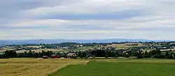
Settlement in Østre Toten is predominantly dispersed. Per January 2015, 42.6% of the population lived in areas defined as urban settlements by Statistics Norway,[8] compared to 81% for Norway as a whole.[9] The urban settlements in Østre Toten are Kapp, Kolbu, Lena, Lensbygda, Nordlia, Skreia and Sletta.
Climate
Østre Toten has a subarctic climate (Dfc). It is very close to a continental climate as September averages 9.7 and May averages 9.0. Summer is the wettest time of year and winters are cold and snowy.
| Climate data for Østre Toten-Apelsvoll 1961-1990, extremes 1968-2015 | |||||||||||||
|---|---|---|---|---|---|---|---|---|---|---|---|---|---|
| Month | Jan | Feb | Mar | Apr | May | Jun | Jul | Aug | Sep | Oct | Nov | Dec | Year |
| Record high °C (°F) | 10.4 (50.7) |
11.7 (53.1) |
19.0 (66.2) |
21.6 (70.9) |
27.6 (81.7) |
32.5 (90.5) |
31.6 (88.9) |
31.6 (88.9) |
26.0 (78.8) |
20.5 (68.9) |
15.9 (60.6) |
10.4 (50.7) |
32.5 (90.5) |
| Average high °C (°F) | −4.9 (23.2) |
−4.1 (24.6) |
1.5 (34.7) |
6.9 (44.4) |
14.3 (57.7) |
19.4 (66.9) |
20.2 (68.4) |
19.0 (66.2) |
13.7 (56.7) |
7.9 (46.2) |
1.3 (34.3) |
−2.5 (27.5) |
7.7 (45.9) |
| Average low °C (°F) | −11.1 (12.0) |
−11.2 (11.8) |
−6.3 (20.7) |
−1.1 (30.0) |
4.7 (40.5) |
9.0 (48.2) |
10.3 (50.5) |
9.3 (48.7) |
5.8 (42.4) |
2.2 (36.0) |
−3.6 (25.5) |
−8.3 (17.1) |
0.0 (32.0) |
| Record low °C (°F) | −33.9 (−29.0) |
−31.0 (−23.8) |
−27.0 (−16.6) |
−15.4 (4.3) |
−4.8 (23.4) |
−1.0 (30.2) |
2.1 (35.8) |
0.0 (32.0) |
−4.6 (23.7) |
−13.7 (7.3) |
−18.9 (−2.0) |
−29.3 (−20.7) |
−33.9 (−29.0) |
| Average precipitation mm (inches) | 37 (1.5) |
26 (1.0) |
29 (1.1) |
32 (1.3) |
44 (1.7) |
60 (2.4) |
77 (3.0) |
72 (2.8) |
66 (2.6) |
64 (2.5) |
53 (2.1) |
40 (1.6) |
600 (23.6) |
| Average precipitation days | 8.1 | 5.7 | 6.2 | 6.0 | 7.8 | 9.2 | 10.4 | 9.7 | 9.7 | 9.8 | 9.5 | 8.5 | 100.6 |
| Source: Met Norway Eklima | |||||||||||||
Economy
Østre Toten is one of the Oppland's most productive farming municipalities. Østre Toten is Norway's largest producers of potatoes and onions. This is reflected in the municipality's coat-of-arms, which displays a potato plant.
The Kims factory (which produces potato chips) is located at Skreia.
Notable residents
- May-Britt Anderssen, musician
- Peder Balke, artist
- Eduard Boeckmann, ophthalmologist and physician
- Halvdan Svarte Gudrødsson, Viking king, father of the first King of Norway Harald I and founder of the House of Yngling
- Roger Ruud, ski jumper
- Inger Lise Rypdal, musician
- Atle Ørbeck Sørheim, former director of the Norwegian State Food Authority from 1988 to 1998.[10]
- Margit Sandemo, author
- Eldar Vågan, musician
Sister cities
The following cities are twinned with Østre Toten:[11]
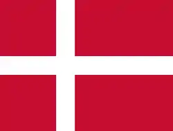 – Jammerbugt, Region Nordjylland, Denmark
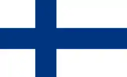 – Kesälahti, Itä-Suomi, Finland
 – Rättvik, Dalarna County, Sweden
References
- "Navn på steder og personer: Innbyggjarnamn" (in Norwegian). Språkrådet.
- "Forskrift om målvedtak i kommunar og fylkeskommunar" (in Norwegian). Lovdata.no.
- moderniseringsdepartementet, Kommunal- og (7 July 2017). "Regionreform". Regjeringen.no. Archived from the original on 23 March 2018. Retrieved 28 April 2018.
- "Toten". snl.no. Retrieved 22 June 2015.
- Norske Kommunevåpen (1990). "Nye kommunevåbener i Norden". Retrieved 1 January 2009.
- "Immigrants and Norwegian-born to immigrant parents". ssb.no. Archived from the original on 2 July 2015. Retrieved 14 July 2017.
- Stagg, Frank Noel (1956). East Norway and its Frontier. George Allen & Unwin, Ltd.
- "Population in densely and sparsely populated areas. Municipality. 1 January 2015". ssb.no. Retrieved 26 May 2016.
- "Stable growth in urban settlements". ssb.no. Retrieved 26 May 2016.
- Velle, Weiert, ed. (1998). Norges veterinærer 1998 (in Norwegian). Bærum: Weiert Velle. p. 343. ISBN 82-991687-2-4.
- "Vennskapskommuner" (in Norwegian). Østre Toten kommune. Retrieved 1 January 2009.
External links
| Wikimedia Commons has media related to Østre Toten. |
| Look up Østre Toten in Wiktionary, the free dictionary. |
- Municipal fact sheet from Statistics Norway
 Oppland travel guide from Wikivoyage
 |
|  | |||||||||||||||||||||||||||||||||||
||