Śrem County
Śrem County (Polish: powiat śremski) is a unit of territorial administration and local government (powiat) in Greater Poland Voivodeship, west-central Poland. It came into being on January 1, 1999, as a result of the Polish local government reforms passed in 1998. Its administrative seat and largest town is Śrem, which lies 36 kilometres (22 mi) south of the regional capital Poznań. The county also contains the towns of Książ Wielkopolski, lying 15 km (9 mi) east of Śrem, and Dolsk, 12 km (7 mi) south of Śrem.
Śrem County
Powiat śremski | |
|---|---|
 Flag  Coat of arms | |
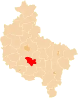 Location within the voivodeship | |
| Coordinates (Śrem): 52°5′N 17°1′E | |
| Country | |
| Voivodeship | Greater Poland |
| Seat | Śrem |
| Gminas | |
| Area | |
| • Total | 574.41 km2 (221.78 sq mi) |
| Population (2006) | |
| • Total | 58,646 |
| • Density | 100/km2 (260/sq mi) |
| • Urban | 34,430 |
| • Rural | 24,216 |
| Car plates | PSE |
| Website | http://www.powiat-srem.pl |
The county covers an area of 574.41 square kilometres (221.8 sq mi). As of 2006 its total population is 58,646, out of which the population of Śrem is 30,227, that of Książ Wielkopolski is 2,724, that of Dolsk is 1,479, and the rural population is 24,216.
Neighbouring counties
Śrem County is bordered by Poznań County to the north, Środa Wielkopolska County to the north-east, Jarocin County to the east, Gostyń County to the south and Kościan County to the west.
Administrative division
The county is subdivided into four gminas (three urban-rural and one rural). These are listed in the following table, in descending order of population.
| Gmina | Type | Area (km²) |
Population (2006) |
Seat |
|---|---|---|---|---|
| Gmina Śrem | urban-rural | 205.8 | 39,841 | Śrem |
| Gmina Książ Wielkopolski | urban-rural | 147.9 | 8,429 | Książ Wielkopolski |
| Gmina Dolsk | urban-rural | 124.8 | 5,732 | Dolsk |
| Gmina Brodnica | rural | 95.9 | 4,644 | Brodnica |
References
| Seat | | |
|---|---|---|
| Urban-rural gminas | ||
| Rural gmina | ||
| City counties |  | |
|---|---|---|
| Land counties | ||
