ʻEua
ʻEua is an island in the kingdom of Tonga. It is close to Tongatapu, but forms a separate administrative division. It has an area of 87.44 km2 (33.76 sq mi), and a population in 2016 of 4,945 people.
.jpg.webp) | |
| Geography | |
|---|---|
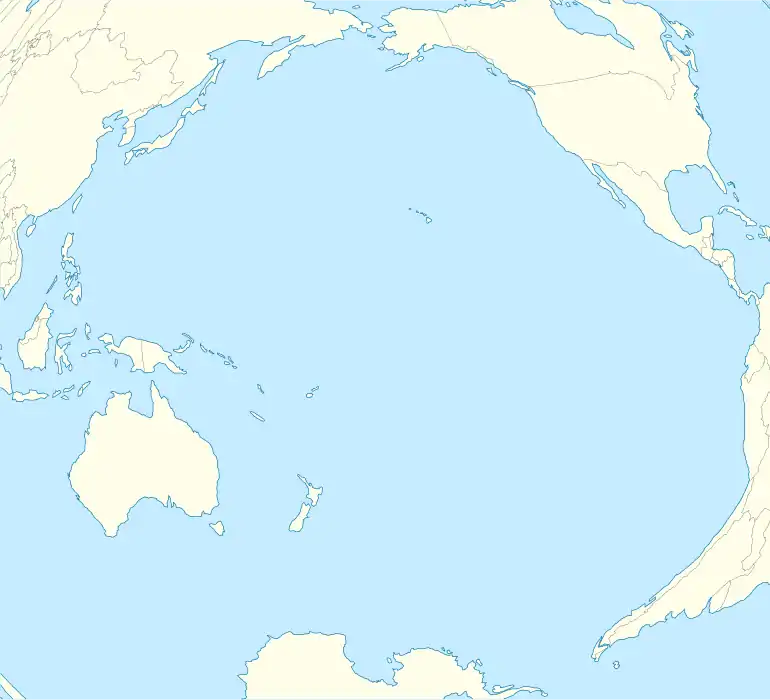
| Location | Pacific Ocean |
| Coordinates | 21°23′S 174°56′W |
| Archipelago | Tonga Tapu Islands |
| Total islands | 2 |
| Major islands | 1 |
| Area | 87.44 km2 (33.76 sq mi) |
| Highest elevation | 312 m (1024 ft) |
| Highest point | Funga Fonua |
| Administration | |
Tonga | |
| Vaka'uta | KVL |
| Largest settlement | 'Ohonua |
| Demographics | |
| Population | 4945 (2016) |
| Pop. density | 60.04/km2 (155.5/sq mi) |
| Ethnic groups | Tongan (majority), European, Chinese, Pacific Islanders |

Geography
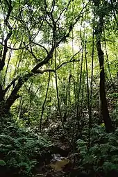
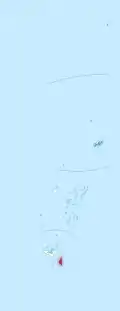
ʻEua is a hilly island, the highest peaks are the Teʻemoa (chicken manure) 312 m, with the grave of the soldier on top, and the Vaiangina (watersprings) 305 m. The island is not volcanic, but was shaped by the rubbing of the Tonga Plate against the Pacific Plate, pushing ʻEua up and leaving the 7-kilometre-deep (4.3 mi) Tonga Trench on the bottom of the ocean, a short distance towards the east. The soil of ʻEua is volcanic, as is that of Tongatapu, but only the top layer, deposited by eruptions of nearby volcanoes ten thousands years ago. Under it are the solid rocks of pushed-up coral. ʻEua counts many huge caves and holes, not all of which have yet been explored.
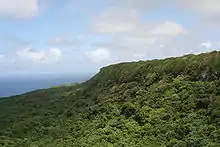
ʻEua and Niuatoputapu are the only islands in Tonga that have streams, and ʿEua had the only bridge in the kingdom until Vavaʻu also built one.[1] The stream drains into the harbour near the capital of the island, ʻOhonua.
A unique feature is the shore between ʻOhonua and Tufuvai. It is coral reef still close to the sea level. Many small tidal pools are found, named the ʻotumatafena.
It is served by ʻEua Airport, which has an unsealed coral runway.
Myths
Together with ʻAta, ʻEua was the first island to be created by Tangaloa, see[2] Tangaloa And The Story Of How ‘Eua Island Was Created.
History
ʻEua was put on the European maps by Abel Tasman who reached it and Tongatapu on 21 January 1643. He called it Middelburg Island, after the capital of the Dutch province of Zeeland. He did not go on land, but proceeded to the Hihifo district of Tongatapu, which he named Amsterdam Island after the capital of the Netherlands.
'Eua was considered by early Missionaries as heathen as it was the rendezvous for whalers, a place that you can trade goods for guns, knives, axes and gunpowder. aka arsenal, or armory of Tonga, as well as its granary.
Captain James Cook visited the island in 1773 and 1777.[3]
Administration
The Division 'Eua is divided into two districts
- 'Eua Motu'a (Old 'Eua), in the north, with six villages and population of 2,949
- 'Eua Niuafo'ou (New 'Eua), in the south, with 2,257 inhabitants in nine villages
The nine villages of the southern district 'Eua Niuafo'ou (or 'Eua Fo'ou for short) were founded by people who had to leave their island of Niuafo'ou in 1946 due to a volcanic eruption; they are all named after villages of Niuafo'ou.
The northern district in contrast is Old 'Eua. The southern village of Kolomaile's inhabitants however are descendants of the former inhabitants of the island of ʻAta, Tonga's southernmost island, evacuated after the island was targeted by slavers.
3.8 kilometres (2.4 miles) south-west of the southern tip of 'Eua (Lakufaanga) is the 35-acre island Kalau.
Demography
The villages of the original inhabitants of ʻEua are all in the north Houma, Taʻanga, ʻOhonua, Pangai, Tufuvai.
Haʻatuʻa and Kolomaile are from the original inhabitants from ʻAta, who were resettled there in 1863. The villages just north of that up to Angahā, are from the inhabitants of Niuafoʻou who were resettled there in 1946.
References
| Wikivoyage has a travel guide for ʻEua. |
- Encyclopædia Britannica – Tonga
- "Tangaloa". Archived from the original on 2009-09-22. Retrieved 2009-09-18.
- Salmond, Anne (2010). Aphrodite's Island. Berkeley: University of California Press. pp. 291-292, 417. ISBN 9780520261143.
- For information on ʻEua: eua-island-tonga.com (Archived 2009-04-18)
See also
| Authority control |
|---|