1892 Atlantic hurricane season
The 1892 Atlantic hurricane season occurred during summer and fall 1892. The season accumulated nine tropical storms, five hurricanes, but no major hurricanes. Three tropical storms made landfall on the United States. However, due to scarce technology and the fact that only storms that affected land or ships were recorded, the actual total could be higher.
| 1892 Atlantic hurricane season | |
|---|---|
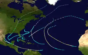
 Season summary map | |
| Seasonal boundaries | |
| First system formed | June 9, 1892 |
| Last system dissipated | October 29, 1892 |
| Strongest storm | |
| Name | Three, Five, and Seven |
| • Maximum winds | 100 mph (155 km/h) (1-minute sustained) |
| Seasonal statistics | |
| Total storms | 9 |
| Hurricanes | 5 |
| Major hurricanes (Cat. 3+) | 0 |
| Total fatalities | 16 |
| Total damage | Unknown |
Timeline

Systems
Tropical Storm One
| Tropical storm (SSHWS) | |
 | |
| Duration | June 9 – June 16 |
|---|---|
| Peak intensity | 50 mph (85 km/h) (1-min) ≤1005 mbar (hPa) |
The first tropical storm developed about 45 mi (70 km) south of Isla de la Juventud on June 9. Initially moving northwestward, the storm made landfall later that day on the south coast of Pinar del Río Province in Cuba. The storm recurved northward and entered the Gulf of Mexico early the following morning, where it intensified and peaked with maximum sustained winds of 50 mph (85 km/h). Around that time, it turned to the northeast and made landfall at 23:00 UTC on June 10 in northern Monroe County, Florida, at the same intensity. The cyclone crossed Florida and emerged into the Atlantic Ocean near modern-day Deerfield Beach early the following day. Thereafter, the system headed out to sea for a few days, before re-approaching the Southeastern United States. Late on June 16, it was last noted about 80 mi (130 km) south-southeast of Cape Lookout, North Carolina.[1]
In Cuba, moderately gusty winds and torrential rainfall were reported from Santa Clara to Pinar del Río, with the worst impact conditions being experienced in Matanzas. There, the San Juan and Yumurí rivers overflowed, causing water to rise 10 ft (3.0 m) above most houses. Civil guards and troops assisted rescue work and evacuation of residents.[2] Furniture in 325 houses were swept away by the floodwaters. About 450 head of cattle drowned. Additionally, 600,000 bags of sugar stored in warehouses were lost.[3] The storm left at least 16 deaths and approximately $1.5 million in damage.[2] The storm also brought winds and rains to Florida. In just a few hours, Hypoluxo recorded 3.6 in (91 mm), while Titusville measured 12.95 in (329 mm) over a period lasting six days.[4] In Jupiter, multiple trees were downed and severe damage was inflicted on crops.[2]
Hurricane Two
| Category 1 hurricane (SSHWS) | |
 | |
| Duration | August 15 – August 21 |
|---|---|
| Peak intensity | 75 mph (120 km/h) (1-min) |
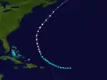
On August 15, a tropical storm was first seen in the open Atlantic east of the Leeward Islands. It tracked northwestward, becoming a hurricane on August 19 before becoming extratropical on August 21. The extratropical storm hit Newfoundland, and completely lost its identity on August 24.
Hurricane Three
| Category 2 hurricane (SSHWS) | |
 | |
| Duration | September 3 – September 17 |
|---|---|
| Peak intensity | 100 mph (155 km/h) (1-min) |
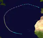
The third hurricane of the year was a long-lasting storm that formed southwest of the Cape Verde islands on September 3. The unnamed storm did not affect land, peaking at 100 mph (160 km/h) before dissipating northeast of the Azores islands near Spain on September 17.
Tropical Storm Four
| Tropical storm (SSHWS) | |
 | |
| Duration | September 8 – September 13 |
|---|---|
| Peak intensity | 60 mph (95 km/h) (1-min) |
On September 8, the fourth tropical storm formed in the southwestern Gulf of Mexico northwest of Campeche. After tracking to the northeast, it made landfalls near New Orleans, Louisiana, and near the Louisiana-Mississippi state lines as a moderate tropical storm. On September 13 the storm became extratropical over Tennessee, and lost its identity on September 17 near Greenland.
Hurricane Five
| Category 2 hurricane (SSHWS) | |
 | |
| Duration | September 12 – September 23 |
|---|---|
| Peak intensity | 100 mph (155 km/h) (1-min) |
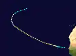
First recorded east of the Cape Verde Islands on September 12, the hurricane directly affected the islands without officially making landfall before dissipating in the open Atlantic near 37°N, 40°W on September 23. The next time a hurricane would affect the islands was in 2015, when Hurricane Fred made landfall.
Tropical Storm Six
| Tropical storm (SSHWS) | |
 | |
| Duration | September 25 – September 27 |
|---|---|
| Peak intensity | 60 mph (95 km/h) (1-min) |
The sixth tropical storm of the season was a very short-lived storm that was first recorded northwest of Ciudad del Carmen on September 25. The storm travelled northwest across the Bay of Campeche before making landfall near the Mexico-Texas border, dissipating inland on September 27.
Hurricane Seven
| Category 2 hurricane (SSHWS) | |
 | |
| Duration | October 5 – October 16 |
|---|---|
| Peak intensity | 100 mph (155 km/h) (1-min) |
On October 5, the seventh storm of the season formed east of Trinidad and Tobago. It made landfalls on Paraguaná, Guajira, and near Cabo Gracias a Dios on the Nicaragua – Honduras border. It sunk a schooner, which resulted in the deaths of sixteen people [5]It dissipated inland on October 16.
Hurricane Eight
| Category 1 hurricane (SSHWS) | |
 | |
| Duration | October 13 – October 17 |
|---|---|
| Peak intensity | 90 mph (150 km/h) (1-min) |
The eighth storm of the season formed northeast of the Bahamas on October 13, and briefly threatened Bermuda. However, it never made landfall before becoming extratropical in the open Atlantic on October 18.
Tropical Storm Nine
| Tropical storm (SSHWS) | |
 | |
| Duration | October 21 – October 29 |
|---|---|
| Peak intensity | 50 mph (85 km/h) (1-min) |
The ninth and final tropical storm of the season formed northwest of the Yucatán Peninsula on October 21. It made its single landfall near Tampa, Florida, as a tropical storm. It then tracked east over Central Florida, turned northeast, and lost its identity on October 29 in the open Atlantic.
See also
References
- "Atlantic hurricane best track (HURDAT version 2)" (Database). United States National Hurricane Center. May 25, 2020.
- Jose Fernandez-Partagas (1996). Year 1892 (PDF). Atlantic Oceanographic and Meteorological Laboratory (Report). National Oceanic and Atmospheric Administration. Retrieved August 31, 2015.
- "Great Damage by Floods in Cuba". Chicago Tribune. Matanzas, Cuba. June 13, 1892. Retrieved August 31, 2015.
- "Observed Rainfall in Florida, Monthly Totals from Beginning of Records to 31 December 1947". Tallahassee, Florida: Division of Water Survey and Research, State of Florida, State Board of Conservation. 1948. Cite journal requires
|journal=(help) - https://www.aoml.noaa.gov/general/lib/lib1/nhclib/mwreviews/1892.pdf