1987 Ecuador earthquakes
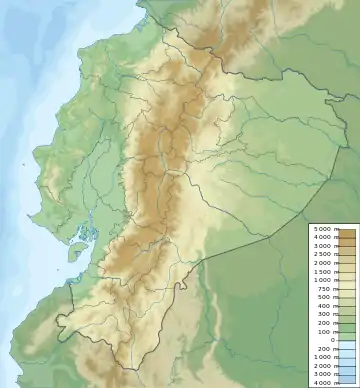
The 1987 Ecuador earthquakes occurred over a six-hour period on March 6. The sequence of shocks measured 6.7, 7.1, and 6.0 on the moment magnitude scale. The main shock had a maximum Mercalli intensity of IX (Violent). The earthquakes were centered in Napo Province in northeast Ecuador; the epicenters were on the eastern slopes of the Andes, about 75 km ENE of Quito and 25 km north of Reventador Volcano. The earthquakes caused about 1,000 deaths. Four-thousand were missing and an estimated US$1 billion in damage was caused.
 Foreshock Mainshock | |
| UTC time | 1987-03-06 04:10:43 |
|---|---|
| ISC event | 471340 |
| USGS-ANSS | ComCat |
| Local date | March 5, 1987 |
| Local time | 23:10:43 ECT |
| Magnitude | 7.1 Mw [1] |
| Depth | 10 km (6.2 mi) [1] |
| Epicenter | 0.07°N 77.75°W |
| Total damage | $1 billion [2] |
| Max. intensity | IX (Violent) [3] |
| Foreshocks | 6.4 Mw March 6 at 01:54 [1] |
| Aftershocks | 6.0 Mw March 6 at 08:14 [1] |
| Casualties | 1,000 dead [4] 4,000 missing [4] 20,000–150,000 displaced [4] |
See also
References
- ISC (19 January 2015), ISC-GEM Global Instrumental Earthquake Catalogue (1900–2009), Version 2.0, International Seismological Centre
- Bolton, P. A. (1991), "Local-level economic and social consequences", The March 5, 1987, Ecuador Earthquakes: Mass Wasting and Socioeconomic Effects, National Academies Press, p. 109, ISBN 978-0309044448
- Espinoza, A. F.; Egred, J.; Garciá-Lopez, M.; Crespo, E. (1991), "Intensity and damage distribution", The March 5, 1987, Ecuador Earthquakes: Mass Wasting and Socioeconomic Effects, National Academies Press, p. 42, ISBN 978-0309044448
- USGS (September 4, 2009), PAGER-CAT Earthquake Catalog, Version 2008_06.1, United States Geological Survey
Sources
- Kawakatsu, H.; Cadena, G. P. (1991), "Focal Mechanisms of the March 6, 1987 Ecuador Earthquakes: CMT inversion with a first motion constraint" (PDF), Journal of Physics of the Earth, 39 (4): 589–597, doi:10.4294/jpe1952.39.589
External links
- Officials Fear Quake Killed 300 in Ecuador – Los Angeles Times
- 300 reported dead and 4,000 missing in Ecuador quakes – The New York Times
- The International Seismological Centre has a bibliography and/or authoritative data for this event.
This article is issued from Wikipedia. The text is licensed under Creative Commons - Attribution - Sharealike. Additional terms may apply for the media files.