1996 Sulawesi earthquake
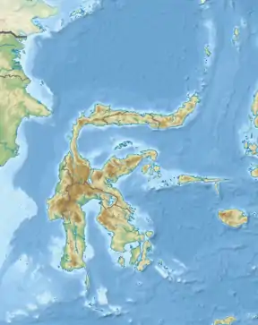
On January 1, 1996, at 4:05 p.m. Central Indonesia Time, a powerful earthquake with an epicenter in the Makassar Strait struck north of Minahasa on the island of Sulawesi, Indonesia. The earthquake registered a magnitude 7.9 on the moment magnitude scale and was centered off Tolitoli Regency in Central Sulawesi, or 25 km from the Tonggolobibi village.[1] A tsunami of 2 to 4 meters was triggered by this earthquake as a result.[2] This event was larger but far less deadly compared to the Mw 7.5 Sulawesi earthquake in 2018 slightly south of where this earthquake occurred. At least 350 buildings were badly damaged, nine people were killed and 63 people injured.[3]
  | |
| UTC time | 1996-01-01 08:05:10 |
|---|---|
| ISC event | 939295 |
| USGS-ANSS | ComCat |
| Local date | January 1, 1996 |
| Local time | 16:05 CIT |
| Duration | ~30 seconds |
| Magnitude | 7.9 Mw |
| Depth | 24.0 km |
| Epicenter | 0.729°S 119.931°E |
| Fault | North Sulawesi Trench |
| Type | Thrust |
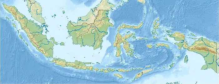
| Areas affected | Sulawesi, Indonesia |
| Total damage | $1.2M USD |
| Max. intensity | VIII (Severe) |
| Tsunami | 2 to 4 meters |
| Casualties | 9 dead, 63 injured |
Tectonic setting
The North Sulawesi Trench is a subduction zone parallel to the Minahasa Peninsula where the Sunda Plate dives beneath the Molucca Sea Plate at a rate of 4 cm/yr. Here, three major tectonic plates, the Sunda, Australian and Philippine Sea Plates interact in a complex manner, broken up into several smaller microplates.[4] The North Sulawesi Subduction joins the Palu-Koro Fault at its westernmost tip.
Earthquake
The thrust fault which this earthquake occurred along had a very shallow dip angle of 7°, during the event, a 90 × 60 km section of it had ruptured. An average slip has been estimated at 1.8 meters. The earthquake took place along a relay zone between the North Sulawesi Trench and Palu-Koro Fault. The strike-slip component of this oblique-thrust event was a result of interaction with the Palu-Koro Fault. The rupture process took roughly 30 seconds.[5] On Pangalasean Island, uplift of 30 to 50 cm was determined.[5]
Two aftershocks in July, a magnitude 6.6 and 7.0 on the 16th and 22nd respectively about 50 km northeast of the January mainshock.[5]
Tsunami
The tsunami inundated more than 100 km of coastline along Northern Sulawesi between 5 to 10 minutes after the tremor.[6] The heights of these waves were between 1.6 to 3.4 meters, according to eyewitness.[5] More than 400 houses in the village of Tonggolobibi were destroyed when the waves swept through.
The water destroyed 183 houses and damaged 228 units around the Bangkir-Tolitoli area. About 100 km of coastline was affected, there were no reports of tsunami data being recorded outside of Sulawesi thus inferring that the tsunami was local. The wave penetrated up to 200 meters up riverbeds and carried five boats including two 500-ton motorboats 250 meters onshore. Since the tsunami occurred at a high tide of 59 cm, and there was a subsidence of the land of about 70 cm.[7]
See also
References
- "M 7.9 - Minahasa, Sulawesi, Indonesia". USGS ANSS. Retrieved 27 November 2020.
- "Tsunami Event Information". NCEI. Retrieved 27 November 2020.
- "Significant Earthquake Information". NCEI. Retrieved 27 November 2020.
- HAMILTON, WARREN (July 1973). "Tectonics of the Indonesian Region" (PDF). Geol. Soc. Malaysia, Bulletin 6.
- J. M. Go´mez, R. Madariaga, A. Walpersdorf, and E. Chalard. "The 1996 Earthquakes in Sulawesi, Indonesia". Bulletin of the Seismological Society of America. 90.CS1 maint: multiple names: authors list (link)
- Pelinovsky, E., Yuliadi, D., Prasetya, G. (1997). "The 1996 Sulawesi Tsunami". Natural Hazards. 16: 29–38. doi:10.1023/A:1007904610680.CS1 maint: multiple names: authors list (link)
- "Tsunami Event Information". NCEI. Retrieved 27 November 2020.